
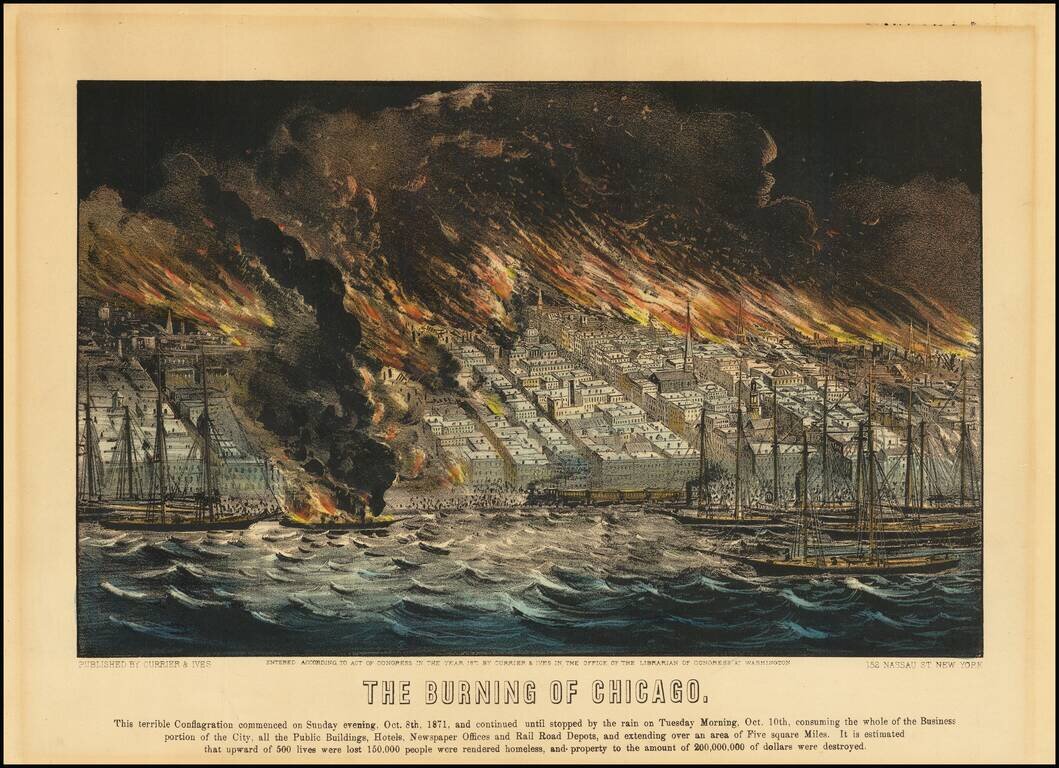
Hand-colored antique lithograph view of the burning of Chicago in 1871, issued by the famed lithography publishers Currier & Ives. The text below the image reads: "This terrible conflagration commenced on Sunday evening, Oct. 8th, 1871, and...
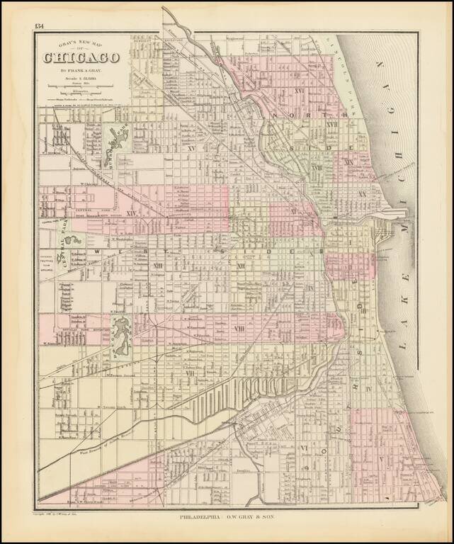
Detailed map of Chicago, published by O.W. Gray & Son. The map is colored by wards and showing streets, rail lines, parks, buildings, stations and a host of other details. One of the earliest maps of Chicago to appear in a commercial atlas.
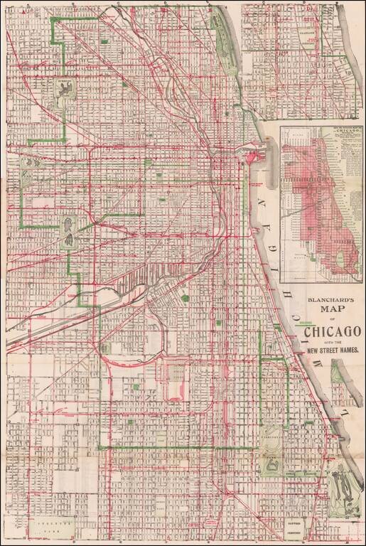
Scarce issued map of the City of Chicago by Rufus Blanchard, one of the leading map makers in Chicago during the late 19th Century. Provides a detailed look at the City of Chicago. The present example was apparently re-issued by George Cram and would...
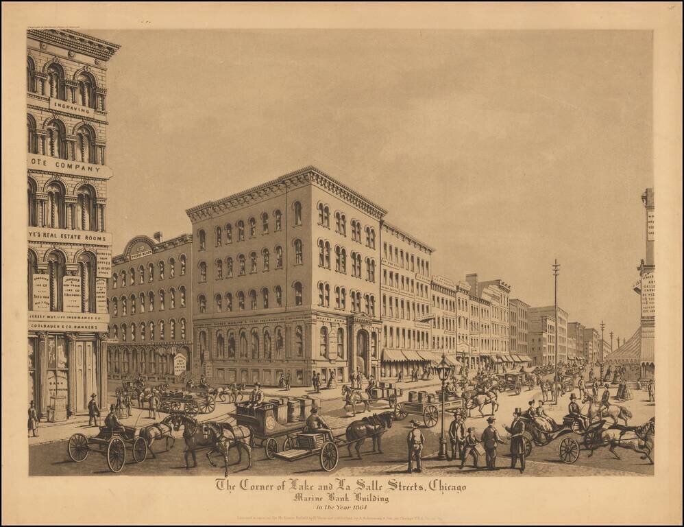
Fine aquatint view of historic Chicago in 1864, showing a bustling scene of commerce at the corner of Lake Street and La Salle Street, looking toward the Marine Bank Building. Includes a lively street scene, with pedestrians and horse drawn wagons,...
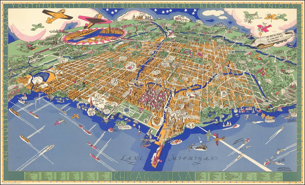
Charles Turzak's Iconic View of Chicago. Nice example of Charles Turzak's remarkable pictorial map of Chicago, with original pictorial folder. This beautiful map of Chicago by Chicago illustrator Charles Turzak, published two years before the...
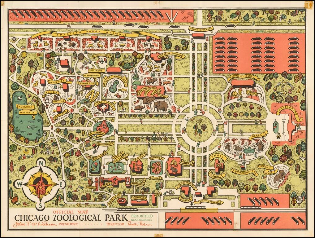
The Brookfield Zoo Map Shortly After Its Opening. A decorative early map of the Brookfield Zoo. The zoo extends to much the same size that it does today, though it is much less densely built up. The map is designed in an attractive pictorial style,...
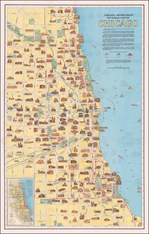
Fine promotional map of Downtown Chicago, showing profile elevations for Chicago's major landmark buildings. Second map on the verso. Offered with original covers.
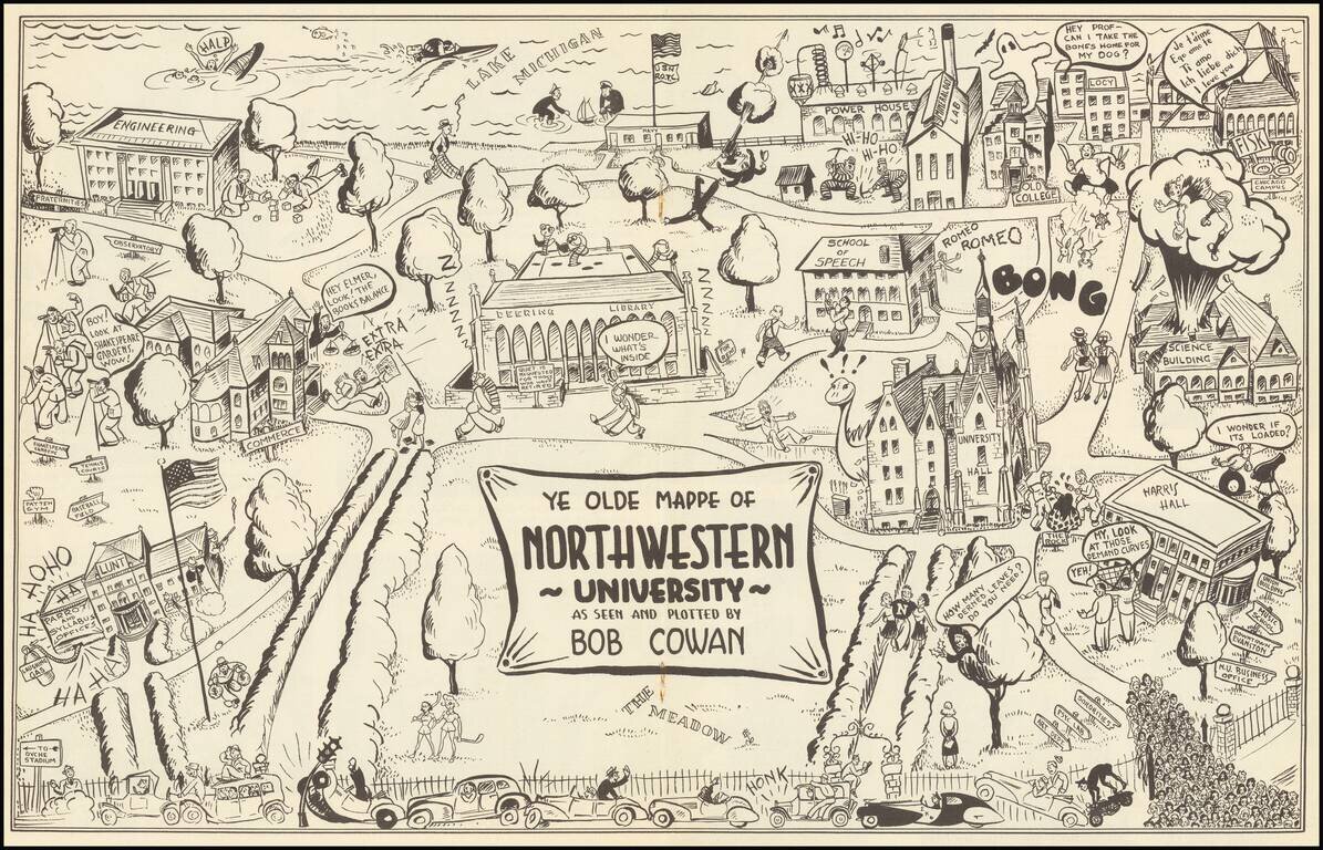
Rare Pictorial of Northwestern - Only Traced Example. This is a vintage pictorial map of Northwestern, providing a humorous portrayal of the prestigious Evanston university. The campus is easily recognizable, portrayed from the west with Lake Michigan...
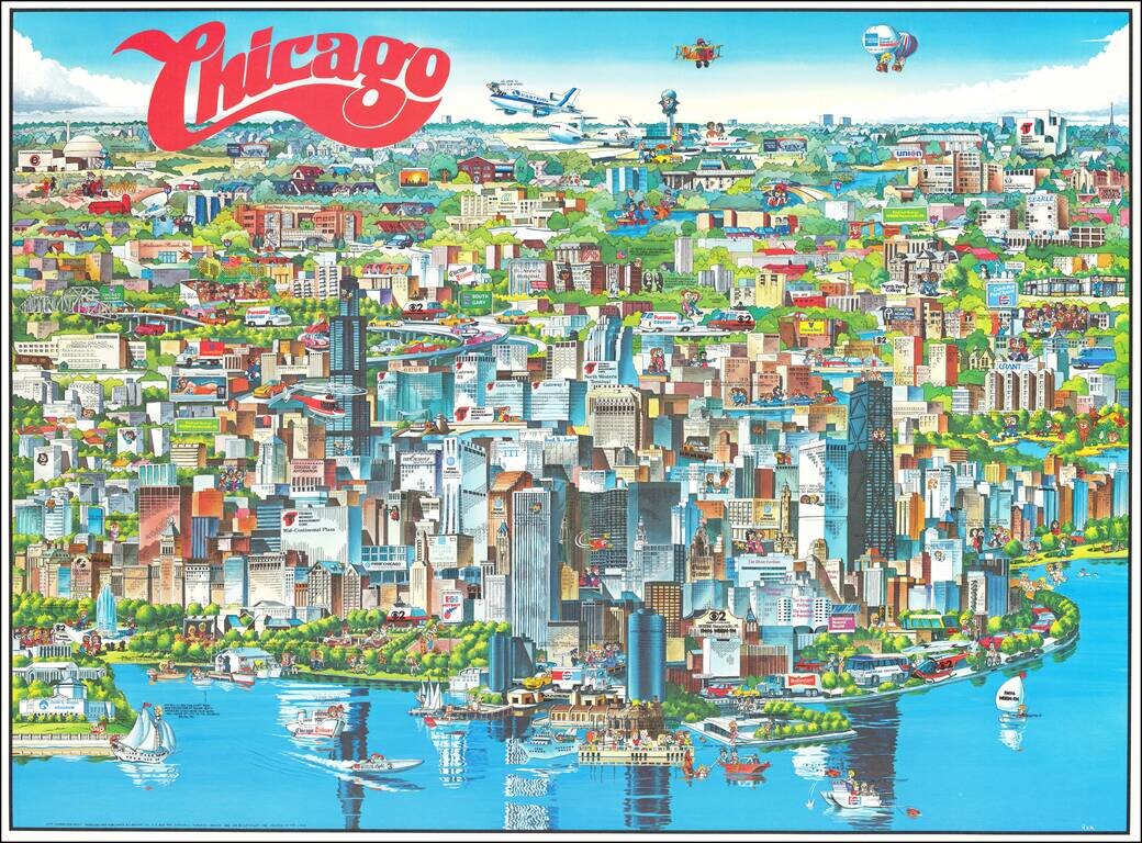
Richly embellished advertising oriented pictorial map / birdseye view of the Chicago area, published by Archar Inc. of Canada. Packed with advertising for local businesses, the images shows buildings, tourism and other landmarks, recreational...
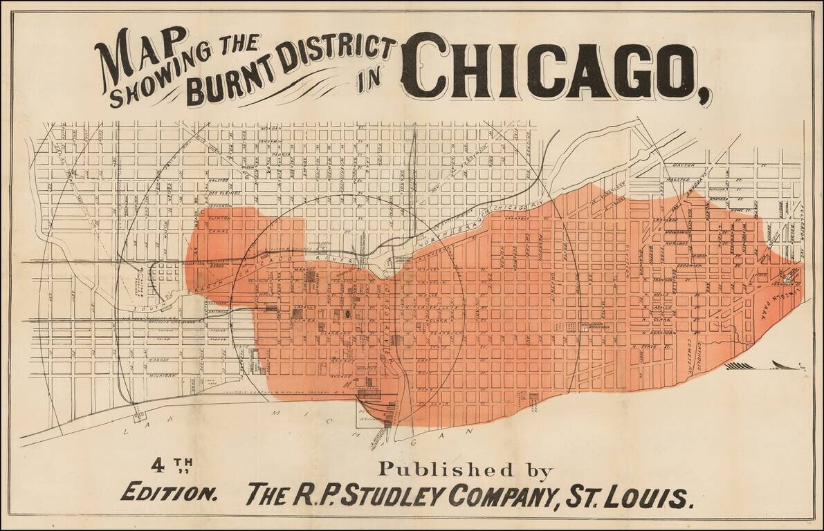
Rare map of Chicago, focusing on the parts of town which were affected by the Great Chicago Fire, October 10, 1871. The map shows in fine detail (in red) the areas affected by the fire. The map identifies streets, buildings, railroads, parks and...
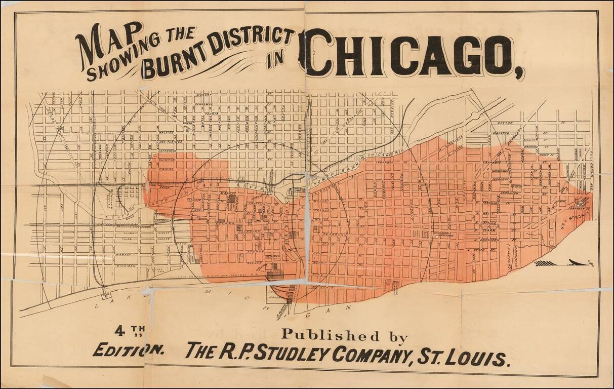
Rare map of Chicago, focusing on the parts of town which were affected by the Great Chicago Fire, October 10, 1871. The map shows in fine detail (in red) the areas affected by the fire. The map identifies streets, buildings, railroads, parks and...
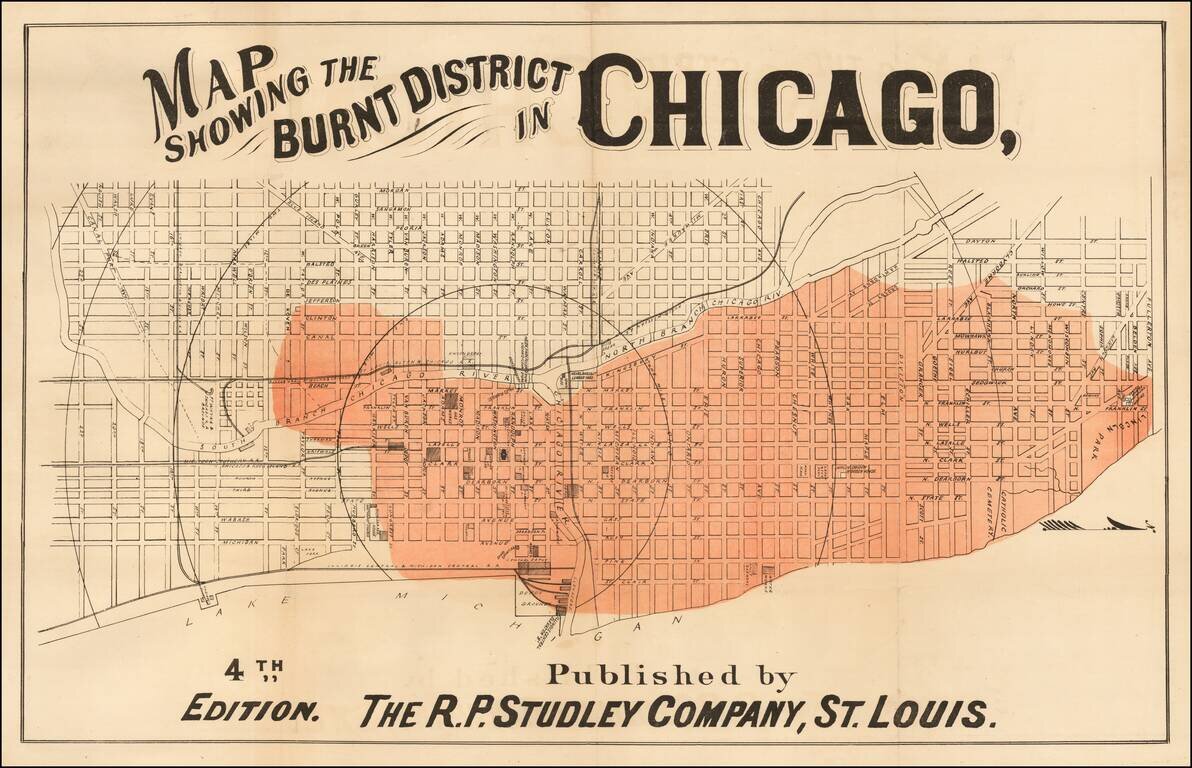
Rare map of Chicago, focusing on the parts of town which were affected by the Great Chicago Fire, October 10, 1871. The map shows in fine detail (in red) the areas affected by the fire. The map identifies streets, buildings, railroads, parks and...
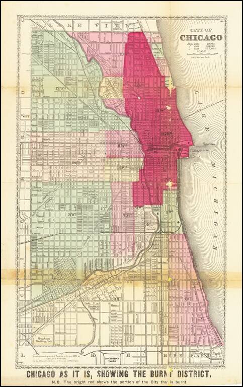
Detailed Plan of Chicago Showing the Area Ravaged by the Great Chicago Fire Scarce map showing the area affected by the Chicago Fire of 1871, with the "Burnt District" colored in red. The map has each street labeled, along with the rivers flowing...
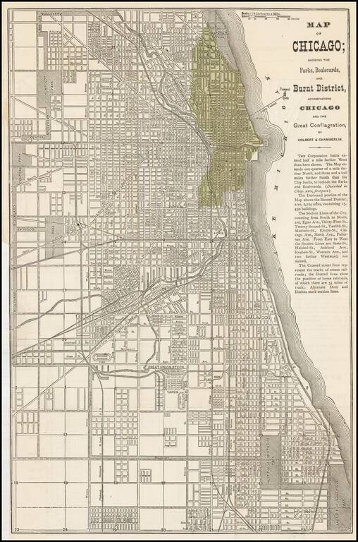
Early map of Chicago issued shortly after the 1871 Fire. The darkened portion of the map shows the Burned District consisting of 2,124 acres and containing 17,450 buildings. A scarce map -- this is the first example we have offered....
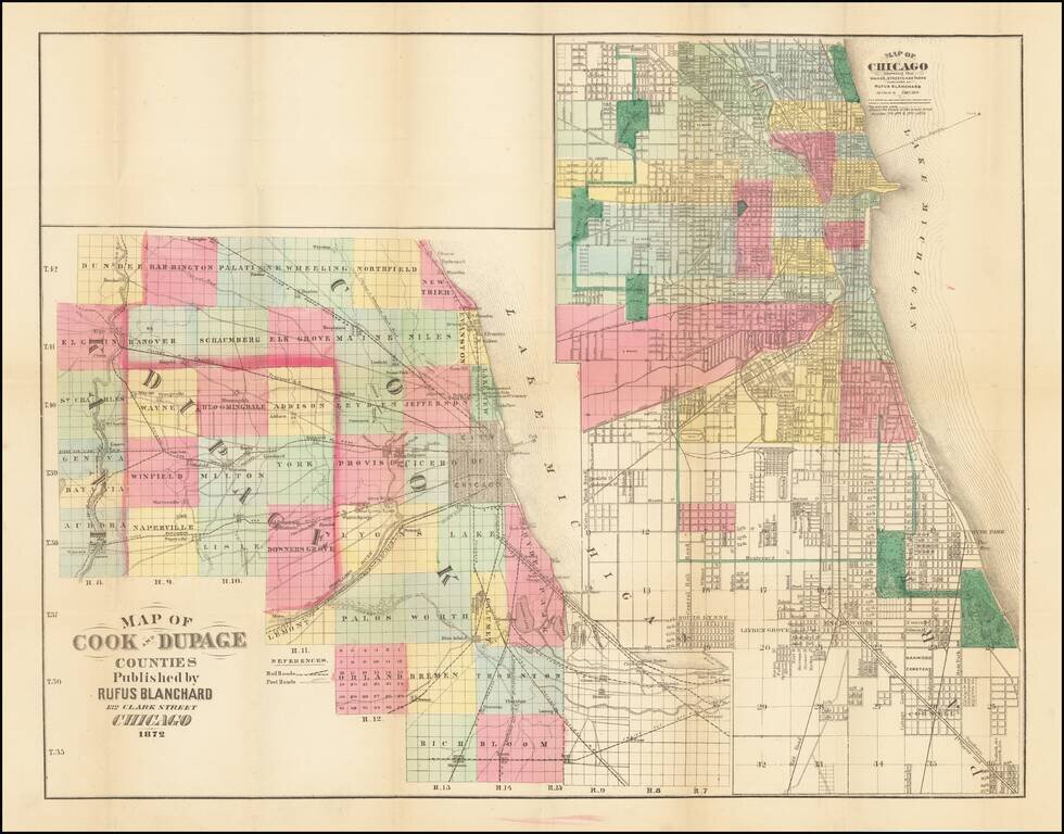
Rare Chicagoland Map Showing Extent of Great Fire. This is a rare separately issued folding map by Rufus Blanchard, creator of some of the earliest maps of Chicago. This 1872 edition of the map shows the extent of the Great Chicago Fire which had...
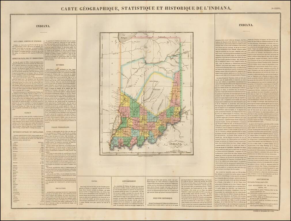
A gorgeous example of the French edition of Carey & Lea's Map of Indiana, showing very early county configurations and other interesting details. Buchon's atlas was the first foreign atlas to include a separate map of Indiana and is one of the...