
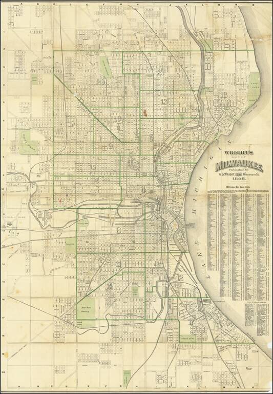
Large color-lithographed folding map of Milwaukee, published by Alfred G. Wright and printed by the Milwaukee Litho. & Engr. Co. in 1898. The map is one of the larger 19th-century maps of the largest city in Wisconsin. The map goes as far north as...
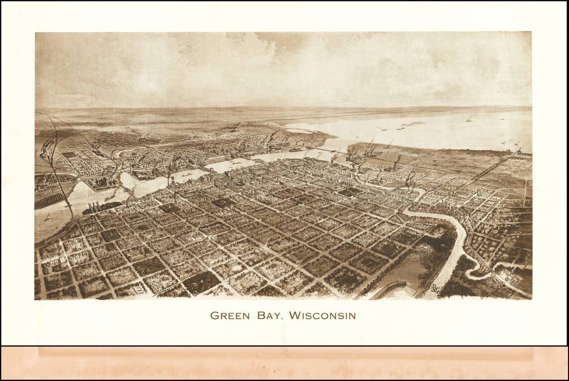
Rare view of Green Bay, published by Barnes-Crosby Company Barnes-Crosby Company Barnes-Crosby was best known for publishing an extensive fine lithograph stereoview series of United States scenes starting in the late 1890’s and continuing for...
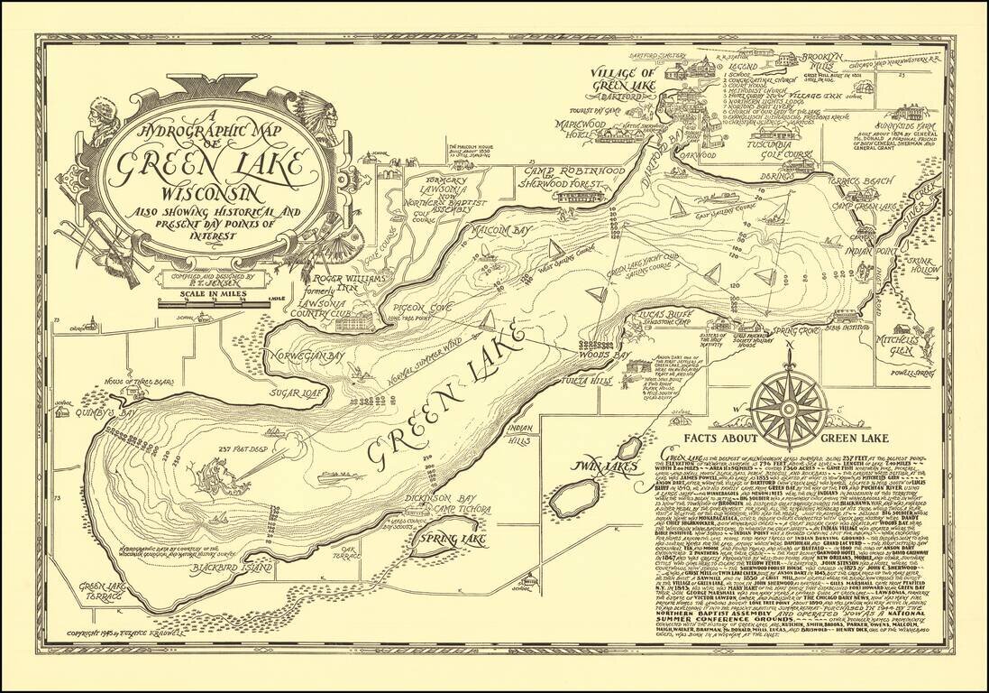
Scarce vintage pictorial map of Green Lake, Wisconsin, compiled and designed by P.T. Jensen and published by F. Clayce Kradwell in 1945. Green Lake is a large lake between Oshkosh and Wisconsin Dells. The Wisconsin Historical Society has a colored...
![[Ashland Wisconin]](/map/small/60288.jpg)
Lake Trout Trolling on Lake Superior! Detailed pictorial map of the area around Ashland, Wisconsin, published by the Ashland Chamber of Commerce. The focal point of the map is recreational activities, including hunting, fishing, skiing, boating,...
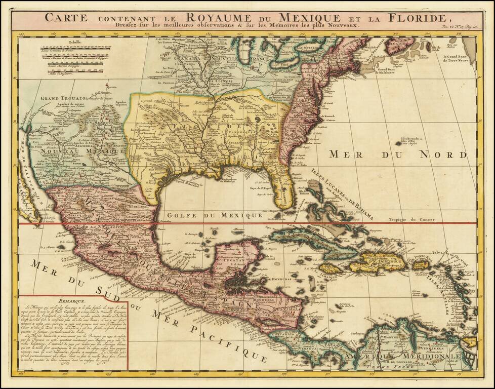
An Early Re-Issue of a Cartographic Landmark Map This is a finely executed map of the southern part of North America by the French mapmaker Henri Chatelain. The map draws its inspiration from the royal mapmaker Guillaume de L'Isle's landmark map of...