Map size in jpg-format: 1.24371MiB
Click to open in high resolution (open in new tab).

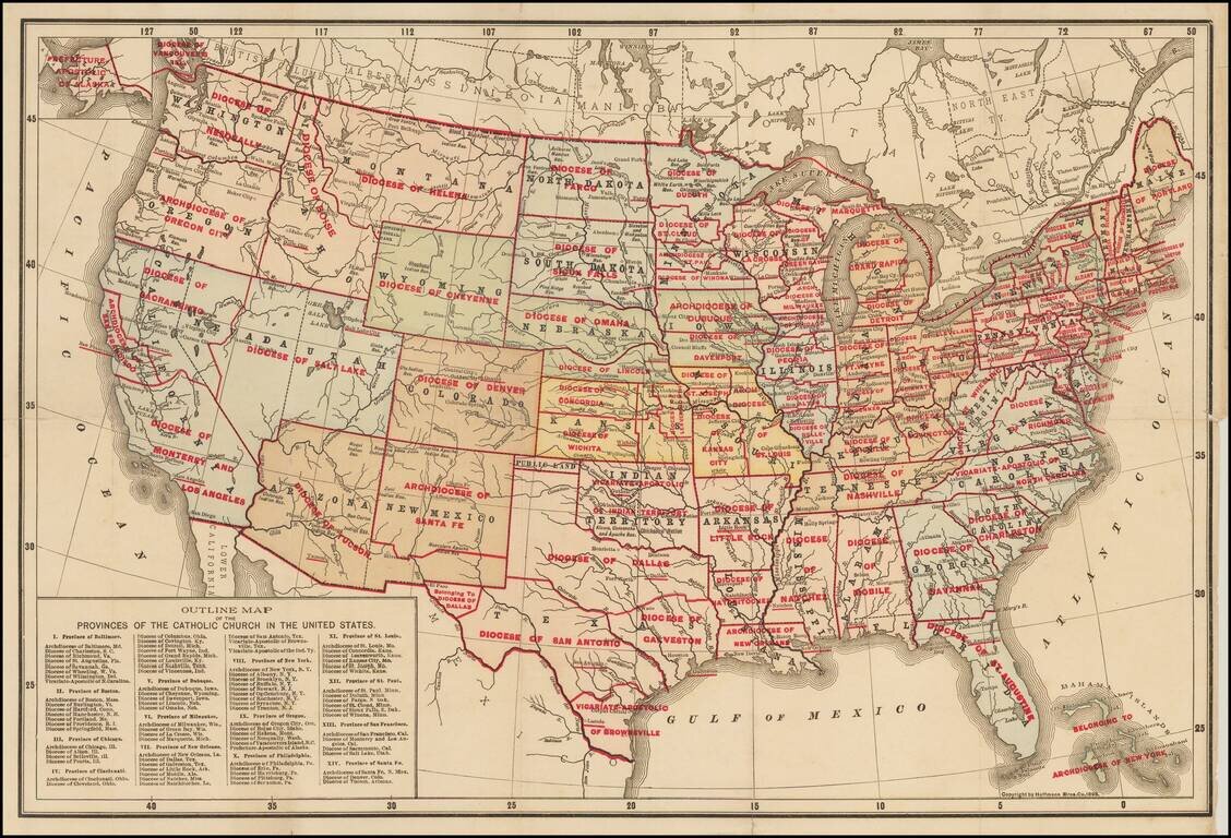
Rare separately issued map of the United States, apparently the earliest printed map to identify the various Catholic Church Provinces and Dioceses within the United States.
Each of the Provinces are divided by Dioceses. Nearly 100 Dioceses are shown.
While we note later maps of the US showing the Catholic Provinces and Dioceses of the same title (M.H. Wiltzius & Co., 1899), the present map is extremely rare. We note only the example at Benedictine College in Kansas.
There is a variant edition of the map, which we previously handled, published in the same year, but with different printed information in the map and different color scheme: /gallery/detail/42523
If you are a student, write to us in telegram: @antiquemaps and indicate what material you need and for what work you need a map in high detail. We are ready to provide material on special terms. For students only!

![[Signed Political Satire Artwork] Vietnam ... Vietnam ... Vietnam ...](/map/small/68726.jpg)
