logo

1890. Rambles Through Our Country. An Instructive Geographical Game For The Young.

  • Rambles Through Our Country.  An Instructive Geographical Game For The Young.

Rambles Through Our Country. An Instructive Geographical Game For The Young. information:

Year of creation: 
Resolution size (pixels): 
 20549x14953 px
Disk Size: 
 134.469MiB
Number of pages: 
 1
Place: 
 Hartford

Print information. Print size (Width x height in inches):
Printing at 72 dpi 
  285.4 х 207.68
Printing at 150 dpi 
 136.99 х 99.69
Printing at 300 dpi 
 68.5 х 49.84

An example of detailing the file of this map of in a printable high-resolution:

Click to open in high resolution (open in new tab).
Attention! this is just the central piece (central area 960x960 px) of the map file!
This is an example, so that you can see and study the level of detail of a given map. The entire Map will be fully available after payment!

Rambles Through Our Country.  An Instructive Geographical Game For The Young.

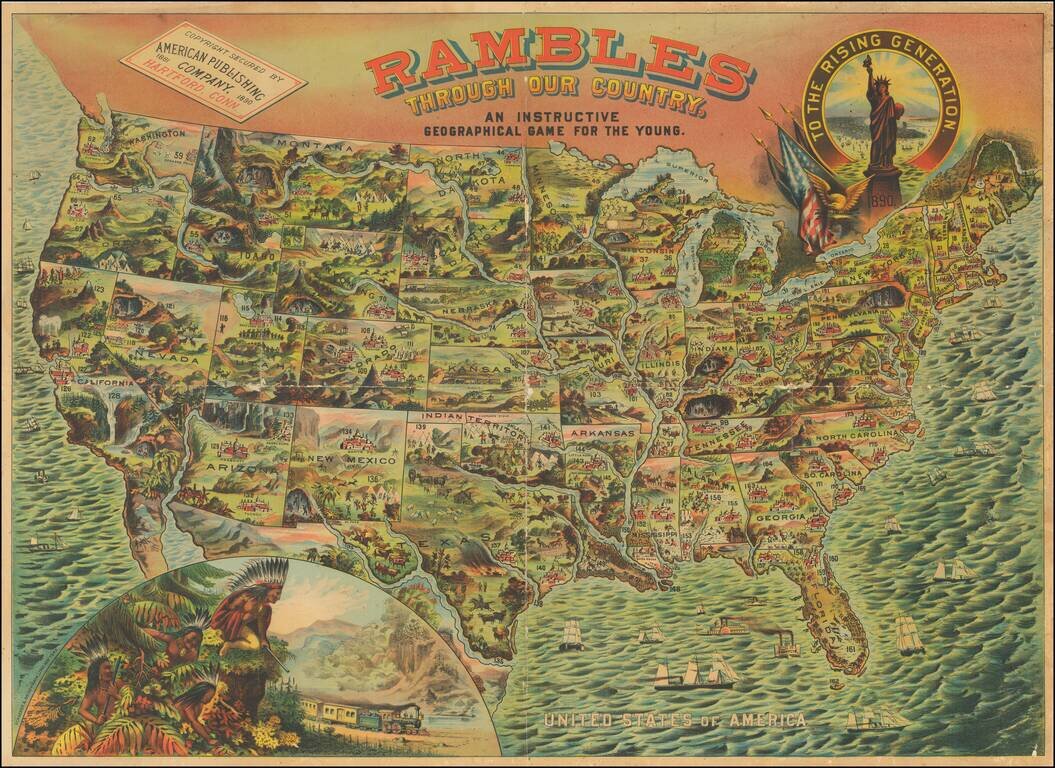
A bright, whimsical chromolithographed map of the United States, designed for a children's game, but wonderful in its own right.

The principal cities of the US are depicted, as are natural resources or landmarks. Texas is shown with Indians chasing a large herd of buffalo. California is dominated by scenes of Yosemite. Also, at the bottom left is a large view of 4 Indians, with rifles, looking down anxiously at a train passing through a mountain pass. At the top right is a view of the Statue of Liberty.

The game went through several revisions between 1881 and 1890.


Special conditions for students!

If you are a student, write to us in telegram: @antiquemaps and indicate what material you need and for what work you need a map in high detail. We are ready to provide material on special terms. For students only!

Item information:

Year of creation:
Size:
20549x14953 px
Disk:
134.469MiB
Number of pages:
1
Place:
Hartford
Author:
American Publishing Co..
$21.99

Related item