logo

1889. United States

  • United States

Map size in jpg-format: 35.1289MiB

Download "United States", in high resolution.

United States information:

Year of creation: 
Resolution size (pixels): 
 15177x10108 px
Disk Size: 
 35.1289MiB
Number of pages: 
 1
Place: 
 Philadelphia

Print information. Print size (Width x height in inches):
Printing at 72 dpi 
  210.79 х 140.39
Printing at 150 dpi 
 101.18 х 67.39
Printing at 300 dpi 
 50.59 х 33.69

An example of detailing the file of this map of in a printable high-resolution:

Click to open in high resolution (open in new tab).
Attention! this is just the central piece (central area 960x960 px) of the map file!
This is an example, so that you can see and study the level of detail of a given map. The entire Map will be fully available after payment!

United States

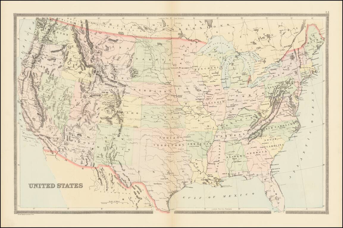
Large Map of the United States, published by William Bradley for a late edition of Mitchell's General Atlas.

Includes a single Dakota and Indian Territory.


Special conditions for students!

If you are a student, write to us in telegram: @antiquemaps and indicate what material you need and for what work you need a map in high detail. We are ready to provide material on special terms. For students only!

Item information:

Year of creation:
Size:
15177x10108 px
Disk:
35.1289MiB
Number of pages:
1
Place:
Philadelphia
Author:
William Bradley & Bros..
$14.99

Related item