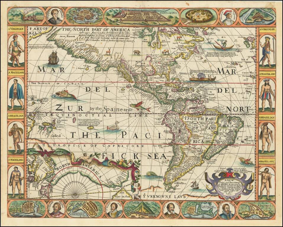
Eye-catching Seventeenth-Century Carte-à-Figure Map of the Americas—An English Rarity Rare, separately-issued English map of the Americas, published in London by Robert Walton. This remarkable map is Walton's version the carte-à-figures style...

An English Rarity Rare, separately-issued English map of the Americas, published in London by Robert Walton. The present example lacks the decorative borders, which may have been trimmed away before the map was bound in the 17th Century. Walton's...
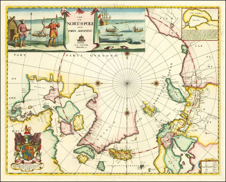
Remarkable Early English Map of the North Polar Regions Fine example of Moses Pitt's original map of the North Pole and surrounding lands. Moses Pitt initially set out to produce an expanded edition of Jansson's Atlas Maior with his partner Jacob Van...
![[Straits of Le Maire, Nova Guinea, South Pacific]](/map/small/61345op.jpg)
The Earliest Printed Map of Le Maire's Voyage Around Cape Horn and Across The Pacific Nice example of Joris van Spilbergen's rendering of Willem Schouten and Jacob Le Maire's map / sea chart of a portion of his circumnavigation of the world, showing...
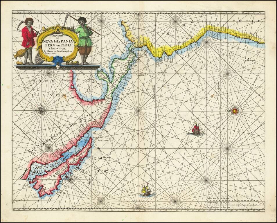
Rare Golden Age Dutch Sea Chart of the Island of California and Western Pacific Rare Johannes Van Loon sea chart of the Western Pacific. The map appeared in the first edition of Van Loon's Zee Atlas. It derives from Doncker's map of the Western...
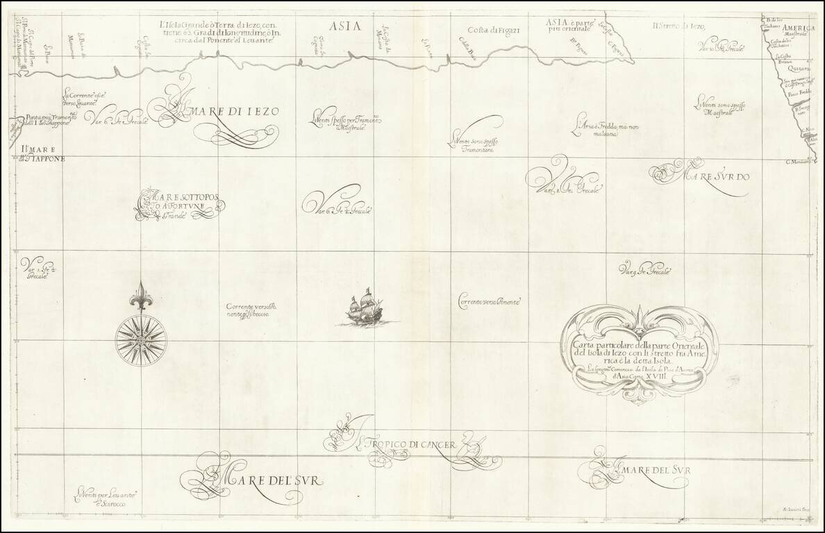
Fascinating map of the southern coast of Japan (Terra Iezo) and the Northwest Coast of America north of Cape Mendocino (including Quivira), from Dudley's Dell'Arcano del Mare. The map shows one of the great cartographic myths of the period, the...
![Representation du Cours ordinaire des Vents de Traverse qui regnent les Cotes dans la grande Mer Du Sud [California as an Island]](/map/small/54744.jpg)
Interesting map charging the course of the trade winds in the Pacific Ocean, published by Bellin in the Histoire Generale de Voyages, based upon the obseravations of Dampier. California is shown as an island. An odd piece of the southern hemisphere...

Nice example of Reinecke's map of the Western Pacific Ocean, Australia, Southeast Asia, etc. Neu Holland vormals Ulimaroa is named, along with an New South Wales. The coastline of Australia is incomplete. New Zealand is shown as two islands. Hawaii...
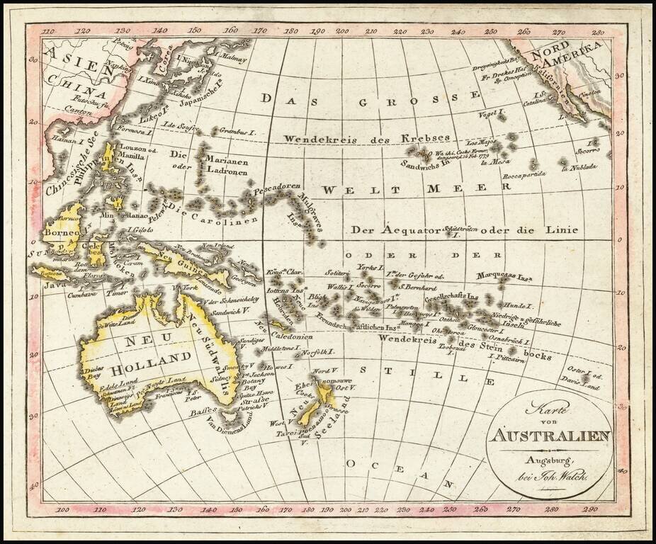
Interesting map of the Southern Part of the Pacific Ocean, published in Augsburg by Walch. Includes Hawaii and fascinating early configurations for Australia and New Zealand.
![[Australia, Phiippines, New Zealand, Hawaii] Oceanica 1828](/map/small/61780.jpg)
Rare Italian Map of the South Pacific, extending from Australia and the Philippines in the east to Hawaii and the Marquesas in the west, The map illustrates the recent discoveries in Australia and provides good detail in Australia and a good sense of...
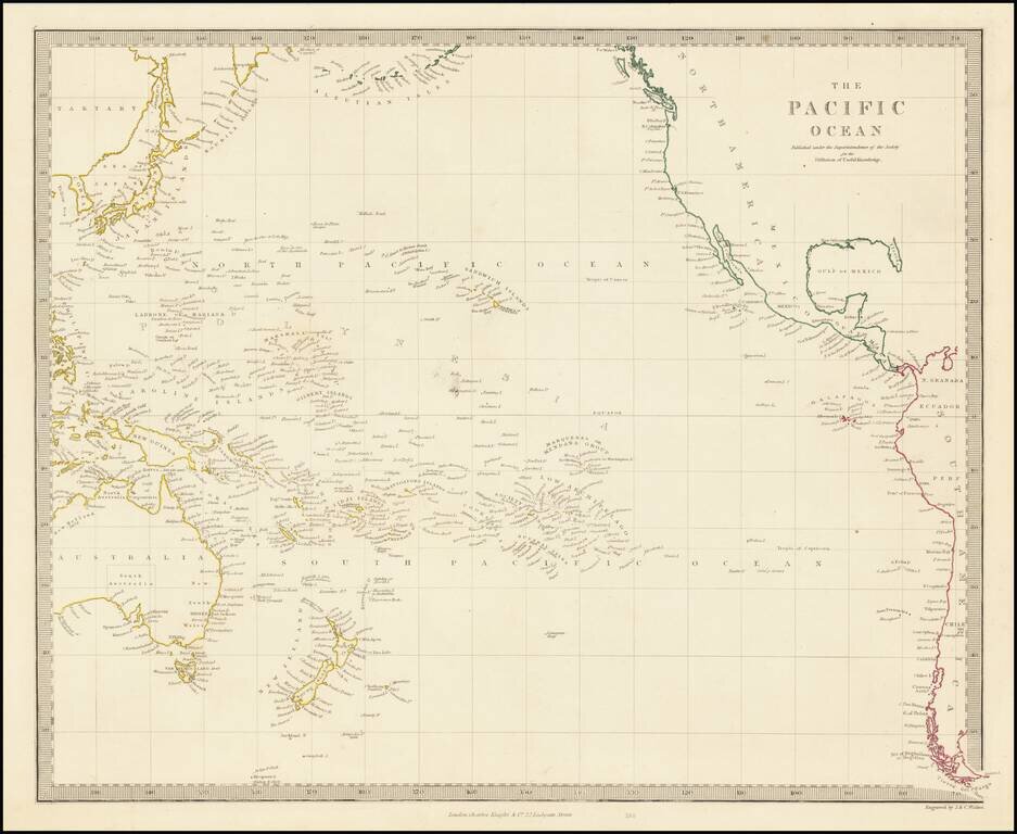
Wonderful detailed map of the whole of the Pacific Ocean, centered on Hawaii and extending from the west coast of America to the east coast of Asia.
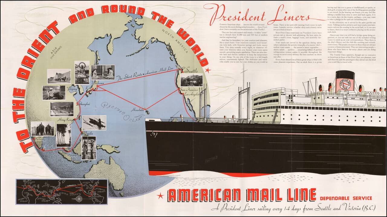
Promotional brochure showing the routes of the Presidential Liner. Both the front and back include numerous photographic images.
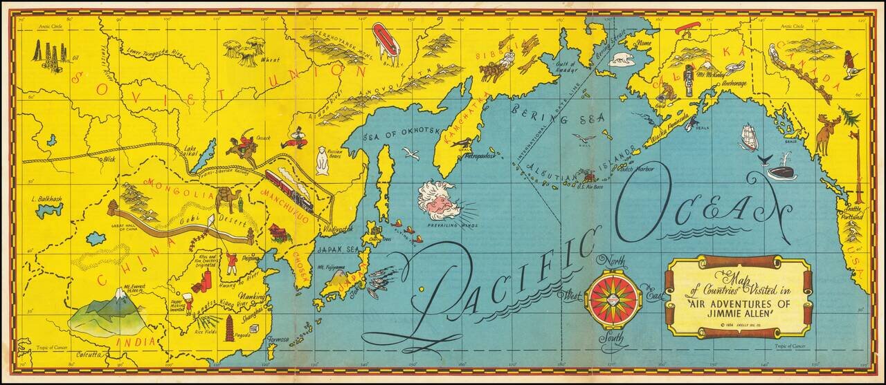
The Gold Age of Radio Theater -- The Air Adventures of 16 Year Old Crime Solving Pilot Jimmie Allen Rare pictorial map of the Pacific printed as a promotional premium for the Air Adventures of Jimmie Allen, theatrical radio production that aired from...
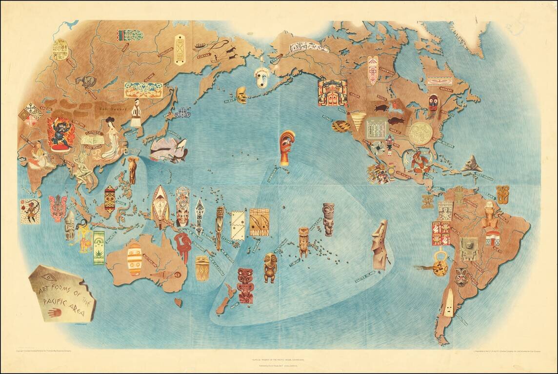
An attractive lithograph showing the art forms of the Pacific, after the eponymous mural by the talented Mexican intellectual Miguel Covarrubias. Many examples of traditional art forms are shown overlaid on a map that includes all of the Americas,...
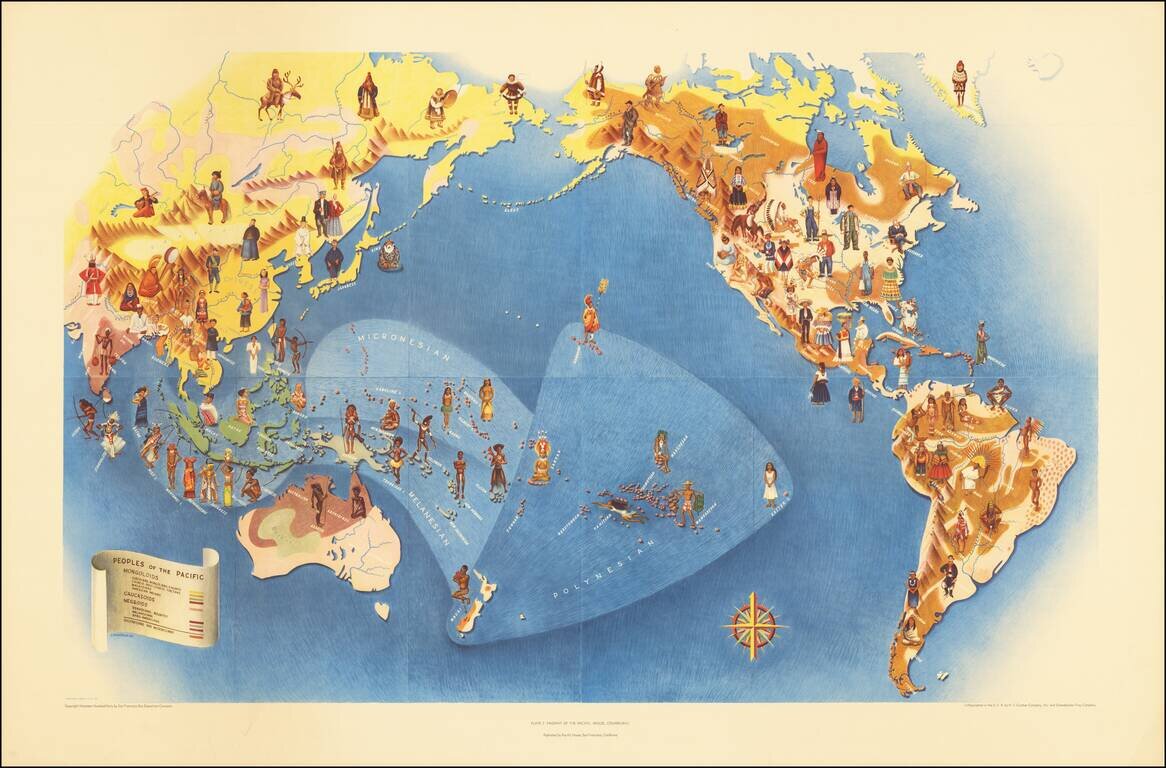
An attractive lithograph from 1940 showing the peoples of the Pacific, after the eponymous mural by the talented Mexican intellectual Miguel Covarrubias. The map shows the Pacific in its entirety and extends to all of the Americas, Oceania, and most of...
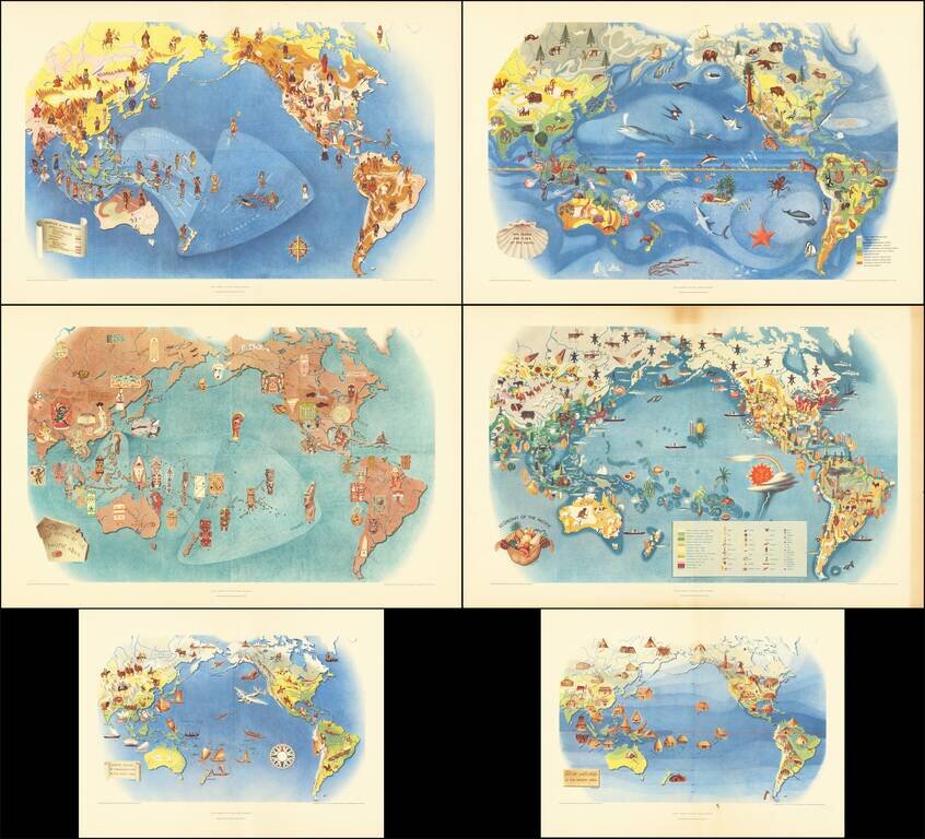
This is a series of six works, lithographed after Covarrubias's mural the Pageant of the Pacific, which was first displayed at the 1939 San Francisco Golden Gate International Exposition. Covarrubias was commissioned to create this mural that would be...