logo

1806. Charte vom Nil-Strome oder Aegyptien, Nubien und Habesch. . . 1806

  • Charte vom Nil-Strome oder Aegyptien, Nubien und Habesch. . . 1806

Charte vom Nil-Strome oder Aegyptien, Nubien und Habesch. . . 1806 information:

Year of creation: 
Resolution size (pixels): 
 2579x3433 px
Disk Size: 
 2.15346MiB
Number of pages: 
 1
Place: 
 Weimar

Print information. Print size (Width x height in inches):
Printing at 72 dpi 
  35.82 х 47.68
Printing at 150 dpi 
 17.19 х 22.89
Printing at 300 dpi 
 8.6 х 11.44

An example of detailing the file of this map of in a printable high-resolution:

Click to open in high resolution (open in new tab).
Attention! this is just the central piece (central area 960x960 px) of the map file!
This is an example, so that you can see and study the level of detail of a given map. The entire Map will be fully available after payment!

Charte vom Nil-Strome oder Aegyptien, Nubien und Habesch. . . 1806

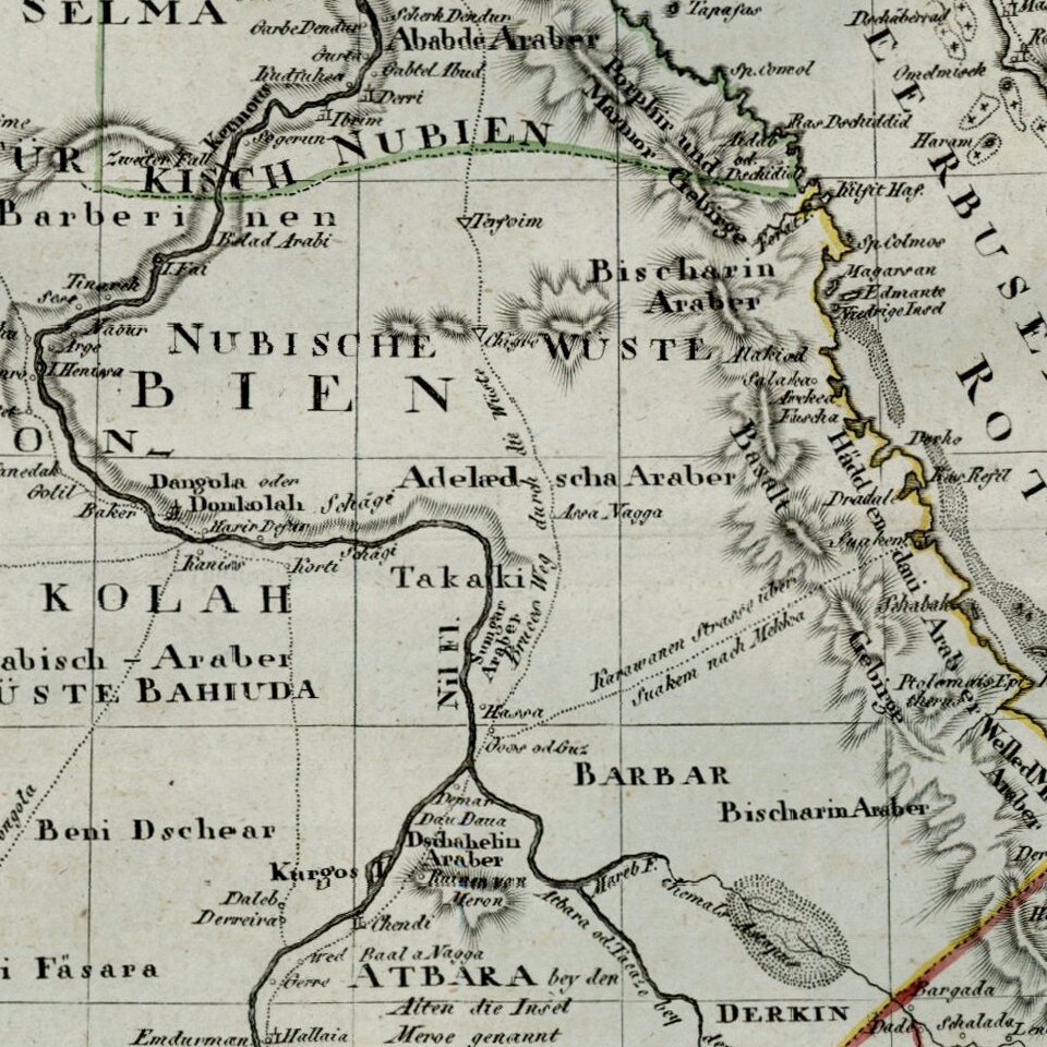
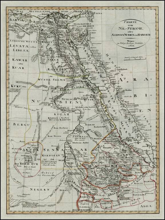
First edition of this scarce map of Egypt and Abyssinia, which was later copied in a pirated edition published in Prague.


Special conditions for students!

If you are a student, write to us in telegram: @antiquemaps and indicate what material you need and for what work you need a map in high detail. We are ready to provide material on special terms. For students only!

Item information:

Year of creation:
Size:
2579x3433 px
Disk:
2.15346MiB
Number of pages:
1
Place:
Weimar
Author:
Weimar Geographische Institut.
$14.99

Related item