Map size in jpg-format: 744252B
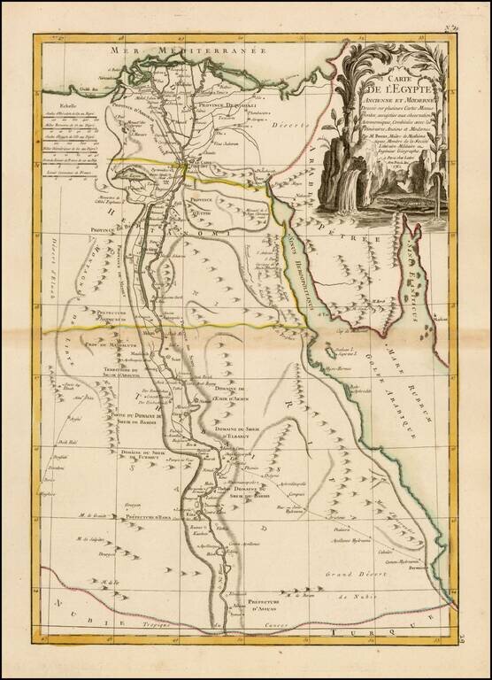
Highly detailed and decorative map of Egypt, published by Lattre in Paris.
Provies a highly detailed treatment of the course of the Nile, early roads, historical and modern place names. Extends south to Asuan and east to the Red Sea.
Jean Lattré (fl. 1743-1793) was a Parisian bookseller and engraver who published many maps, plans, globes, and atlases. He worked closely with other important French cartographers, including Janvier, Bonne, and Delamarche, as well as other European mapmakers, such as William Faden, Santini, and Zannoni. Lattré is also interesting due to his propensity to bring suits against those who copied his work; plagiarism was common practice in eighteenth-century cartography and mapmakers struggled to maintain proprietary maps and information.
If you are a student, write to us in telegram: @antiquemaps and indicate what material you need and for what work you need a map in high detail. We are ready to provide material on special terms. For students only!
![[Arabian Peninsula, Red Sea, Nile River and Gulf of Aden] L'Afrique . . . 1740](/map/small/59382.jpg)
![Turcici Imperii Imago [shows Cyprus]](/map/small/68676.jpg)