logo

1880. Arabia, The Red Sea and Persian Gulf

  • Arabia, The Red Sea and Persian Gulf

Arabia, The Red Sea and Persian Gulf information:

Year of creation: 
Resolution size (pixels): 
 12688x8968 px
Disk Size: 
 28.8232MiB
Number of pages: 
 1
Place: 
 Edinburgh & London
Author: 

Print information. Print size (Width x height in inches):
Printing at 72 dpi 
  176.22 х 124.56
Printing at 150 dpi 
 84.59 х 59.79
Printing at 300 dpi 
 42.29 х 29.89

An example of detailing the file of this map of in a printable high-resolution:

Click to open in high resolution (open in new tab).
Attention! this is just the central piece (central area 960x960 px) of the map file!
This is an example, so that you can see and study the level of detail of a given map. The entire Map will be fully available after payment!

Arabia, The Red Sea and Persian Gulf

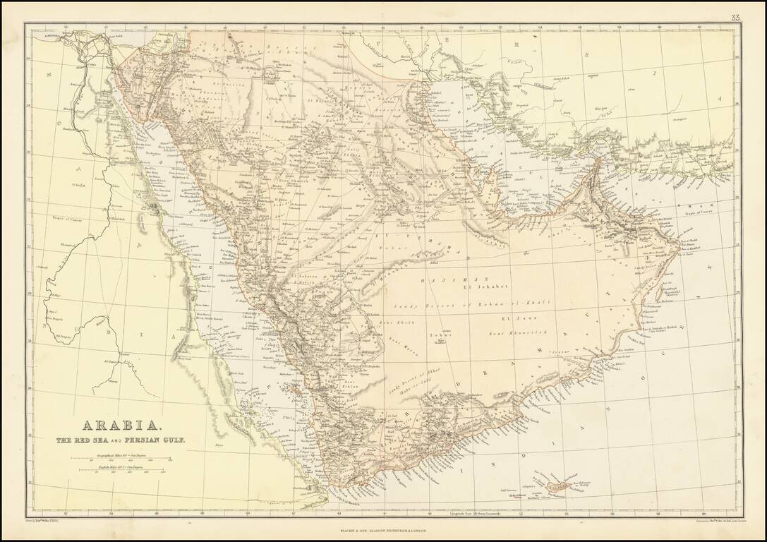
Detailed map of the Arabian Peninsula and Middle East, published by Edward Weller.

The map includes a number of overland routes across the Arabian Peninsula.

The map also locates Abou-Thubbi (Abu Dhabi), Debai (Dubai) and Sharja, as well as El Biddah (Doha).


Special conditions for students!

If you are a student, write to us in telegram: @antiquemaps and indicate what material you need and for what work you need a map in high detail. We are ready to provide material on special terms. For students only!

Item information:

Year of creation:
Size:
12688x8968 px
Disk:
28.8232MiB
Number of pages:
1
Place:
Edinburgh & London
Author:
Blackie & Son.
$14.99

Related item