logo

1797. L'Arabia Delineata Sulle Ultime Osservazioni . . . 1797

  • L'Arabia Delineata Sulle Ultime Osservazioni . . . 1797

L'Arabia Delineata Sulle Ultime Osservazioni . . . 1797 information:

Year of creation: 
Resolution size (pixels): 
 13014x9994 px
Disk Size: 
 28463100B
Number of pages: 
 1
Place: 
 Rome

Print information. Print size (Width x height in inches):
Printing at 72 dpi 
  180.75 х 138.81
Printing at 150 dpi 
 86.76 х 66.63
Printing at 300 dpi 
 43.38 х 33.31

An example of detailing the file of this map of in a printable high-resolution:

Click to open in high resolution (open in new tab).
Attention! this is just the central piece (central area 960x960 px) of the map file!
This is an example, so that you can see and study the level of detail of a given map. The entire Map will be fully available after payment!

L'Arabia Delineata Sulle Ultime Osservazioni . . . 1797

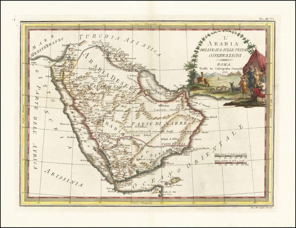
Decorative 18th Century map of the Arabian Peninsula, published in Rome by Cassini.

The map extends from the Red Sea to the Persian Gulf, Straits of Hormuz and Indian Ocean, centered on Arabia, which is divided into several regions, including Paese di Nagen, Paese Di Mahre, Seger, Yemen, Bahrein, and Teham. Dozens of early place names are shown.

Marvelous cartouche shows a nomadic camp ground, with indigenous animals and costumes.


Special conditions for students!

If you are a student, write to us in telegram: @antiquemaps and indicate what material you need and for what work you need a map in high detail. We are ready to provide material on special terms. For students only!

Item information:

Year of creation:
Size:
13014x9994 px
Disk:
28463100B
Number of pages:
1
Place:
Rome
Author:
Giovanni Maria Cassini.
$14.99

Related item