Map size in jpg-format: 27.4323MiB
Click to open in high resolution (open in new tab).
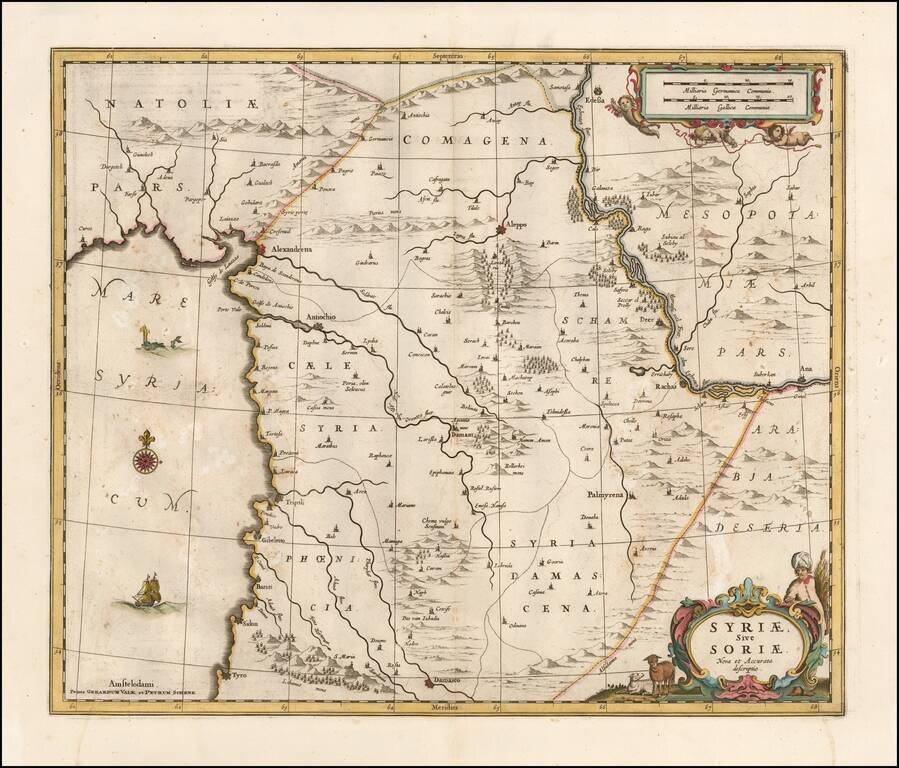
Detailed late 17th Century map of Syria published in Amsterdam.
The map extends from Damascus and Sidon in the south, to Edessa, Alexandretta, and Antioch in the north as well as to Aleppo, Palmyrena, Damant, etc.
The map also extends from the Mediterranean to the Euphrates.
Originally engraved by Jan Jansson, the copperplate was later acquired by Valk & Schenk.
The Valk & Schenk edition is by far the more scarce edition of the map.
If you are a student, write to us in telegram: @antiquemaps and indicate what material you need and for what work you need a map in high detail. We are ready to provide material on special terms. For students only!

![[Europe, Mediterranean, Asia Minor and the Persian Empire]](/map/small/43558.jpg)
