Map size in jpg-format: 2.75641MiB
Click to open in high resolution (open in new tab).
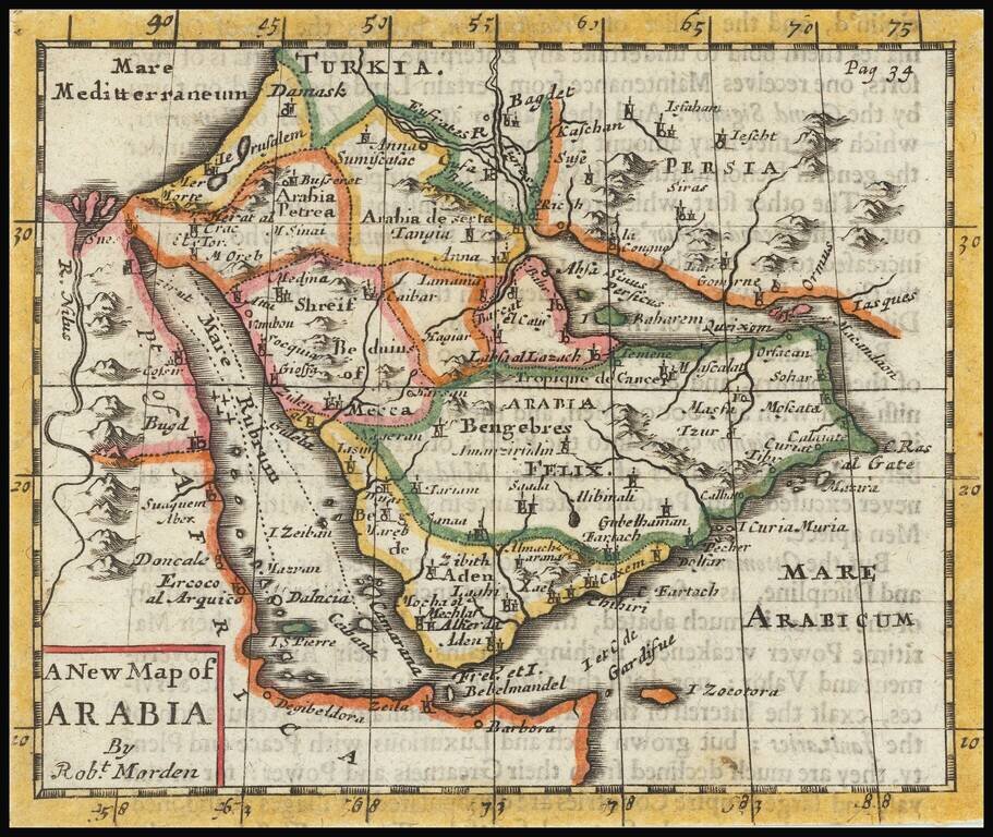
Rare early English map of Arabia, extending from the Mediterranean to the Red Sea to the Persian Gulf, with many kingdoms, place names, etc. shown.
Mecca and Medina area located.
Robert Morden (d. 1703) was a British map and globe maker. Little is known about his early life, although he was most likely apprenticed to Joseph Moxon. By 1671, Morden was working from the sign of the Atlas on Cornhill, the same address out of which Moxon had previously worked. Most famous for his English county maps, his geography texts, and his wall maps, Modern entered into many partnerships during his career, usually to finance larger publishing projects.
If you are a student, write to us in telegram: @antiquemaps and indicate what material you need and for what work you need a map in high detail. We are ready to provide material on special terms. For students only!

![[Europe, Mediterranean, Asia Minor and the Persian Empire]](/map/small/43558.jpg)
