logo

1762. L'Amerique Meridionale divisee en ses principaux Etats . . . 1762

  • L'Amerique Meridionale divisee en ses principaux Etats . . . 1762

L'Amerique Meridionale divisee en ses principaux Etats . . . 1762 information:

Year of creation: 
Resolution size (pixels): 
 12077x8706 px
Disk Size: 
 18.6648MiB
Number of pages: 
 1
Place: 
 Paris
Author: 

Print information. Print size (Width x height in inches):
Printing at 72 dpi 
  167.74 х 120.92
Printing at 150 dpi 
 80.51 х 58.04
Printing at 300 dpi 
 40.26 х 29.02

An example of detailing the file of this map of in a printable high-resolution:

Click to open in high resolution (open in new tab).
Attention! this is just the central piece (central area 960x960 px) of the map file!
This is an example, so that you can see and study the level of detail of a given map. The entire Map will be fully available after payment!

L'Amerique Meridionale divisee en ses principaux Etats . . . 1762

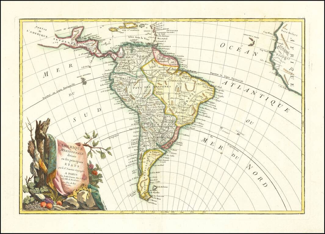
Decorative map of South America, published in Paris by Jean Janvier.

A classic example of the French unwillingness to enhance maps with speculative cartography.

Large decorative cartouche.


Special conditions for students!

If you are a student, write to us in telegram: @antiquemaps and indicate what material you need and for what work you need a map in high detail. We are ready to provide material on special terms. For students only!

Item information:

Year of creation:
Size:
12077x8706 px
Disk:
18.6648MiB
Number of pages:
1
Place:
Paris
Author:
Jean Janvier.
$14.99

Related item