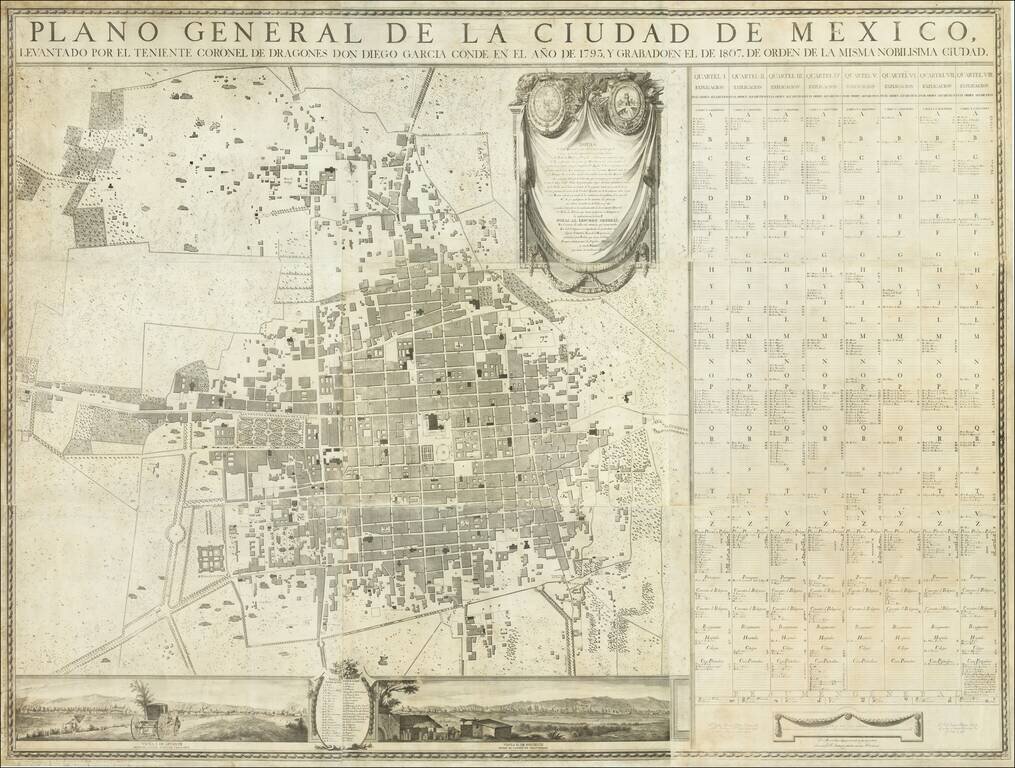
One of the Earliest Printed Maps of Mexico City—Extremely Rare First Edition! Fine nine-sheet plan of Mexico City surveyed by Diego Garcia Conde and compiled by some of Mexico's most important engravers and artists. It was published in Mexico City...
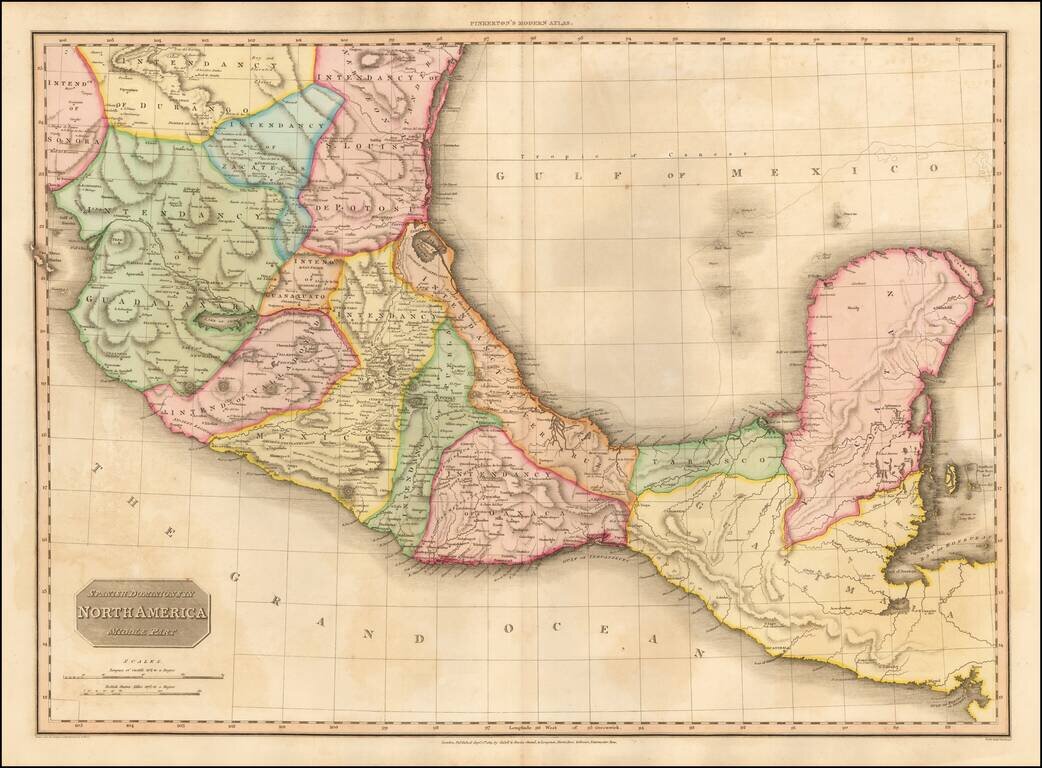
Fine example of John Pinkerton's finely detailed map of Southern Mexico, the Yucatan and Guatemala, published in 1811. The map provides a fine depiction of the heart of Mexico, just months after the Grito de Dolores, on September 16, 1810, and...
![[Gulf Coast, Mexico, Puebla, Vera Cruz, etc] Amer. Sep. No. 65. Partie Du Mexique](/map/small/55042.jpg)
Highly detailed regional map of the east coast of Mexico, extending from Nuevo Santander and Barra de Santander in the North to Pres. De San Felipe and Barra de S. Pedro, and including virtually all of Vera Cruz and Puebla and extending west to include...
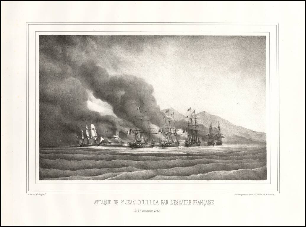
The Decisive Battle of the Pastry War Fine early lithographic view depicting the Battle of Veracruz. Overview During the early years of the new Mexican republic there was widespread civil disorder as factions competed for control of the country....
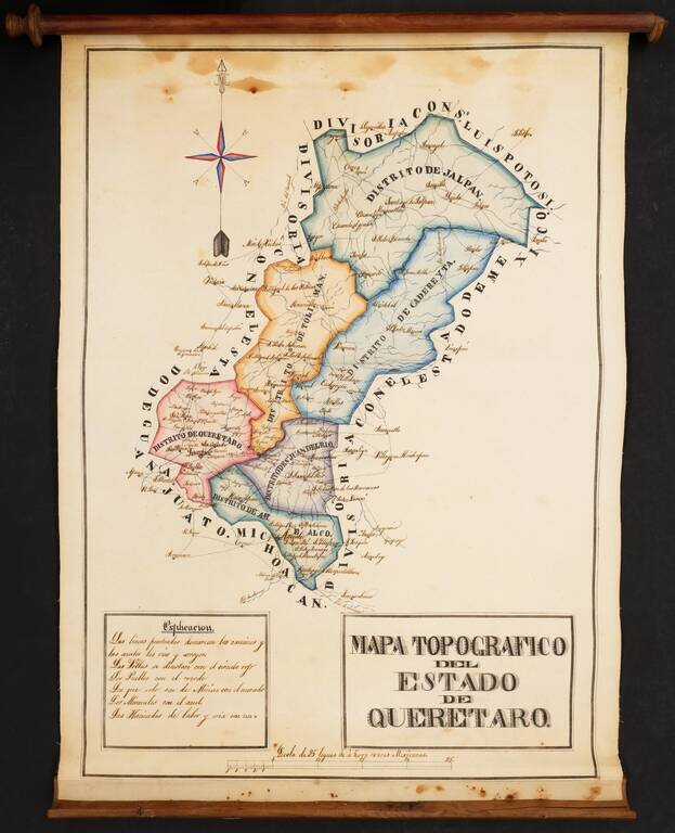
Striking Manuscript Map of the Mexican State of Querétaro Colorful and detailed manuscript map of the state of Querétaro, in central Mexico. The map is drawn is a skilled hand and was likely prepared by an official for government use and possible...
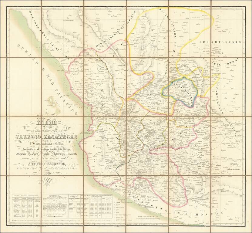
Rare Map of Jalisco, Zacatecas, and Aguascalientes published in Belgium Fine Vandermaelen map of central Mexico. The map is densely detailed, and demographic and coordinates information in the lower left. This map is a collection of the provinces of...
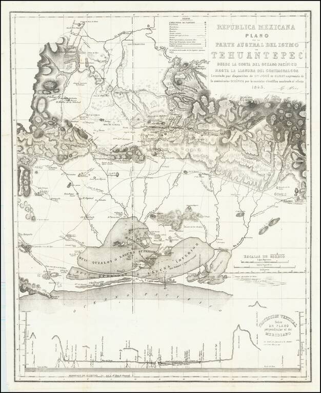
Rare map of the southern portion of the Isthmus of Tehuantepec, with Laguna Superior abutting the Pacific Ocean. At bottom is a profile showing elevations across the isthmus. The map is the result of the surveys undertaken by Don Jose de Garay,...
![El numero 1 q[ue] se haya en la orilla de la ???ya que corre a San Ysidro es el gran ?? de partida siguencio? la numeracion immediata a los puntos amarillos ?on los ?inderos, hasta? el numero 19 con que vierra en el terreno marcados con la letra C.](/map/small/65664ba.jpg)
Resolving a Land Dispute In Temascalcingo, Mexico in 1845 Finely construted map of a large portion of the city of Temascalcingo in the State of Mexico, which officially set the boundary markers (mojoneras, spelled here with an h), for different...
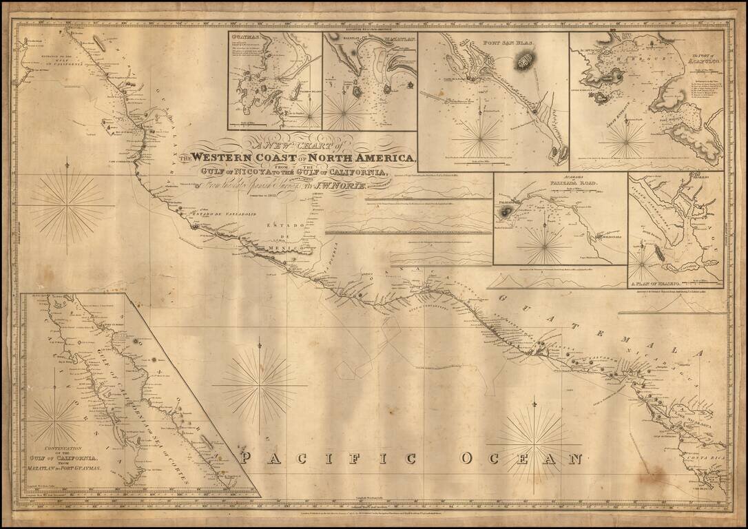
Engraved sea chart covering the area from Cape Blanco, Costa Rica, to the mouth of the Gulf of Mexico, with an inset map titled "Continuation of the Gulf of California, from Mazatlan to Port Guymas." The map includes the following harbor map insets:...
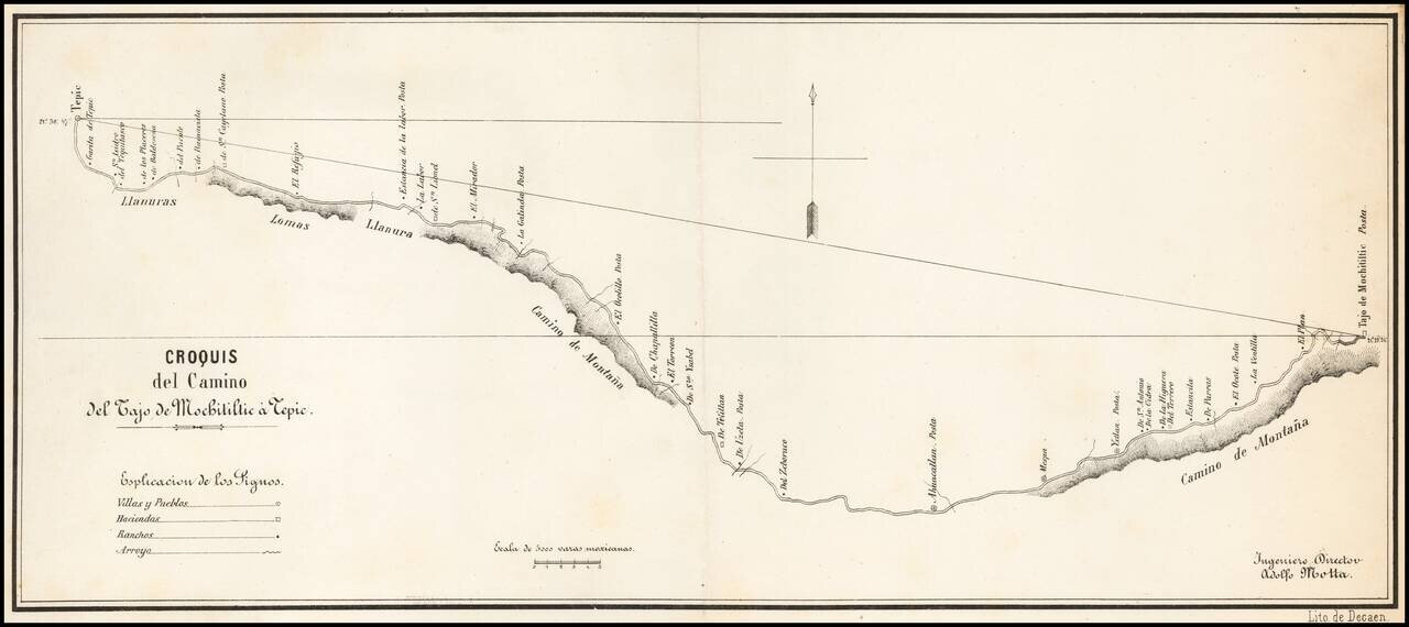
Detailed map of the road from Tepic, southeast toward Guadalajara, published in Mexico City and signed by Ingeniero Director Adolfo Motta. The map is based upon a manuscript map by J.A. Motta, drawn in 1856, as described by Manuel Orozco y Berra, in...
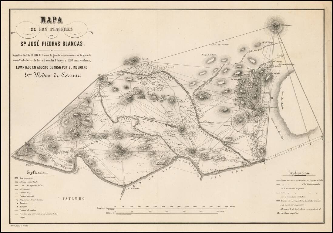
Detailed map of the area around San Jose Piedras Blancas (Michoacan) by the Belgian Engineer Guilermo Wodon de Sorinne, an important observer of regional Mexican culture. The map shows Wodon de Sorinne's triangulation methodology in surveying the...
The Southernmost Portion of the Camino Real de Tierra Adentro (Road to Santa Fe). Rare map showing the southernmost portion of the Camino Real, proceeding north from the outskirts of Mexico City toward Santa Fe. The map is oriented with east at the...
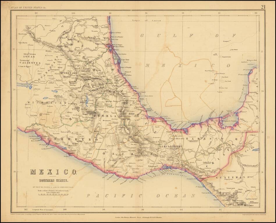
Lithographed map of Southern Mexico by Rogers & Johnston. The map covers the states of Queretaro, Mexico, Puebla, Veracruz, Oajaca, Guerrero, Tehuantepec, Tabasco, Chiapas.
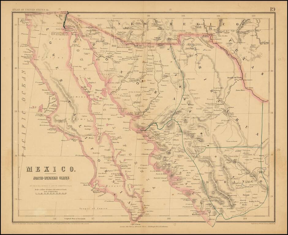
Rare map of Northern Mexico, from Rogers & Johnston's rare Atlas of the United States. The map is part of a wall map of the United States & Mexico, published by Rogers & Johnston. Conceived as a collaborative effort between W & AK...
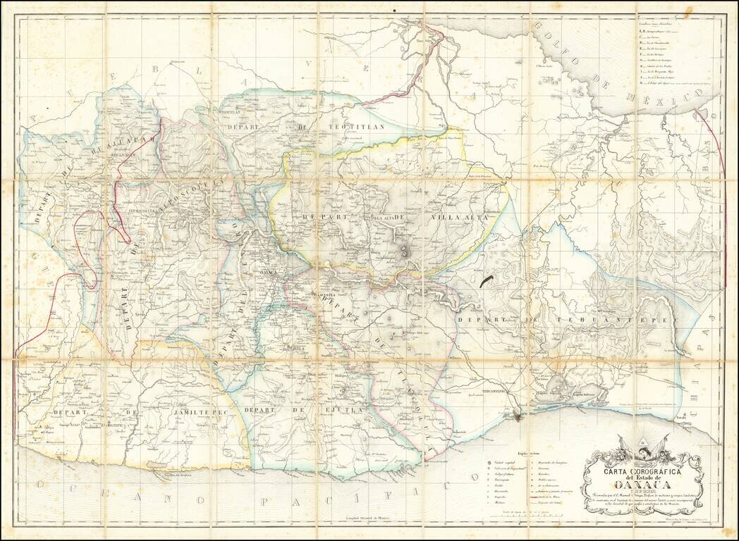
Early Modern Map of the State of Oaxaca Finely executed map of the State of Oaxaca, prepared by C. Manuel Ortega and lithographed by Litog de Salazar, on Calle de la Palma in Mexico City. Drawn from Ortega's original map of Oaxaca (#787 in the...
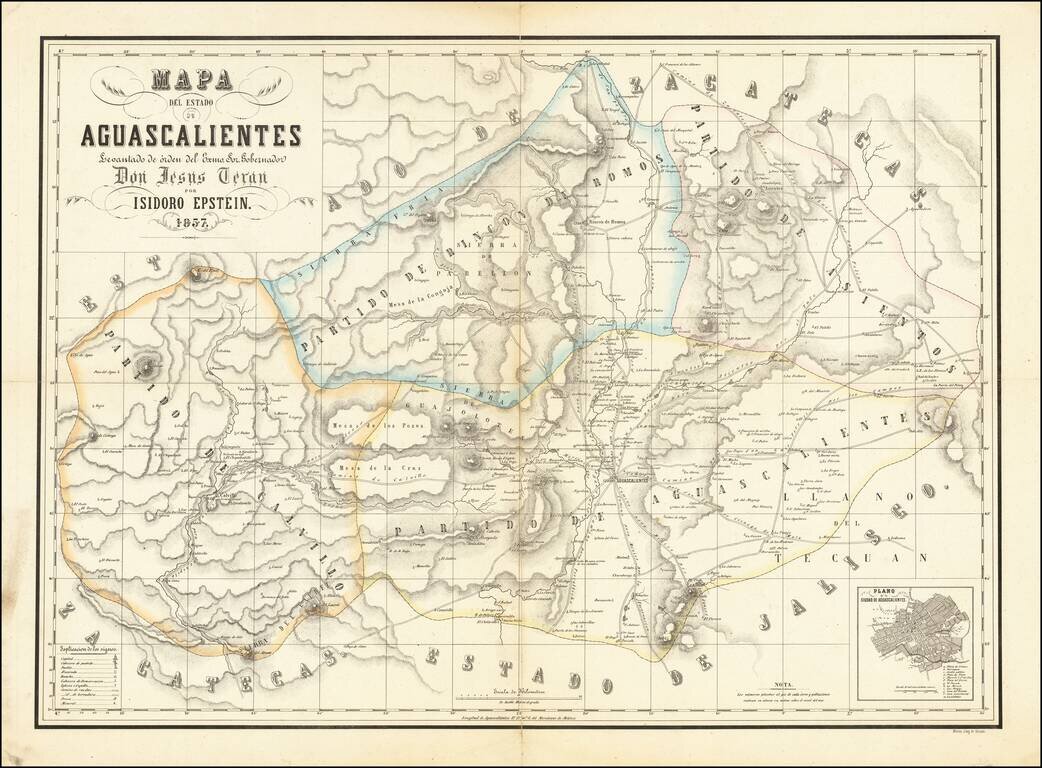
Detailed Map of the State of Aguascalientes Fine map of Aguascalientes, drawn by German mapmaker Isidoro Epstein, under direction by Governor Jesús Terán and published by the lithography shop of Decaen. This is one of the first separately published...