logo

1857. Mexico Southern States.

  • Mexico Southern States.

Map size in jpg-format: 22.4503MiB

Download "Mexico Southern States.", in high resolution.

Mexico Southern States. information:

Year of creation: 
Resolution size (pixels): 
 10585x8569 px
Disk Size: 
 22.4503MiB
Number of pages: 
 1
Place: 
 London & Edinburgh

Print information. Print size (Width x height in inches):
Printing at 72 dpi 
  147.01 х 119.01
Printing at 150 dpi 
 70.57 х 57.13
Printing at 300 dpi 
 35.28 х 28.56

An example of detailing the file of this map of in a printable high-resolution:

Click to open in high resolution (open in new tab).
Attention! this is just the central piece (central area 960x960 px) of the map file!
This is an example, so that you can see and study the level of detail of a given map. The entire Map will be fully available after payment!

Mexico Southern States.

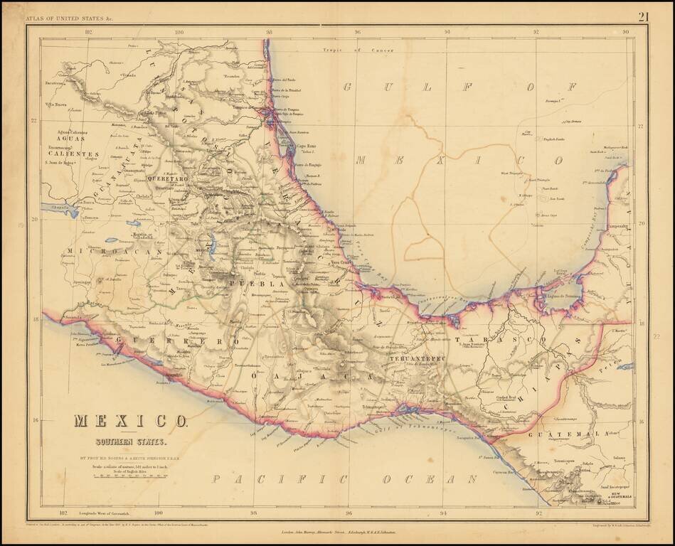
Lithographed map of Southern Mexico by Rogers & Johnston.

The map covers the states of Queretaro, Mexico, Puebla, Veracruz, Oajaca, Guerrero, Tehuantepec, Tabasco, Chiapas.


Special conditions for students!

If you are a student, write to us in telegram: @antiquemaps and indicate what material you need and for what work you need a map in high detail. We are ready to provide material on special terms. For students only!

Item information:

Year of creation:
Size:
10585x8569 px
Disk:
22.4503MiB
Number of pages:
1
Place:
London & Edinburgh
Author:
Henry Darwin Rogers. Alexander Keith Johnston.
$14.99

Related item