Map size in jpg-format: 87.7684MiB
Click to open in high resolution (open in new tab).
Rare Map of Jalisco, Zacatecas, and Aguascalientes published in Belgium
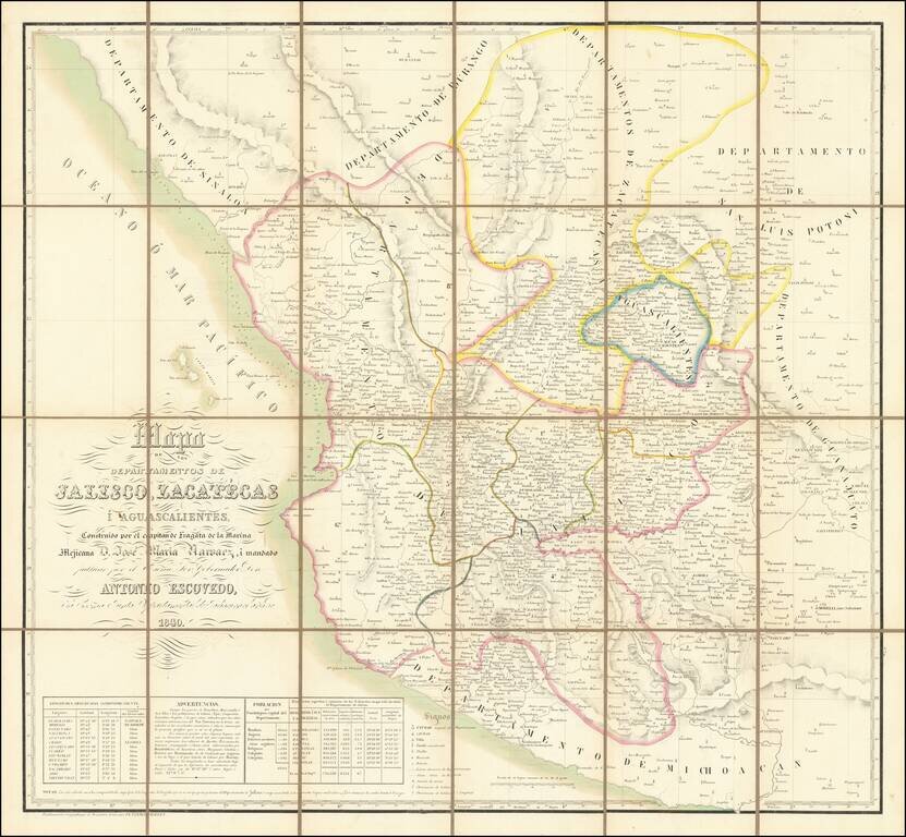
Fine Vandermaelen map of central Mexico. The map is densely detailed, and demographic and coordinates information in the lower left.
This map is a collection of the provinces of the states of Jalisco, Zacatecas, and Aguascalientes. The title, encompassed in simple line work and found on the bottom left of this map, reads “Map of the States of Jalisco, Zacatecas, and Aguascalientes, constructed by the Captain of the Mexican Naval Frigate Don Jose Maria Narvaez, and ordered for publication by the esteemed Governor and member of the Departmental Board of Jalisco Don Antonio Escovedo in 1840.” This map also includes portions of the states of Sinaloa, Durango, San Luis Potosi, Guanajuato, Michoacán, and the Islas Marias, but these are peripheral.
While this is not the first-ever printed map of these regions, it is the first to illustrate census-type detail. This legend lists the population of Guadalajara, the capital of Jalisco, as well as the figures for the other seven districts in Jalisco, habitants per square mile, longitude and latitude of cities, locations of pueblos, haciendas, and ranchos. The longitudes and latitudes of each big city as well as the name of the explorer of the city are listed on the far left of the legend. This legend includes a note that reads:
Although the ports of Tomatlan, Manzanillo, and San Blas, and the towns of Colina, Tepic, Compostela, Zapotlan, Sayula, and all lakes are located by the astronomical observations of Sir Narvaez, we do not have his calculations or the results and numbers; they are only known by the graphic position that is seen at this scale. Some of the numbers placed here indicate a location’s elevation above sea level expressed in Mexican rods. The heights of Morelia, Patzenaro, Salamanca, Guanajualo and Charo are determined by Humboldt: those of Zacatecas, Jerez, Huajucar, Catalan, and Bolanos by Bustamante: that of Undameo by Lejarza; and those of Tepic and the frozen peak of Colima by Beeehey. All the longitudes have been calculated under the assumption that the difference of meridians between Paris and Cadi is 8° 37’ 30” and between Mexico and Cadi 92° 8’ 7.5”.
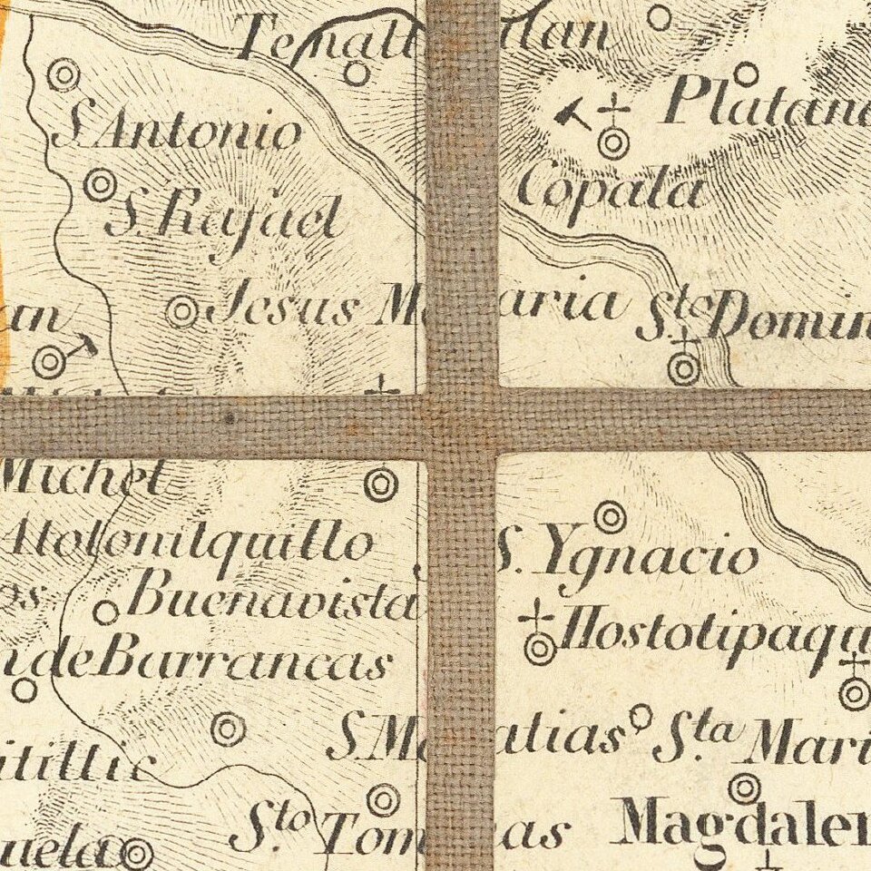
This map exhibits the location of capital cities, cities, pueblos, haciendas, ranches, villas, beaches, mines, volcanoes, naval ports, mountain ranges, and bodies of water. The note found at the very bottom of this map reads “In these calculations, the surface of the Chapala lagoon has not been understood, which for the most part belongs to the state of Jalisco and whose total area is ninety square leagues (numbers denote fathoms)”.
Jose Maria Narvaez was a Spanish, and later a Mexican, naval officer. In early 1788, he was stationed at the main Spanish naval base on the west coast of Mexico. Narvaez served as a pilot in Spain’s 1788 voyage to Alaska, 1789 expedition to Nootka Sound on present day Vancouver Island, 1791 expedition to Saturna Island, Pender Island, Guemes Island, Cypress Island, and Lummi Island, 1813 voyage to the Philippines, and more.
In 1817, Narvaez began his work mapping the province of Jalisco. When Mexico won their independence from Spain, Narvaez stayed in Guadalajara with his family, retired from the Spanish Navy, and was elected Provincial Deputy of Guadalajara in 1821. When the Mexican Navy was created late that year, Jose was appointed frigate lieutenant and given command of the San Carlos to explore Baja California. When Narvaez returned, he was given command of the Mexicana to survey and map the west coast of Mexico. Even in retirement, Narvaez created many maps of the border areas between Louisiana, Texas, and Mexico, and the first official map of the state of Jalisco.
Don Antonio Escovedo was an esteemed Governor of Jalisco for portions of time between the years 1836-1846. In his earlier years, Escovedo served in the First Legislature of the State Congress on the Finance Commission. When he was first elected in 1836, Escovedo was a member of the Departmental Board of Jalisco. In 1837, he was appointed Vice Governor of Jalisco. For a brief period in 1838 Escovedo served as interim Governor and placed great emphasis on education; he likely ordered this map to be made in this period, although it was not published until 1840. In 1844, he became the Constitutional Governor of the Department of Jalisco.
Jalisco, Zacatecas, and Aguascalientes
Jalisco is a culturally rich state, home to mariachi music, sombreros, rodeos, tequila, and many colonial towns. However, in 1810, rebel forces of Miguel Hidalgo’s new army conquered Guadalajara. Jalisco became a site of conflict as the War for Independence continued. In 1811, Hidalgo and his rebels lost a battle against Royalist forces, were captured, and executed. It was not until 1823 that the freed state of Jalisco joined with other states to become the Mexican Republic of today.
Zacatecas’ history began with the largest and bloodiest battle of the Mexican Revolution. It is well known as an agricultural center, big producer of beverages, and home to silver mines and robust commerce. Like much of Mexico in the nineteenth century, Zacatecas was troubled with years of political and military conflicts. When Mexico won its independence in 1821, Zacatecas joined and was incorporated into the new Mexican Republic in 1824.
While Aguascalientes is one of the smallest Mexican states, it is well known for its railroad and textile industries, and its culinary tradition. During this period, Aguascalientes was in frequent jurisdictional disagreements with neighboring Zacatecas. In 1804, Aguascalientes became a subdelegation of Zacatecas, a status in which it remained until 1921.
Rarity
The map is extremely rare.
OCLC locates only the examples in the Biblioteca Nacional Mexico and the Bibliotheque National de France.
If you are a student, write to us in telegram: @antiquemaps and indicate what material you need and for what work you need a map in high detail. We are ready to provide material on special terms. For students only!


![Map of Mexico, Central America, and the West Indies [Insets of Bermuda, Sandwich Islands, Jamaica and Panama Railroad]](/map/small/69133.jpg)