Map size in jpg-format: 5.13332MiB
Click to open in high resolution (open in new tab).

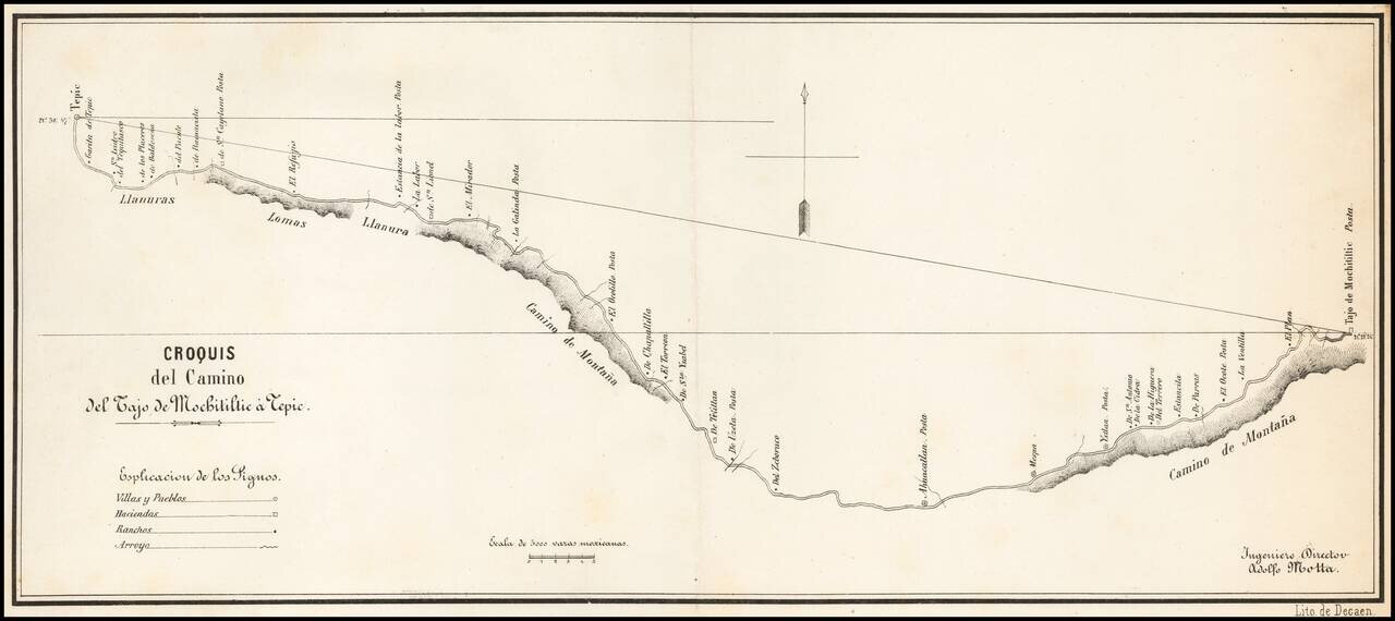
Detailed map of the road from Tepic, southeast toward Guadalajara, published in Mexico City and signed by Ingeniero Director Adolfo Motta.
The map is based upon a manuscript map by J.A. Motta, drawn in 1856, as described by Manuel Orozco y Berra, in Materials para una cartografie mexicana por el ingeniero Lic. Manuel Orozco y Berra, published in Mexico City by the Sociedad Mexicana Geografia y Estadistica.
If you are a student, write to us in telegram: @antiquemaps and indicate what material you need and for what work you need a map in high detail. We are ready to provide material on special terms. For students only!


![Map of Mexico, Central America, and the West Indies [Insets of Bermuda, Sandwich Islands, Jamaica and Panama Railroad]](/map/small/69133.jpg)