Map size in jpg-format: 24.4448MiB
Click to open in high resolution (open in new tab).
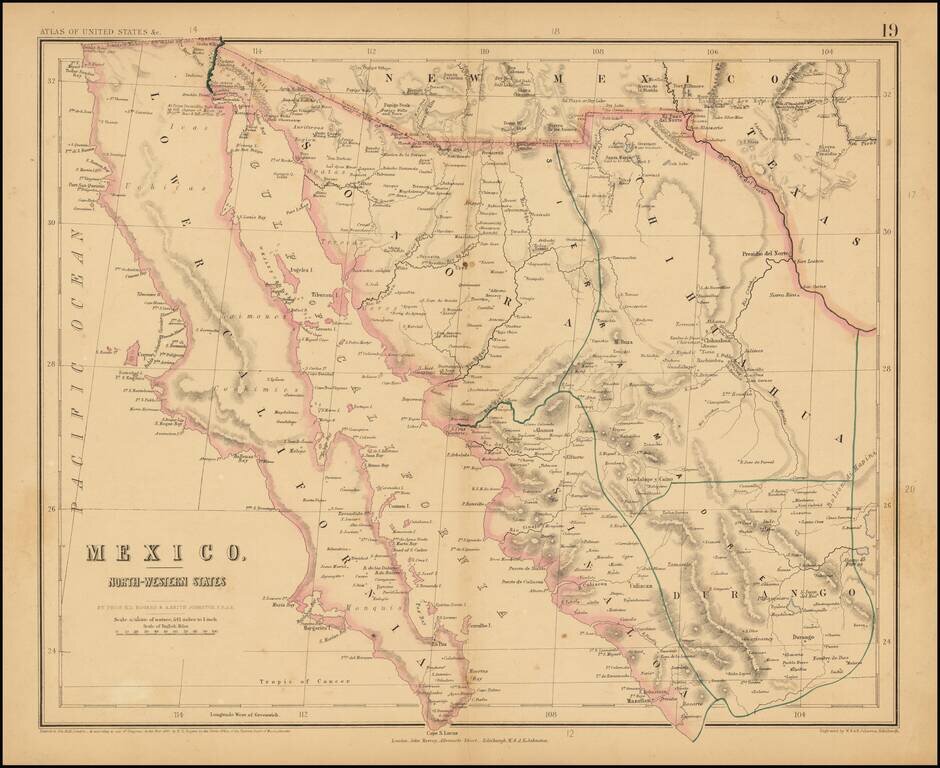
Rare map of Northern Mexico, from Rogers & Johnston's rare Atlas of the United States.
The map is part of a wall map of the United States & Mexico, published by Rogers & Johnston. Conceived as a collaborative effort between W & AK Johnston (of London) and H.D. Rogers (of Boston), the project began with a wonderful wall map of the United States in 1856, which Rumsey describes as one of the most beautiful maps of the period.
If you are a student, write to us in telegram: @antiquemaps and indicate what material you need and for what work you need a map in high detail. We are ready to provide material on special terms. For students only!


![Map of Mexico, Central America, and the West Indies [Insets of Bermuda, Sandwich Islands, Jamaica and Panama Railroad]](/map/small/69133.jpg)