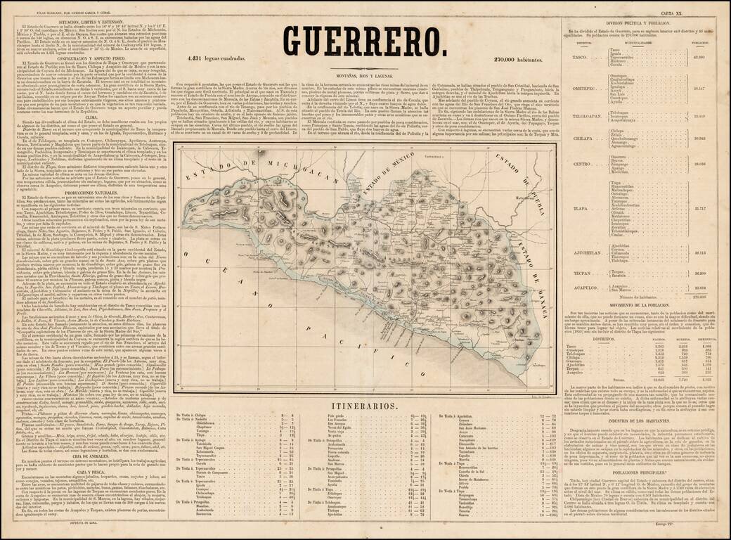
Scarce map of the State of Guerrero in Mexico, from Antonio Garcia y Cubas' monumental Atlas Geographico, Estadistico e Historico de la Republica Mexicana, the first atlas of the Mexican Republic. Garcia Cubas' map of Guerrero is one of the earliest...
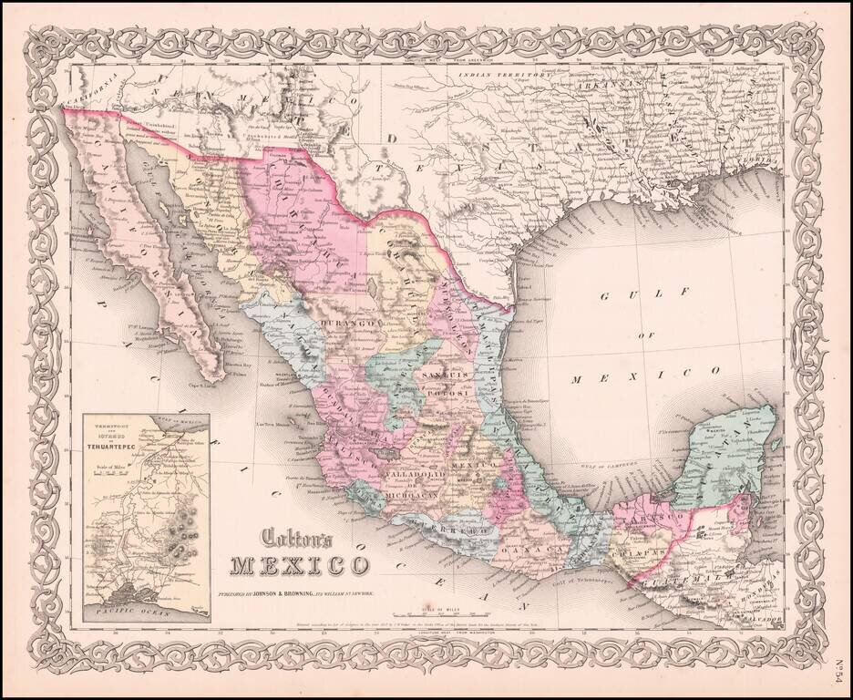
Very detailed map showing towns, counties, Gulf of Mexcico and Gulf of California with lovely decorative border and inset of Territory and Isthmus of Tehuantepec. An excellent pre-Civil War map. From the scarce 1859 edition of Colton's atlas, which is...

Detailed lithographed map of the Mexican State of Campeche on the western side of the Yucatan Peninsula, published in Mexico in 1861. The map differentiates between eight (!) different kinds of settlements, including haciendas, rancherias, villas,...
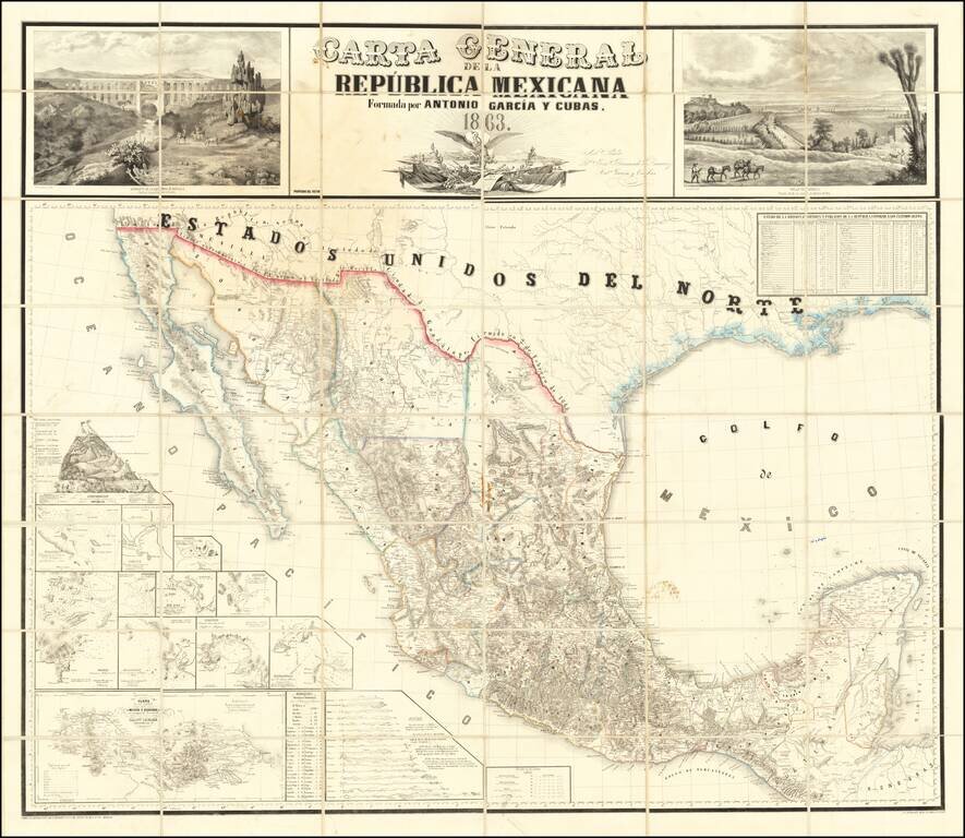
The First Wall Map of The Mexican Republic Published in Mexico Fine example of the first official map of Mexico published in Mexico from indigenous surveys. Antonio Garcia y Cubas' map of Mexico is the first official map of Mexico, printed in Mexico...
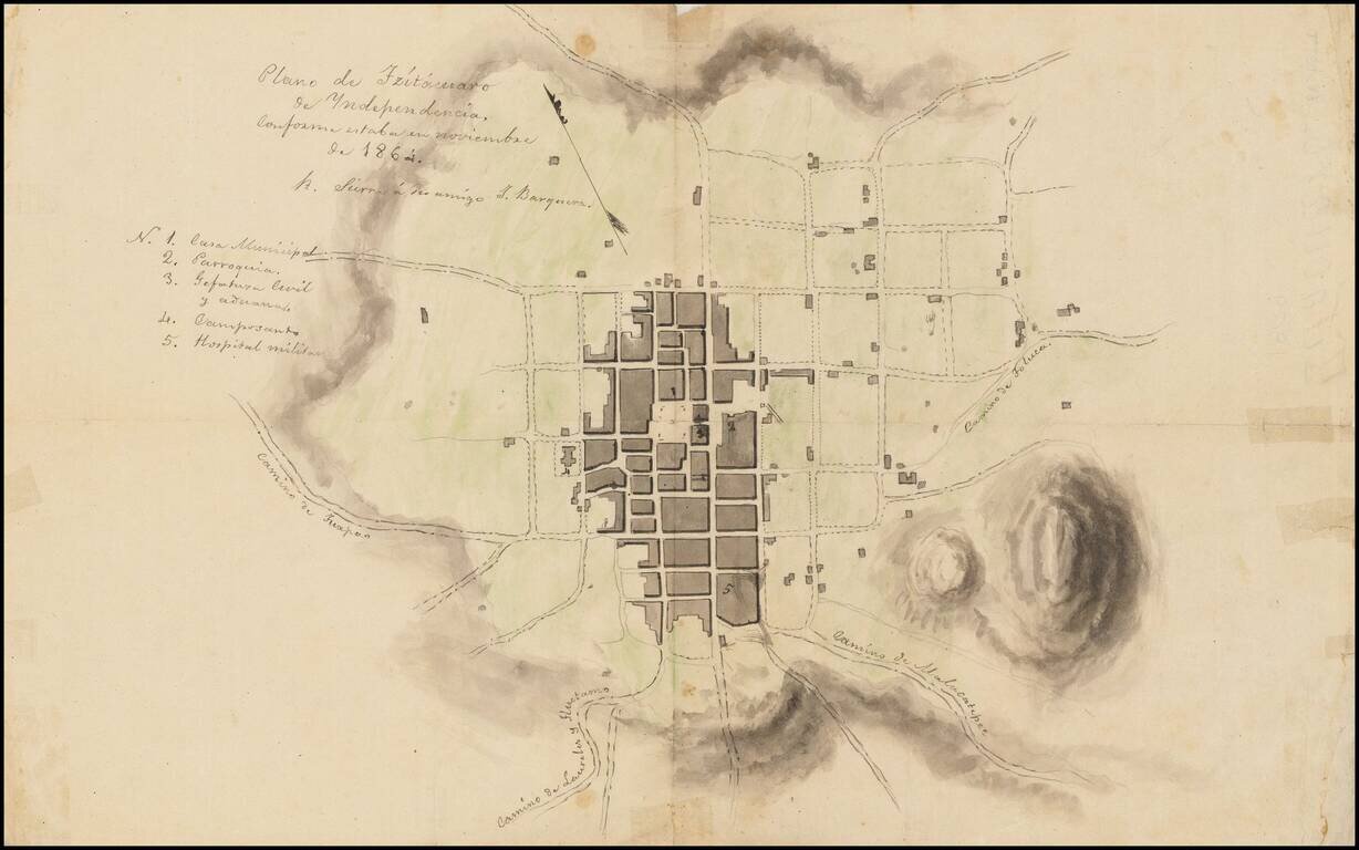
Town Plan of Zitácuaro de Independencia with Manuscript Notes This is a sketch of a plan of Zitácuaro, another copy of which is available at /gallery/detail/49465ba . It is not an exact copy, however, as it has some manuscript notes, including one...
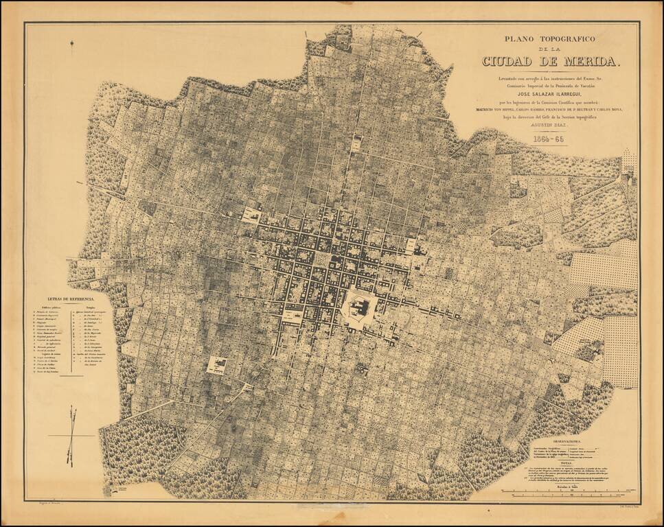
Fine photo-lithographic reproduction of Augustin Diaz's rare plan of Merida, originally published in Paris in 1865 for the Comision Cientifica. The map notes at the bottom center (obliterated on this copy) that it was reproduced by the Engineer...
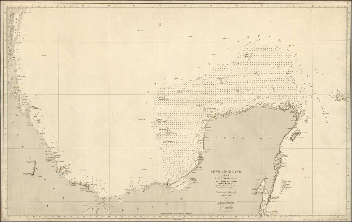
Scarce separately issued Spanish Sea chart of the Coast of Mexico, from Santander to Yucatan. Highly detailed, including soundings and lighthouses.
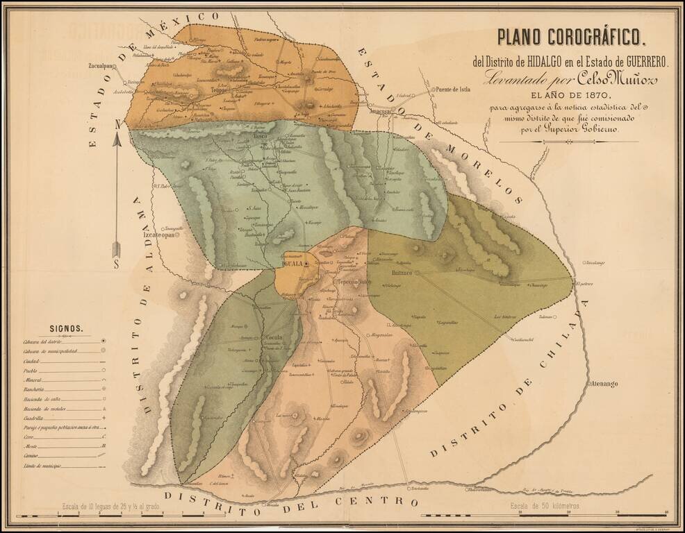
Rare map of the Hidalgo District in the State of Guerrero. showing its divisions and highlighting the cities of Iguala, Cocula, Huitzuco, Taxco and Tetipac. The map shows topographical details, roads, routes, towns, ranches and haciendas.
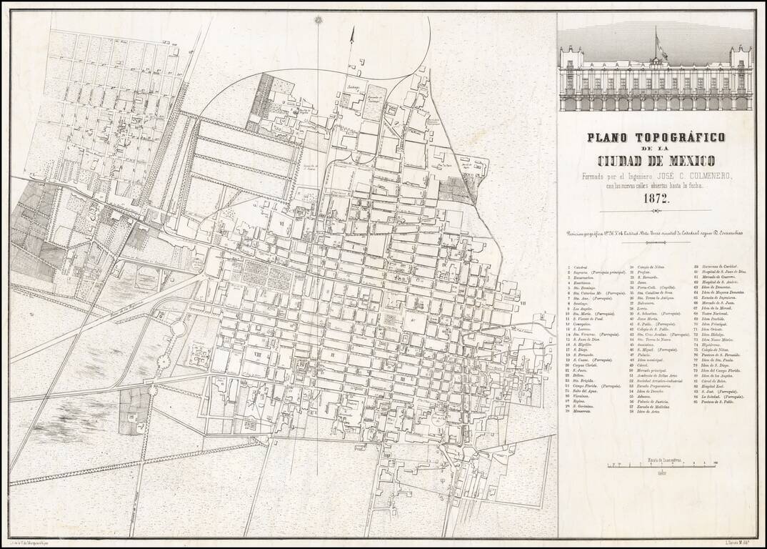
Rare separately issued map of Mexico City, lithographed by V. de Murguia e hijos in Mexico City. The map provides a fine overview of the city, including identifying newly opened streets, as noted in the title of the map. The map includes an inset...
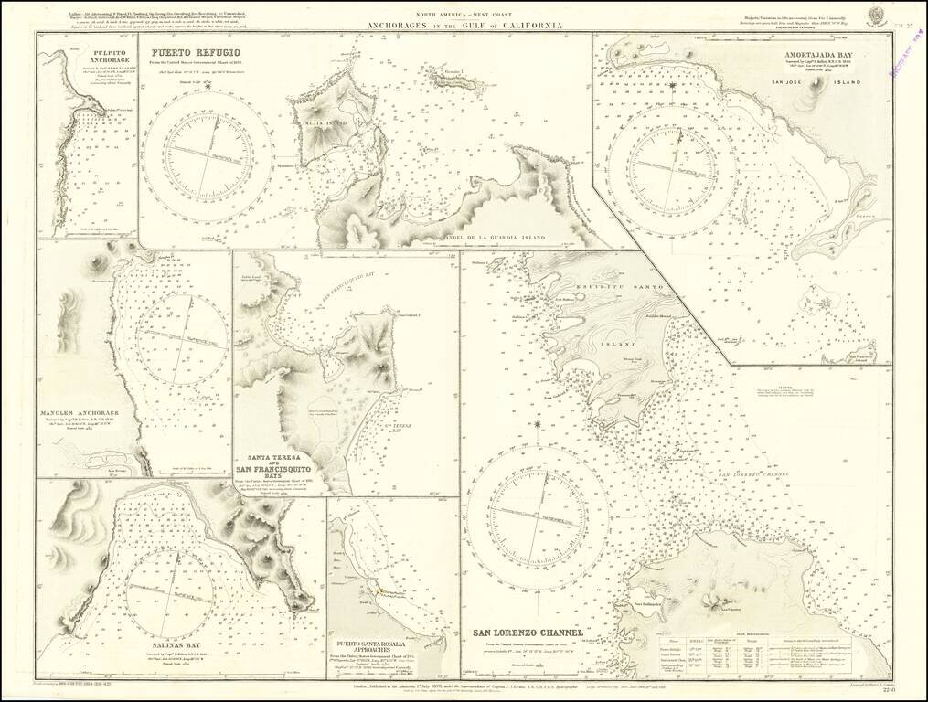
Detailed chart of the anchorages in the Gulf of California, including those on the eastern shores of Baja California. Much of the information comes from Henry Kellett's important 1845 hydrographical survey for the Royal Navy, undertaken on HMS Herald...
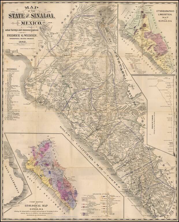
Rare map of Sinaloa in northwestern Mexico, lithographed by W.T. Galloway and published in San Francisco in 1882. While created for the mining industry, the map's most unique features is the large inset "Ethongraphic-Linguistic Map of Sinaloa,"...
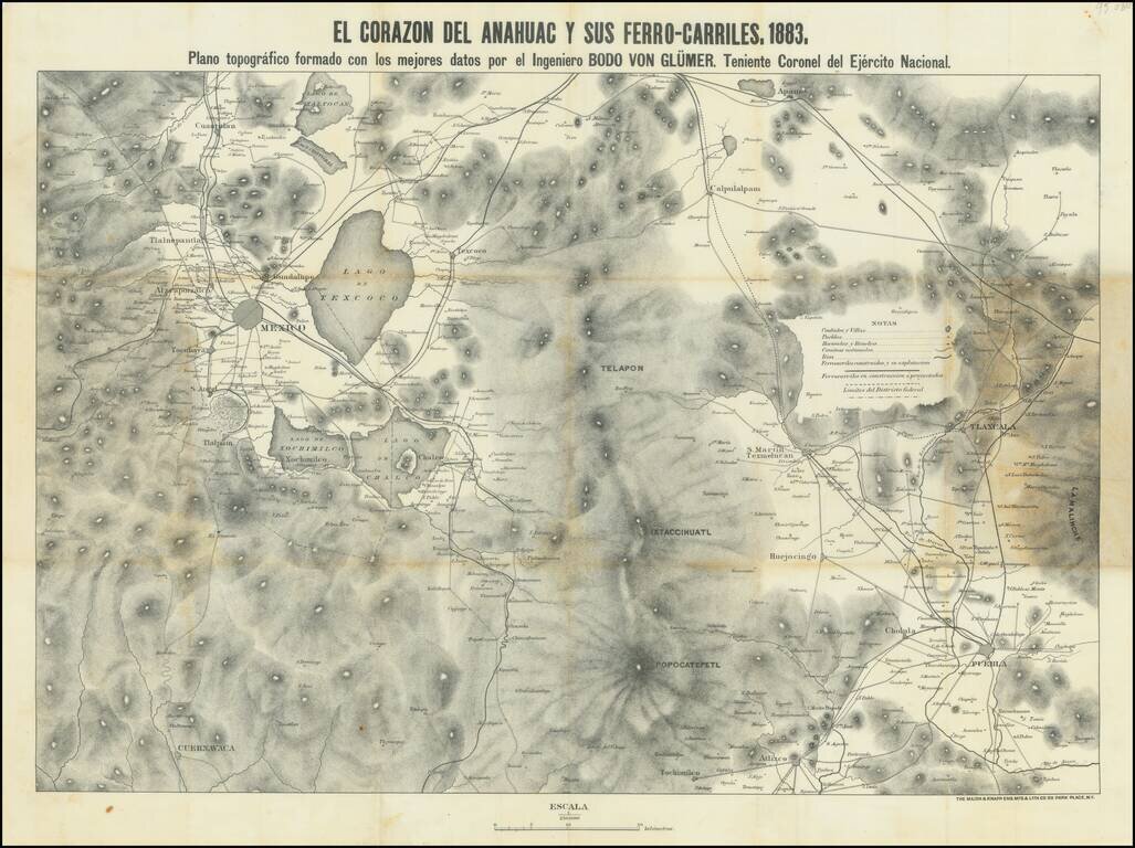
This is a map showing the region around Mexico City, focusing on the railroads of the area. Topography, cities, towns, rivers, and other roads are also shown. The title refers to the Nahuatl name for the Aztec homeland. Mexico City is visible in the...
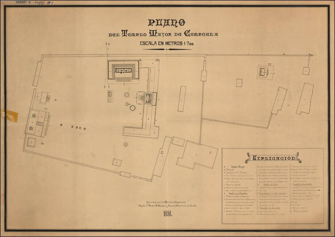
Striking Plan of the Templo Mayor de Cempoala (Zempoala) in the state of Veracruz This late-nineteenth century plan shows the larger temple of Cempoala, also known as Zempoala. It is an important archaeological site for Mesoamerican history, but also...
![A Map of British Honduras... [bound in:] Tratado de Limites Entre Los Estados-Unidos Mexicanos y Honduras Britanica Seguido de los principales documentos que a el se refieren. Edicion Oficial.](/map/small/70984.jpg)
Determining Belize's Northern Limits. Frist official Mexican edition of the treaty with Great Britain establishing the Mexico-Belize border. Belize's borders have long been an issue for the country and its neighbors. The Belize-Mexico and...
![[Mexico City] Reduccion Del Plano Oficial De La Ciudad De Mexico Aumentado y Rectificado Con Todos Ultimos Datos Recogidos De La Direccion De Obras Publicas y de la Oficina Technica del Saneamiento . . . 1900](/map/small/64123.jpg)
Rare separately published map of Mexico City, published by the Compañia Litografica Tipografica S.A. This fascinating and attractive map captures the Mexican Capital when the city had a population of only approximately 500,000. Based on official...
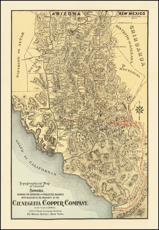
Promoting Copper Mine Investments in Sonora During the Copper Boom in the Early 20th Century Finely executed map showing the transit routes to the Copper Mines of Eastern Sonora in Mexico. While the map is unrecorded, it was likely published in order...