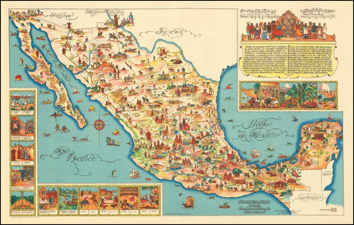
Rare large format version of this decorative map of Mexico, published in Mexico City. The map is one of the liveliest and most interesting maps of Mexico published in this pictographic style, with vivid colors and fantastic images.
The Seldom Seen Full-Sized Poster Version. Rare large format version of this decorative map of Mexico, published in Mexico City. This is the poster-sized version of the 1950 version of Miguel Gomez Medina's 1931 pictorial map of Mexico, which was...
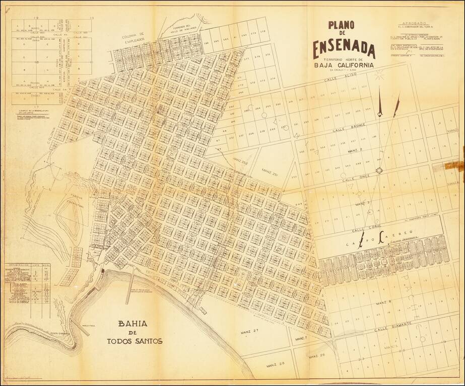
A mid-century map of Ensenada, Baja California del Norte. It shows the port of Todos Santos, the layout of the city and its neighborhoods, and plots of land not yet developed. The margins contain notes and tables showing how new plots should be labeled...
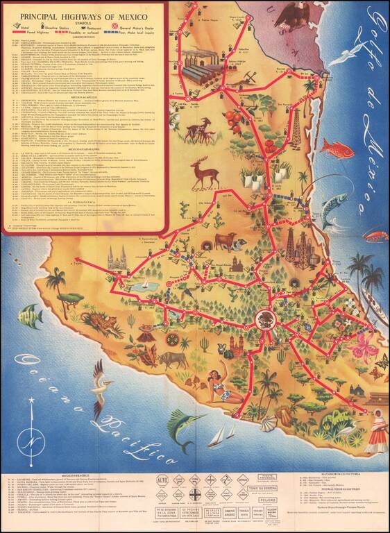
Decorative pictorial map of Mexico, showing the principal roads throughout the country. The map focuses on illustrating the principal resources and points of interest, with a symbol noting the availability of gasoline in major towns. The map was...
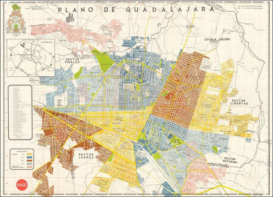
Beautiful vintage map of Guadalajara, Mexico, featuring a wonderful Bauerkeller-style coloring scheme. The map numbers the postal zones of the sprawling central Mexico metropolis. On the verso is some information aimed at tourists and shoppers, and a...
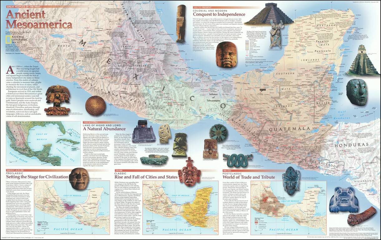
Fascinating pictorial map that portrays the pre-colonial history of Central America from southern Mexico to Nicaragua. Map itself shows the region, with information on cities, trade routes, topography, and the economies of each area. Insets detail the...
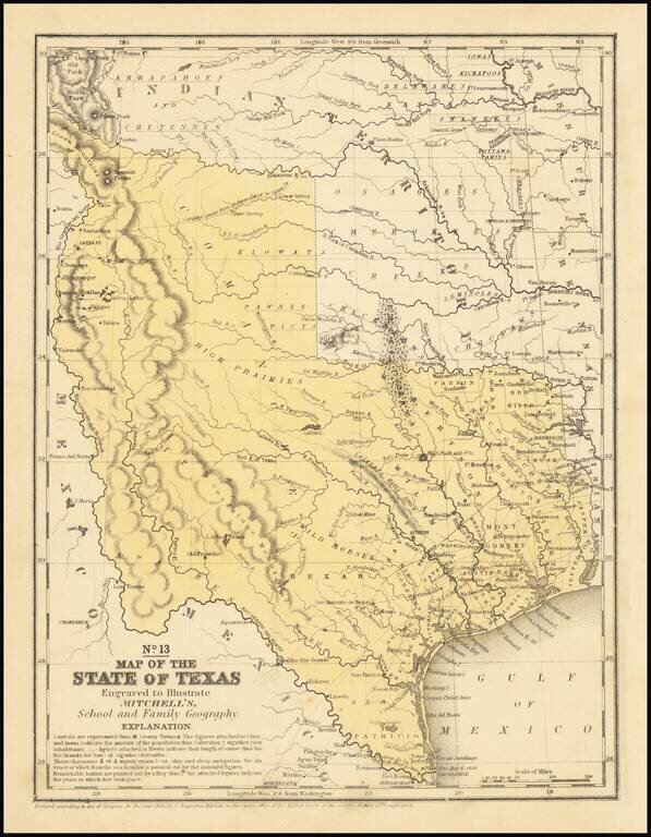
An interesting map of Texas published the year after the state's admission to the Union. In the North, several Indian Districts are shown, including the Comanches, Kiowas and Pawnee-Picts. A region named Wild Horses is shown, this nomenclature derives...
![Amer. Sep. No. 58 Partie De La Vieille Californie [Baja California, Gulf of California and Sonora]](/map/small/62785.jpg)
Highly detailed map covering the Baja from Isle Redonda to just south of Santa Margarita Island on the Pacific and Tiberon Island to Cerralbo and P. Arenas in the Gulf on the Sea of Cortez. Includes most of Sonora. Shows towns, roads, Missions, Bays,...
![[Baja Peninsula] Outing Map of Lower California](/map/small/69977.jpg)
Fine large format touring map of Baja California, published by the Automobile Club of Southern California, with a 24 page pamphlet on Baja California. The title on the covers is Log of the Peninsula of Lower California and the Gulf of California...
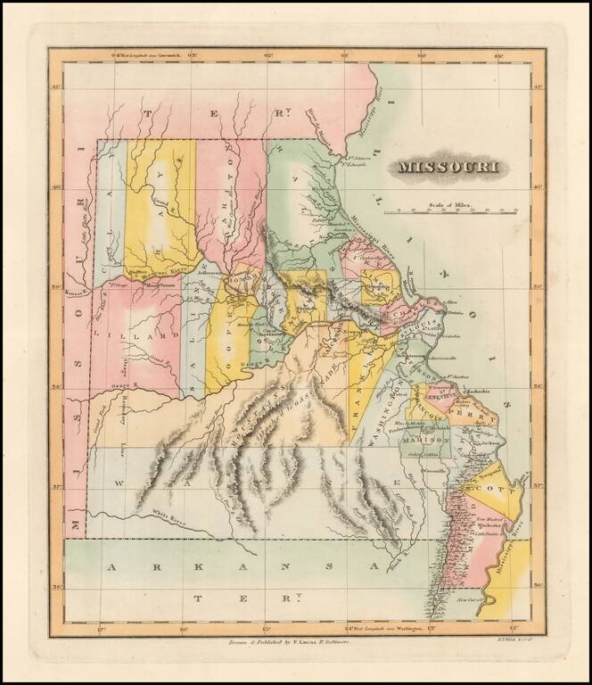
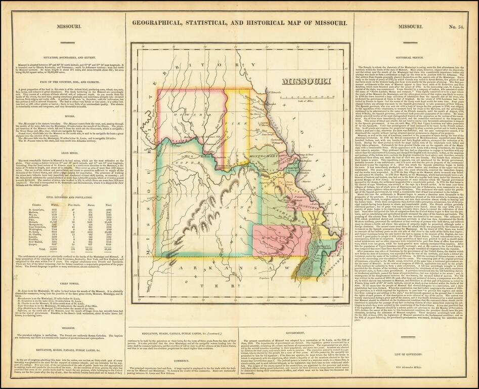
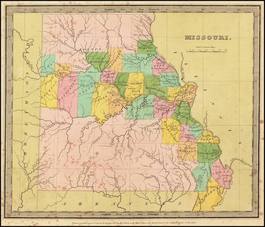
One of the Earliest Printed Maps of the State of Missouri Rare early map of Missouri just two years after statehood. Early state boundaries and most Western area are not yet partitioned into smaller counties. An Osage Boundary Line passes through...
Nice example of the first printed map of Missouri as a state from the first edition of Carey & Lea's Atlas. Size includes text below map, which contains details concerning the topography, indigenous lands, rivers, chief towns, commerce,...
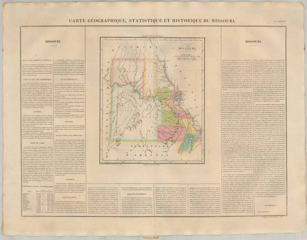
The First European Printed Map of Missouri . Fine example of Buchon's map of Missouri, the first map of Missouri published outside of America. Buchon's map appeared in his Atlas Geographique, Statistique, Historique et Chronologique ...., the first...
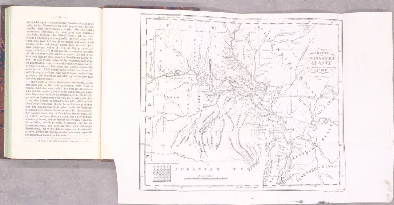
The Beginning of German Immigration to Missouri. Second and best edition. Gottfried Duden was among the first German immigrants to Missouri, having traveled there in 1824. He established a farm in the Missouri River valley between St. Louis and...
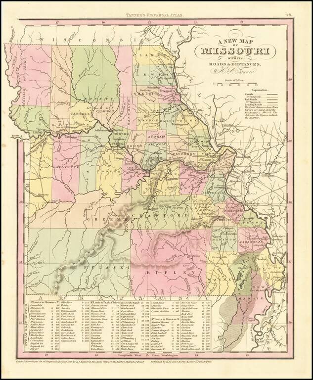
Detailed map of Missouri from Tanner's New Universal Atlas. Hand colored by county and showing towns, rivers, lakes, railroads, roads, etc. Table of Steam Boat routes and distances. Includes a number of ovesized counties, including Barry, Taney,...
Striking full color example of the first edition of David Burr's map of Missouri, which appeared in his Universal Atlas. Includes fascinating primitive counties, large unnamed counties in the north and south, Bounty Lands above Chariton, etc. The...
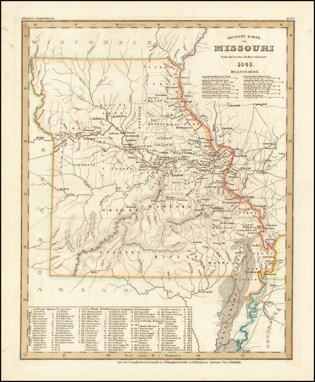
Elegantly engraved & detailed map, taken based upon Tanner's work in the early 1840s. Shows counties, towns, roads, mountain ranges, rivers etc. Includes a table of Distances and times for various steamship routes along several rivers.