Map size in jpg-format: 12.6127MiB
Click to open in high resolution (open in new tab).
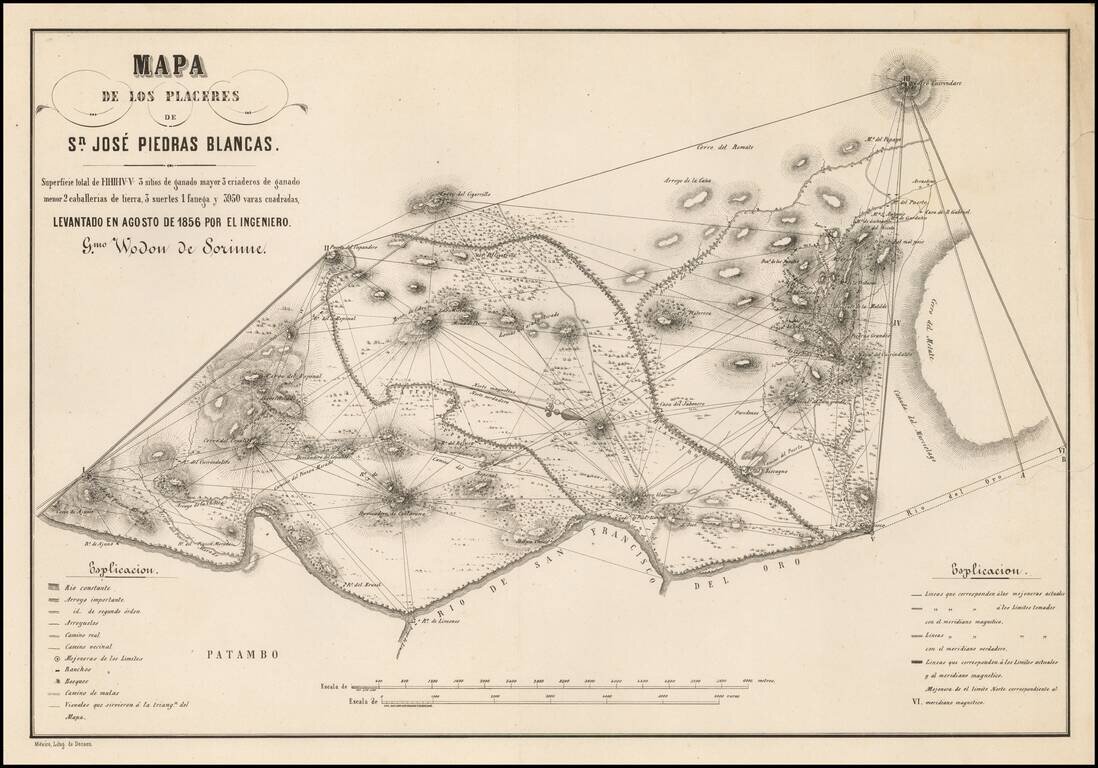
Detailed map of the area around San Jose Piedras Blancas (Michoacan) by the Belgian Engineer Guilermo Wodon de Sorinne, an important observer of regional Mexican culture.
The map shows Wodon de Sorinne's triangulation methodology in surveying the region, which was dominated by cattle ranching.
The Belgian engineer Guillermo Wodon de Sorinne worked in the second half of the nineteenth century in Morelia. In addition to cartographical material, he supervised several renovations such as the Colegio San Nicolás, the hotel Juaninos, the Palacio de Justicio and Palacio de Sorinne.
Rarity
The map is extremely rare. We note only the example referenced in Materials para una cartografie mexicana por el ingeniero Lic. Manuel Orozco (1871), #2946.
If you are a student, write to us in telegram: @antiquemaps and indicate what material you need and for what work you need a map in high detail. We are ready to provide material on special terms. For students only!


![Map of Mexico, Central America, and the West Indies [Insets of Bermuda, Sandwich Islands, Jamaica and Panama Railroad]](/map/small/69133.jpg)