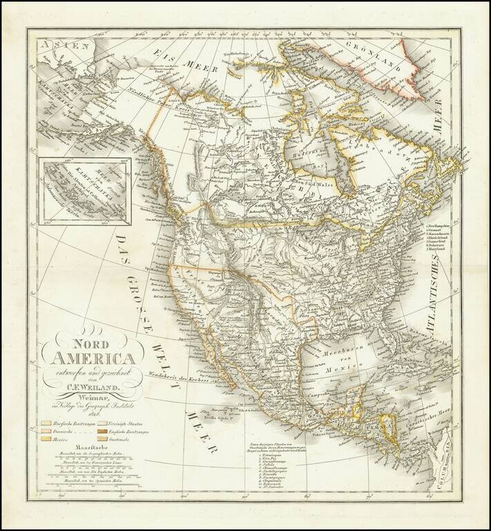
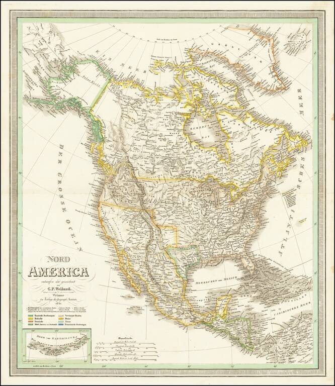
Ruins of an ancient city of the Aztecs Scarce map of North America, published shortly before Texas declared its independence from Mexico. In New Mexico, a note reads "Ruinen einer alten Stadt der Azteken" (Ruins of an ancient city of the Aztecs)...
Scarce map of North America, published shortly before Texas declared its independence from Mexico. This map also includes significant revisions in British Columbia attributable to the explorations and discoveries made by the Northwest Company and...
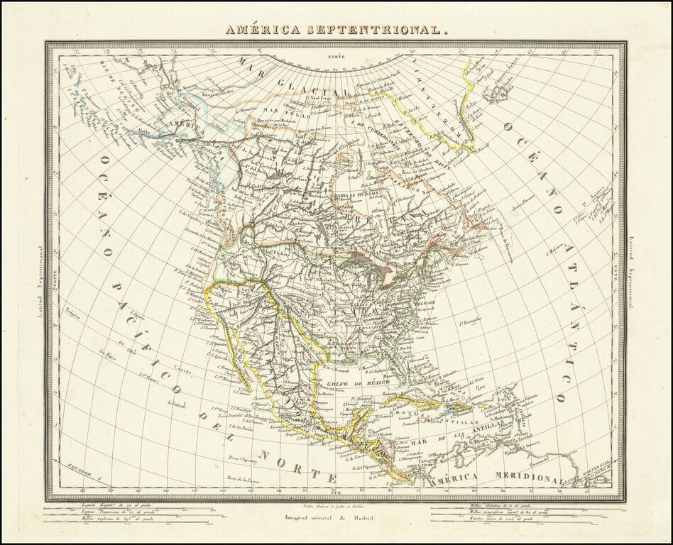
Rare Map of North America Published in Barcelona Scarce, detailed Catalan map of North America, published in Barcelona. The map shows the continent covered in mountains ranges and riverine systems. The names of indigenous groups are included,...
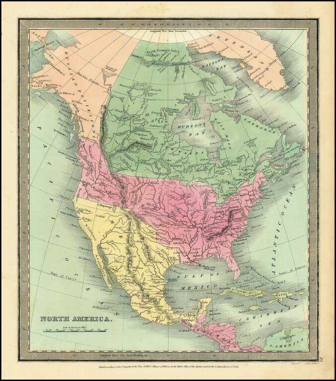
Marvelous map of North America, published In London by Hinton, Simpkin & Marshall. The map includes a double wide Arkansas Territory, massive Missouri Territory extending to the Rocky Mountains, wonderful early Russian Territory with a still...
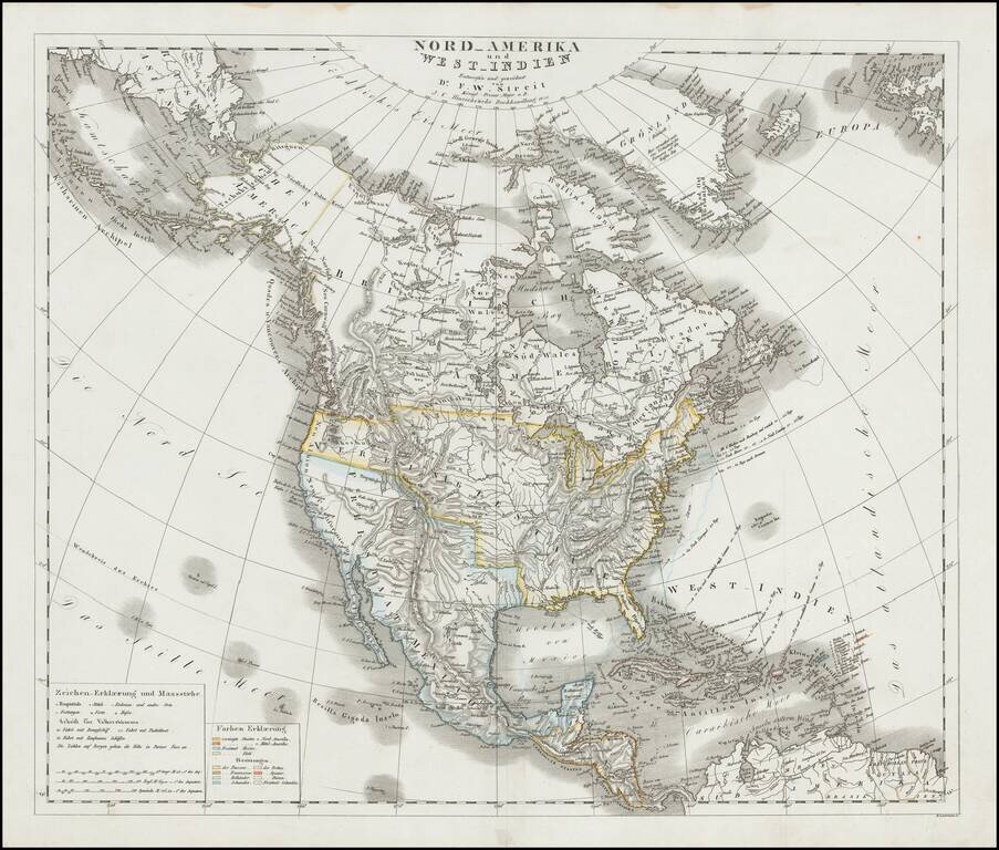
Scarce large format map of North America, published in Leipzig in 1833, showing North America shortly after Mexico's Independence and just before the establishment of the Republic of Texas. The map shows a pro-British version of the 54-40 or fight...
![[Russian Territory In California] Carte Generale de l'Amerique Septentrionale, et des Iles qui en Dependent . . . 1836](/map/small/65208.jpg)
Blue Dot For Fort Ross, California -- Part of Russian Territory Nice example of Brue's map of North America, published in Paris in 1836 Excellent map of North America and the West Indies. Beautifully engraved on fine heavy paper with the embossed...
Attractive example of David Burr's scarce map of North America, from his rare Universal Atlas. The cartography of the Northwest and Upper Missouri regions are dominated by information from Lewis & Clark. The map includes a 54-40 or fight...
Attractive engraved map of North America, published by Allan Bell & Co. in London in 1837. The map favors the American claims to the Oregon Territory, stretching well into present-day British Columbia. The map is fairly outdated for when it was...
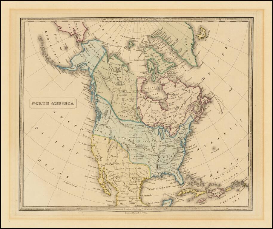
Highly detailed map of North America, with marvelous post Lewis & Clark pre-Fremont cartography. The 54-40 or Fight border of Oregon Territory is shown, with a number of early forts and Hudson Bay Company posts shown in the Northwest. The course...
![Carte Generale de l'Amerique Septentrionale, et des Iles qui en Dependent . . . 1840 [Republic of Texas]](/map/small/62415.jpg)
Blue Dot For Fort Ross, California -- Part of Russian Territory Nice example of Brue's map of North America, published in Paris in 1840 Excellent map of North America and the West Indies. Beautifully engraved on fine heavy paper with the embossed...
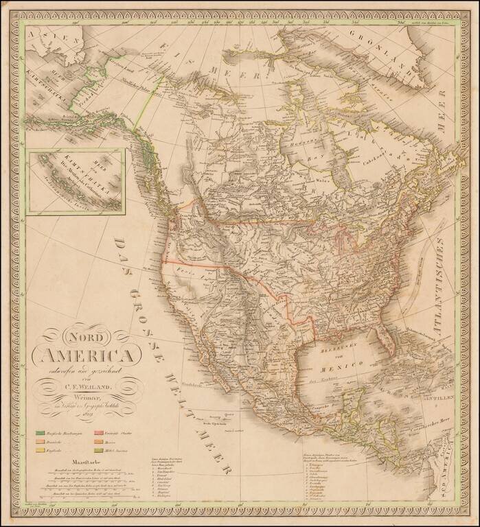
With Texas as a Republic. Scarce map of North America, published shortly after Texas declared its independence from Mexico. This map also includes significant revisions in British Columbia attributable to the explorations and discoveries made by the...
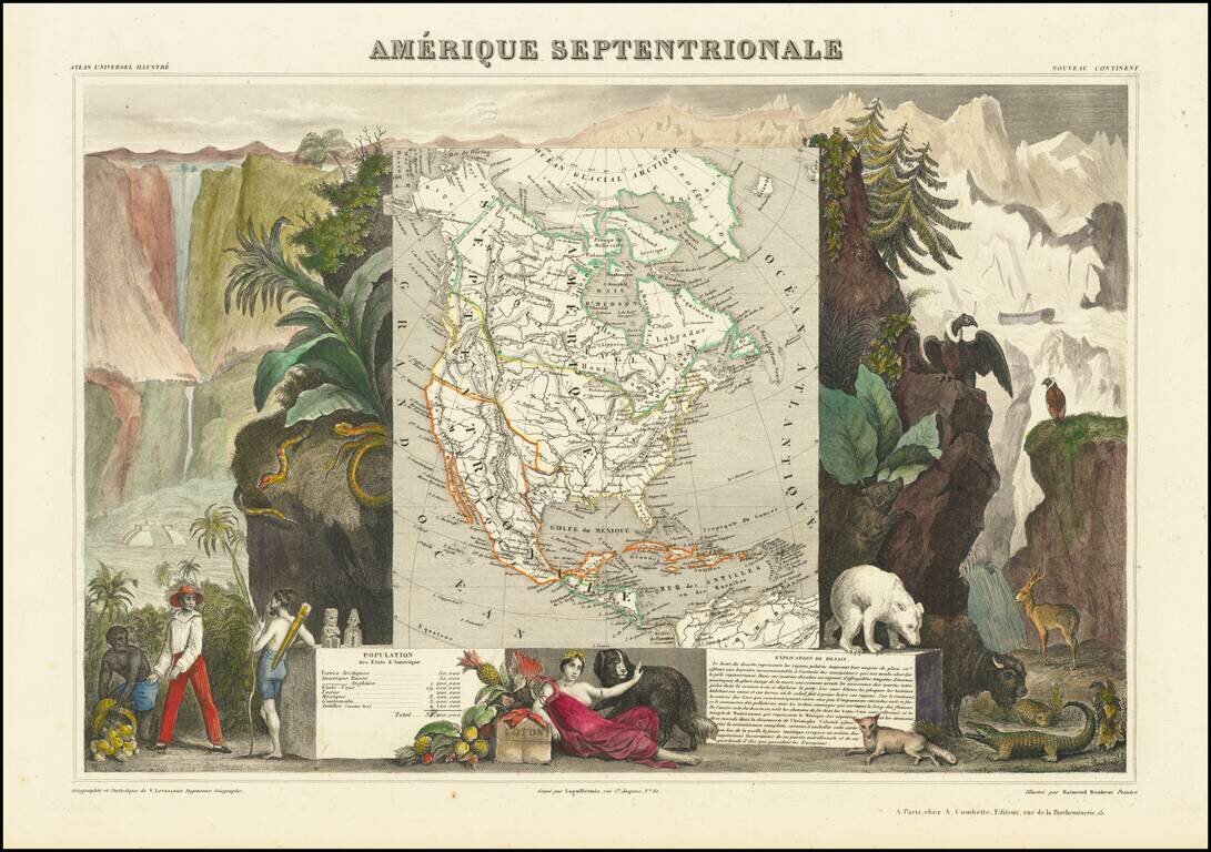
Decorative map of North America, showing the Republic of Texas and a "54-40 or Fight" border with Canada, extending far north of the final boundary. The map is surrounded by decorative allegorical scenes. Engraved by Raimond Bonheur, father of the...
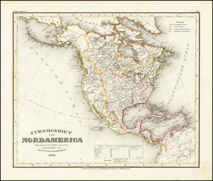
A fascinating early geographical map of North America, showing the various regions drained by major North American Rivers, including Colorado, Columbia, Mississippi, Rio Del Norte, Mackenzie, Saskatchewan, and the St. Lawrence, among others. Very...
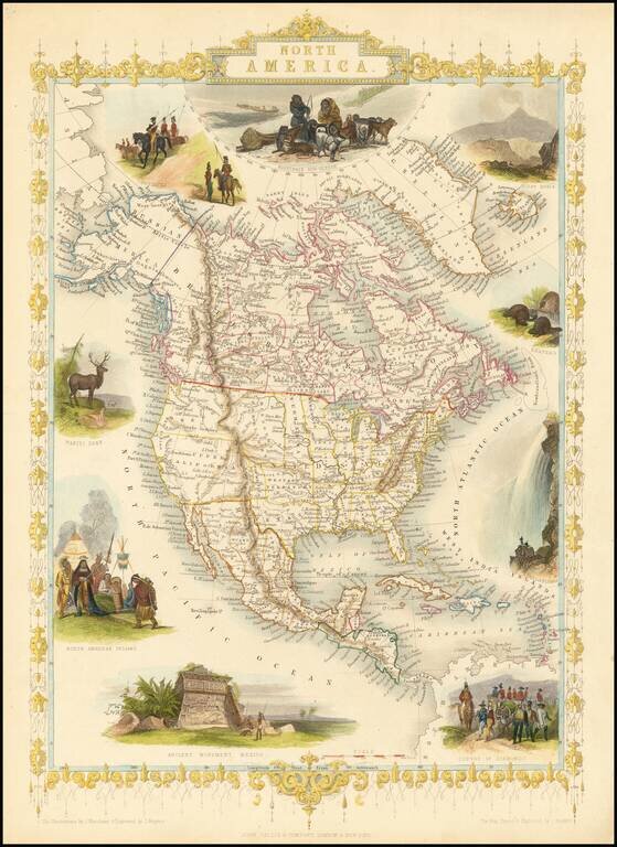
Nice full color example of Tallis's map of North America. Includes decorative vignettes of Esquimaux's Mount Hekla, Beavers, Niagara Falls, a Convoy of Diamonds, Ancient Monument in Mexico, North American Indians, Wapiti Deer, and Russian Cossacks!...
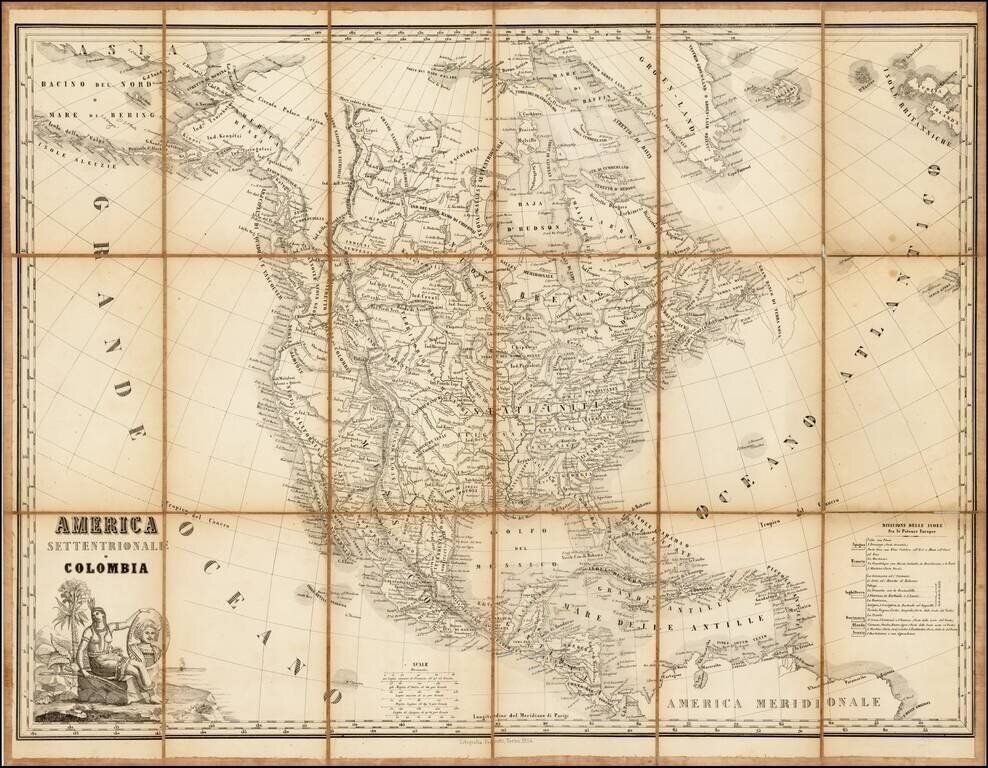
Rare lithographic edition of this fine decorative map of North America, originally published jointly by Maggi in Torino and Stucchi in Milan. The present edition was re-issued as a lithograph in Torino by Fedratti in 1854, without any obvious changes...
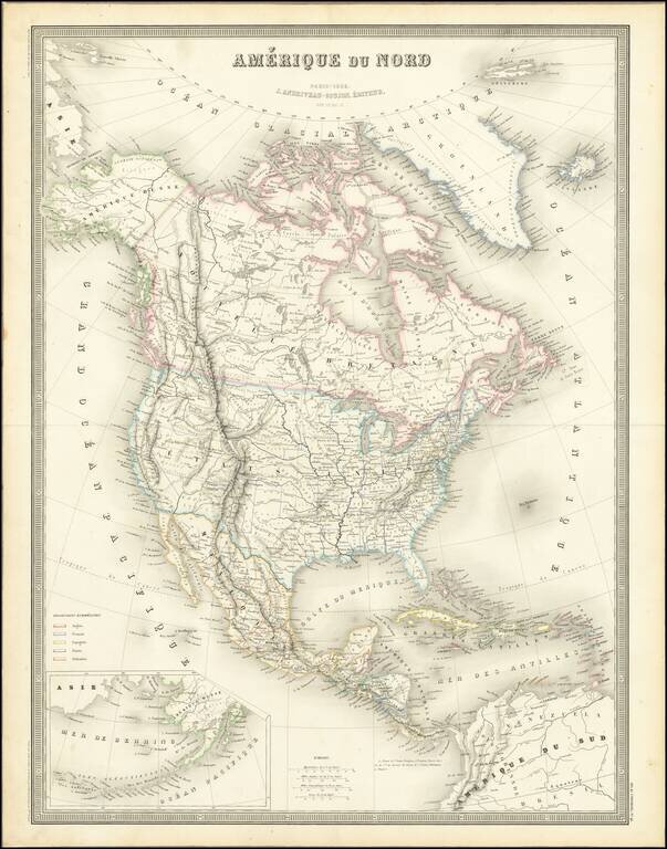
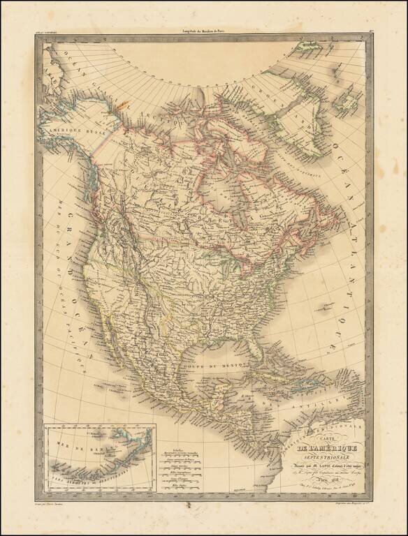
Excellent detailed map of North America, published in Paris by Andriveau-Goujon. Alaska is still Russian America, with Western Canada filled with early Forts and trading posts of the Northwest Company and Hudsons Bay Company. The border between...