logo

1837. North America

  • North America

Map size in jpg-format: 19.1355MiB

Download "North America", in high resolution.

North America information:

Year of creation: 
Resolution size (pixels): 
 9414x7906 px
Disk Size: 
 19.1355MiB
Number of pages: 
 1
Place: 
 London
Author: 

Print information. Print size (Width x height in inches):
Printing at 72 dpi 
  130.75 х 109.81
Printing at 150 dpi 
 62.76 х 52.71
Printing at 300 dpi 
 31.38 х 26.35

An example of detailing the file of this map of in a printable high-resolution:

Click to open in high resolution (open in new tab).
Attention! this is just the central piece (central area 960x960 px) of the map file!
This is an example, so that you can see and study the level of detail of a given map. The entire Map will be fully available after payment!

North America

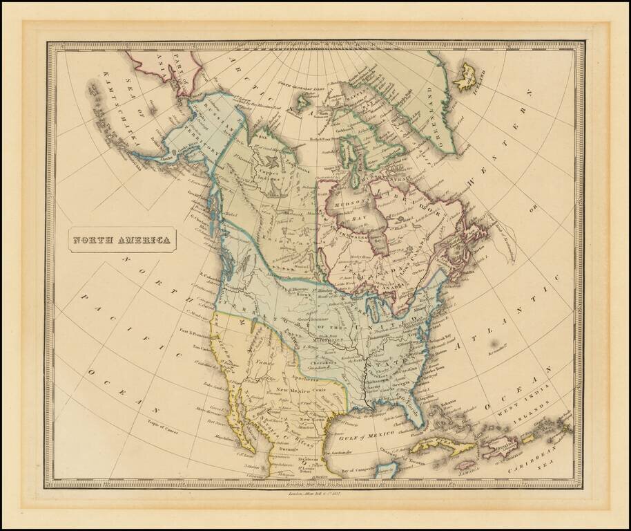
Attractive engraved map of North America, published by Allan Bell & Co. in London in 1837.

The map favors the American claims to the Oregon Territory, stretching well into present-day British Columbia.

The map is fairly outdated for when it was published, failing to acknowledge the Republic of Texas and showing both East and West Florida.


Special conditions for students!

If you are a student, write to us in telegram: @antiquemaps and indicate what material you need and for what work you need a map in high detail. We are ready to provide material on special terms. For students only!

Item information:

Year of creation:
Size:
9414x7906 px
Disk:
19.1355MiB
Number of pages:
1
Place:
London
Author:
Allan Bell & Co..
$14.99

Related item