Map size in jpg-format: 1.02298MiB
Click to open in high resolution (open in new tab).
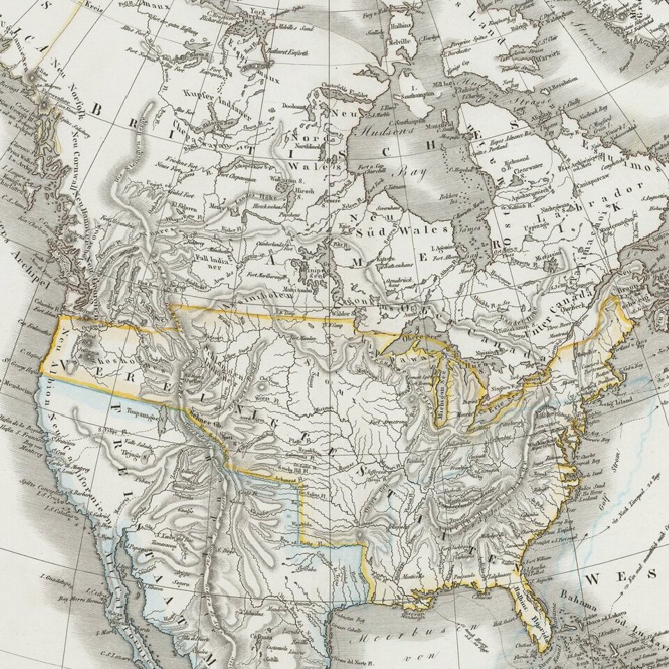
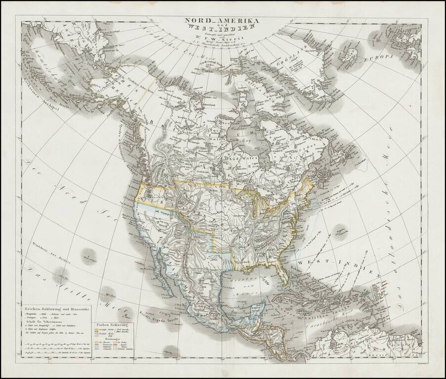
Scarce large format map of North America, published in Leipzig in 1833, showing North America shortly after Mexico's Independence and just before the establishment of the Republic of Texas.
The map shows a pro-British version of the 54-40 or fight Oregon Territorial border.
The mythical lake Tejugo appears just below Lake Timpanagos in Utah, a misspelling of Teguayo.
The San Felipe River is shown flowing tentatively from the Salt Lake area to San Francisco.
The map includes a fine account of the Western Indian Tribes, detail in the mountain ranges, rivers and other features. Alaska is Russian America. The California Missions are named.
Navigational notes to Europe appear on the East Coast and the West Indies.
Streit's maps are quite scarce and collectable.
If you are a student, write to us in telegram: @antiquemaps and indicate what material you need and for what work you need a map in high detail. We are ready to provide material on special terms. For students only!


![[Signed Political Satire Artwork] Vietnam ... Vietnam ... Vietnam ...](/map/small/68726.jpg)