Map size in jpg-format: 53.2939MiB
Click to open in high resolution (open in new tab).
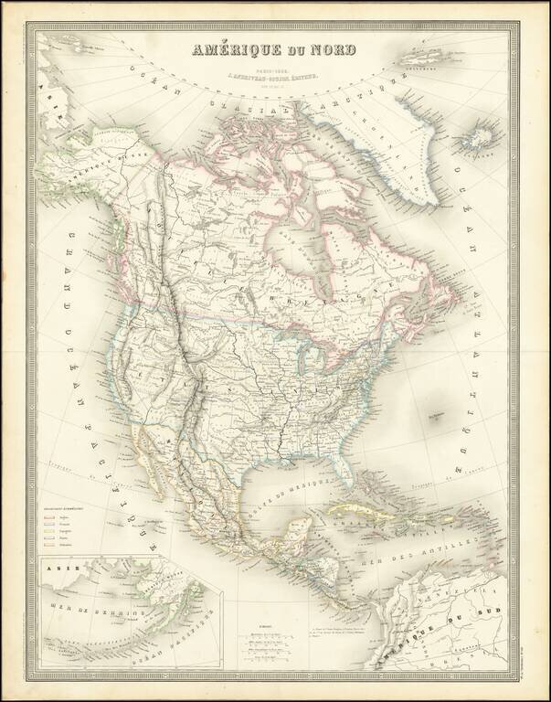
Excellent detailed map of North America, published in Paris by Andriveau-Goujon.
Alaska is still Russian America, with Western Canada filled with early Forts and trading posts of the Northwest Company and Hudsons Bay Company.
The border between Oregon Territory and British America has now been resolved, with a massive "Northwest Territory" immediately east of Oregon Territory, pre-dating the establishment of Nebraska Territory.
To the south, Utah Territory and New Mexico Territory stretch from California to the Rocky Mountains, with a pre-Gadsden Purchase border between Mexico and the US shown tracking the Gila River.
If you are a student, write to us in telegram: @antiquemaps and indicate what material you need and for what work you need a map in high detail. We are ready to provide material on special terms. For students only!


![[Signed Political Satire Artwork] Vietnam ... Vietnam ... Vietnam ...](/map/small/68726.jpg)