Map size in jpg-format: 21.4068MiB
Click to open in high resolution (open in new tab).

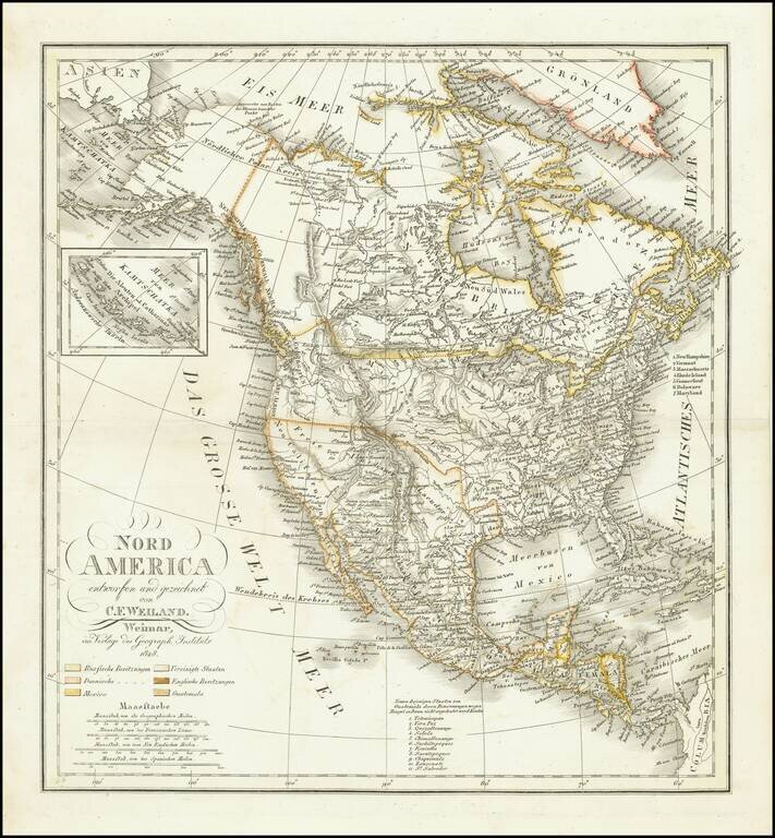
Ruins of an ancient city of the Aztecs
Scarce map of North America, published shortly before Texas declared its independence from Mexico.
In New Mexico, a note reads "Ruinen einer alten Stadt der Azteken" (Ruins of an ancient city of the Aztecs)
This map also includes significant revisions in British Columbia attributable to the explorations and discoveries made by the Northwest Company and Hudson's Bay Company in the region.
The map is remarkably detailed, especially in the West. Texas is not yet named. Northwest of Texas, there is a significant amount of Indian and topographical details, more so than on most maps of the period. Oregon Territory includes the details from Lewis & Clark, the Astorians, and other early explorations in the region, along with lots of Indian details.
The map includes fine detail in Neu (Upper) California, including the Missions, mythical rivers, but pre-dates the 1834 appearance of Russian Settlements near San Francisco on the map. Highly details NW Coast of America, including American, British and Russian settlements and forts, Indian Tribes, etc. Nice detail in Alaska, which is called "Nordlicher Polar Kreis." Massive Northwest and Missouri Territories shown.
The Rocky Mountains extend north nearly MacKenzie River. A portion of the Arctic coastline is still unknown in Alaska and to the west of Hudson Bay.
While we periodically see the larger Weiland maps, we have not previously handled this smaller sized map.
If you are a student, write to us in telegram: @antiquemaps and indicate what material you need and for what work you need a map in high detail. We are ready to provide material on special terms. For students only!


![[Signed Political Satire Artwork] Vietnam ... Vietnam ... Vietnam ...](/map/small/68726.jpg)