Map size in jpg-format: 5523870B
Click to open in high resolution (open in new tab).
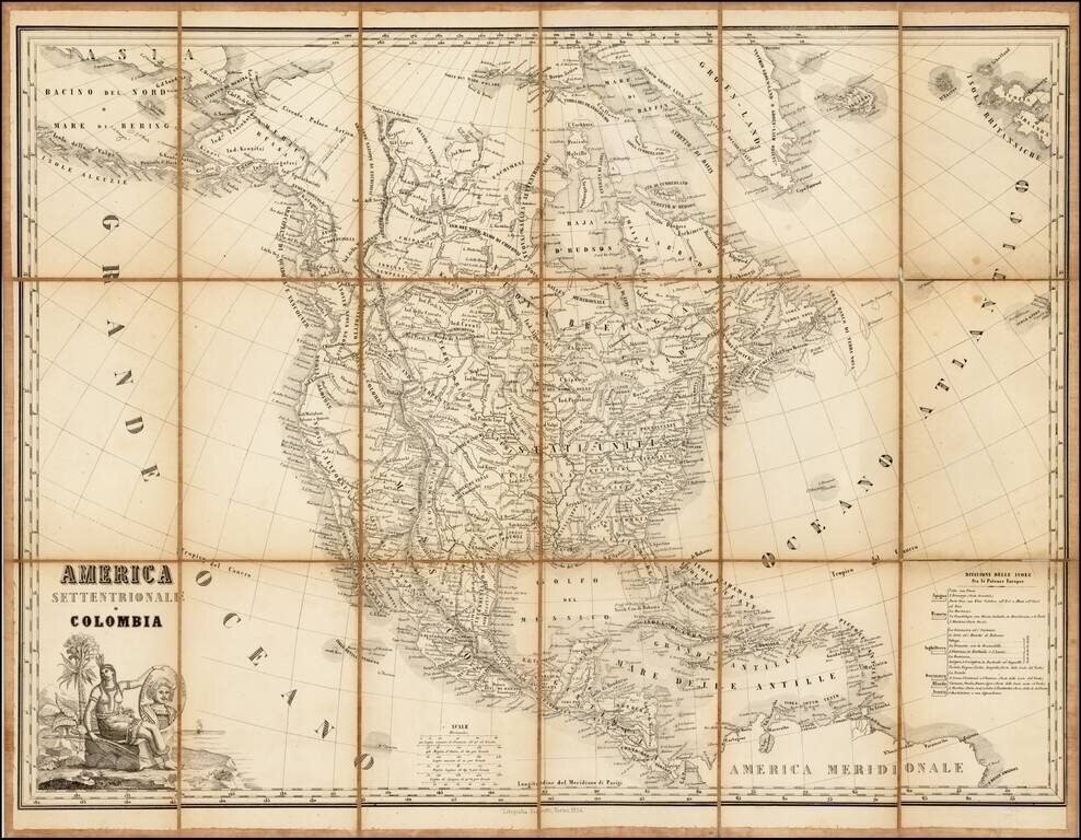
Rare lithographic edition of this fine decorative map of North America, originally published jointly by Maggi in Torino and Stucchi in Milan.
The present edition was re-issued as a lithograph in Torino by Fedratti in 1854, without any obvious changes to the cartographic content.
The map is largely reminiscent of the Fredonia map by R.H. Laurie and contemporary French maps by Brue and Lapie. It includes a fine depiction of the travels of Lewis & Clark, Pike, Humboldt and Long. One of the mythical rivers of the west extends to Lake Timanagos, but the second river is truncated in a range of mountains extending from the Bay area to just south of the lower (mythical) Salt Lake. Galveston and the Presidio appear in Province of Texas, among other places.
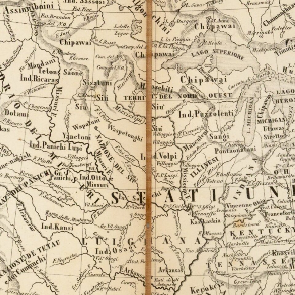
The map includes excellent detail east of Salt Lake. Ft. Mandan and Ft. Mannel are shown on the upper Missouri, and many of the Hudson Bay Trading Houses are shown, including Chesterfield, Nelson, Acton, Buckingham, Hudson, Carlton, Cigna, Albany, Grent, Pine, Brandon, and others, a few of which are unnamed. Arkansas is double wide. Many forts and Indian tribes named in the west and Mississippi and Missouri River Valleys. The missions of California are all named.
The map was apparently sheet No. 5 in Stucchi's Grande Atlante universale.
We note earlier copper engraved version of the map published in 1825 and 1830.
If you are a student, write to us in telegram: @antiquemaps and indicate what material you need and for what work you need a map in high detail. We are ready to provide material on special terms. For students only!


![[Signed Political Satire Artwork] Vietnam ... Vietnam ... Vietnam ...](/map/small/68726.jpg)