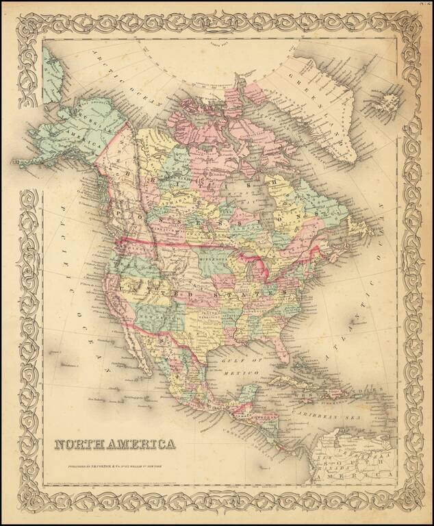
Detailed map of North America, published by JH Colton in New York. The map shows early western territorial configurations, including a massive Nebraska, Kansas running to the Rockies, and only California, Oregon, Washington, Utah and New Mexico west...
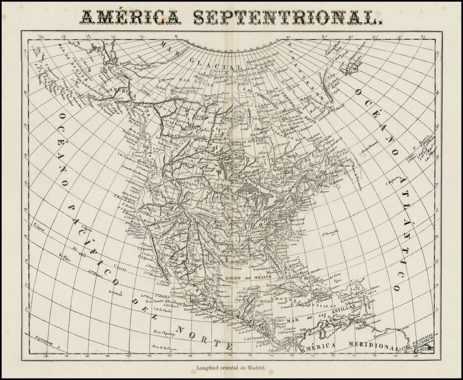
Very unusual Spanish map of North America, apparently issued some time in the middle of the 19th Century. While the paper suggests that it was published in the 2nd half of the 19th Century, the map's cartography is circa 1830, showing Russian America,...
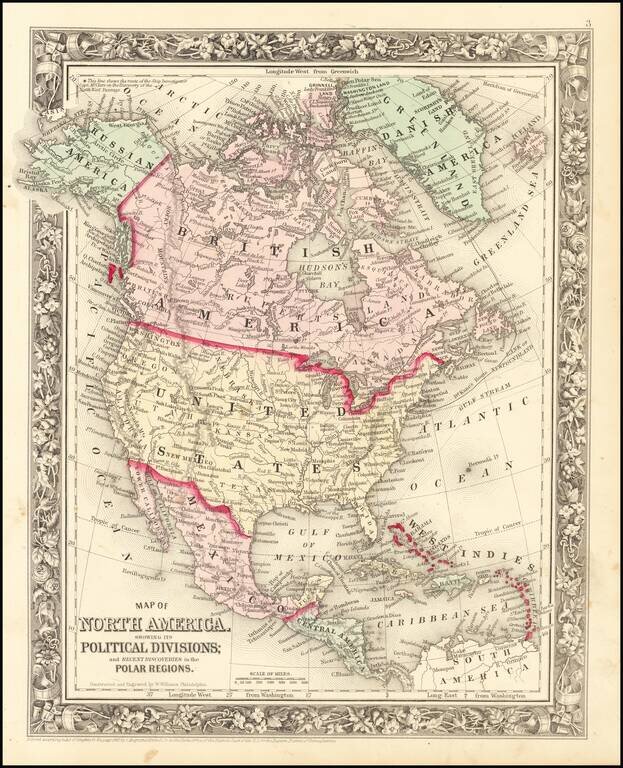
Decorative map of North America, colored by country. Shows recent discoveries in Russian America, including McClure's northwest passage aboard the Investigator. Locates cities, rivers, mountains, forts, lakes, etc. Decorative border.
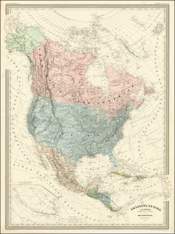
Detailed wall map of North America, published by A.H. Dufour. Arizona is below New Mexico (the Baylor Line), a vestige of the attempt to create a slave and non-slave territory prior to the Civil War. Colorado is named (the map shows Colona in the...
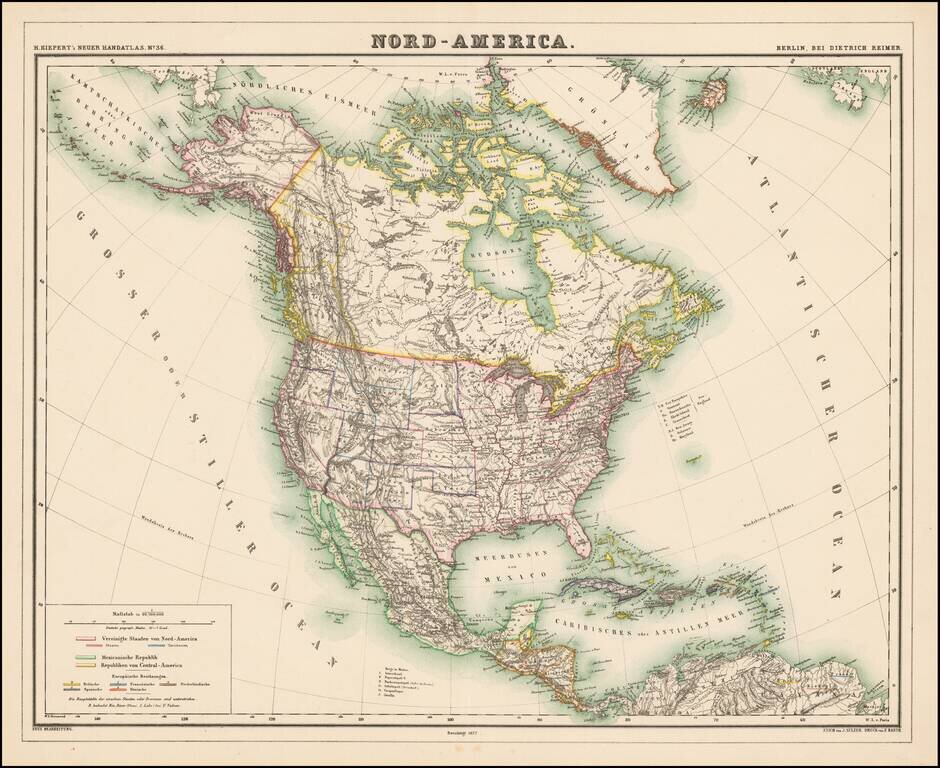
Detailed map of North America, with most of the Western Territories now named and in their proper configurations. The Northwest Passage is well illustrated. The region above British Columbia is Stekeen Colony, named for the Stikine River. Stikine...
![[Fruit Crate Label Advertising Map] Panama Brand (North America & Panama Canal)](/map/small/48860.jpg)
Decorative Fruit Crate Label, showing various routes through the Panama Canal, published for the Johnson Fruit Company of Santa Barbara, California.
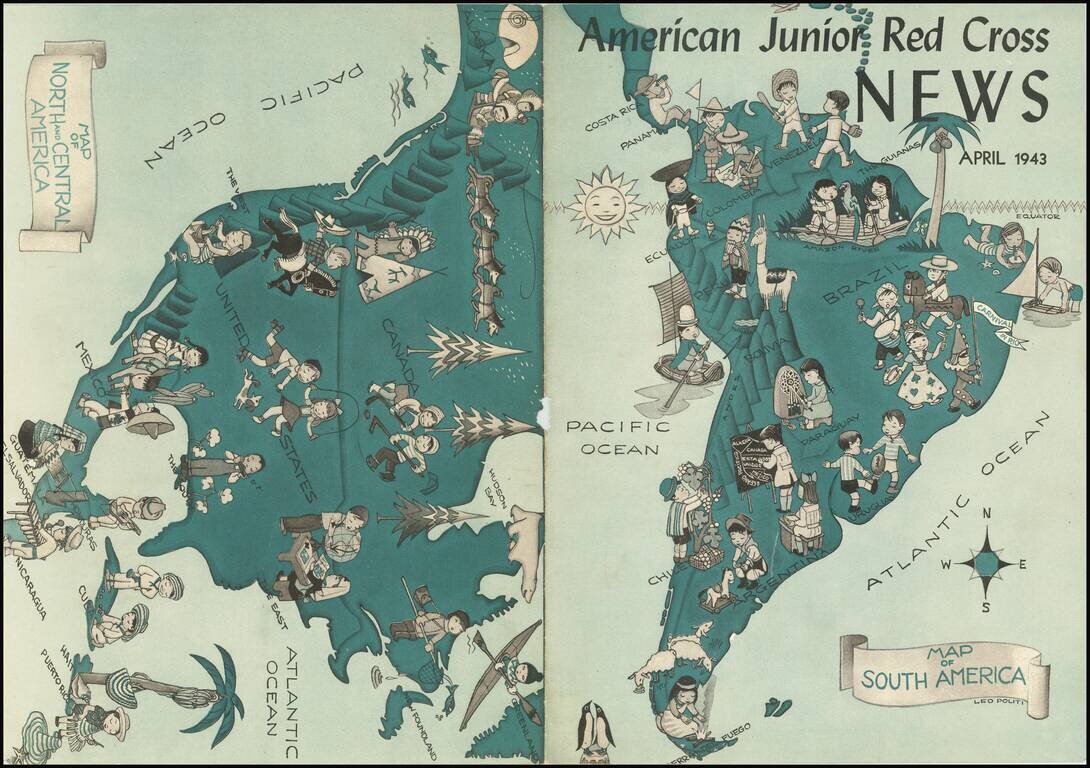
This is a map of the Americas, used as the cover for the 1943 edition of the American Junior Red Cross News. The map shows the activities of children all throughout the America, dressed in regional clothing and partaking at various games. While...
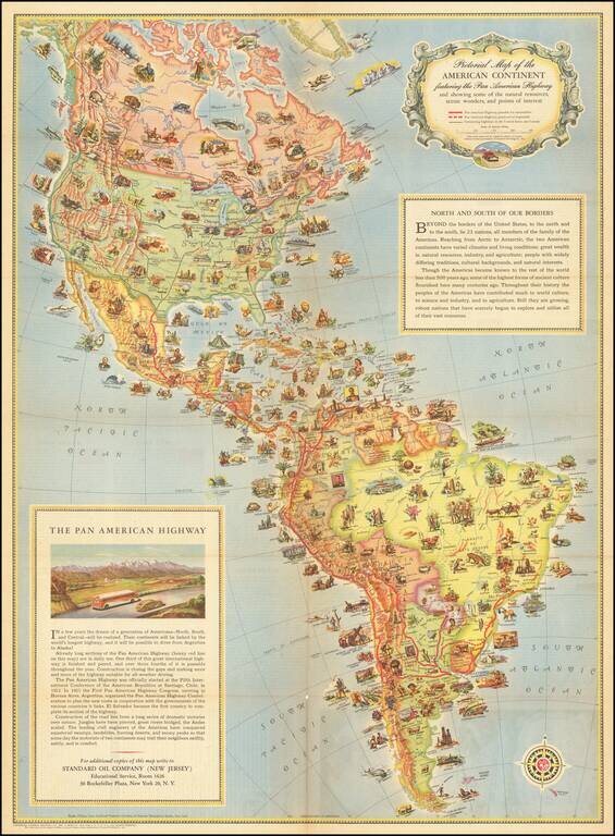
A Standard Oil Pictorial Map of the American Continent This is an attractive vintage pictorial map of the American content, stretching from Fairbanks, Alaska to Cape Horn. The map shows major roads in North America, the Pan-American Highway in South...
Fine large format map of the United States, executed by R.W. Berry and printed by Rand McNally & Company. The map is apparently very rare -- we locate only the Library of Congress copy.
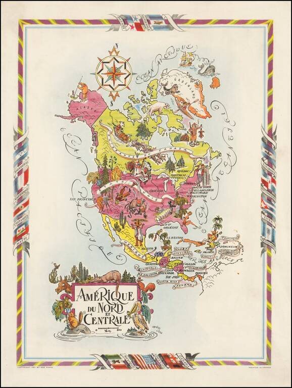
Decorative map of North and Central America, published by Jacques Lizou. Lizou published a number of maps in this style in 1951, including maps of the French provinces, etc. The map was also used in a Pan American Airways menu in the 1960s.
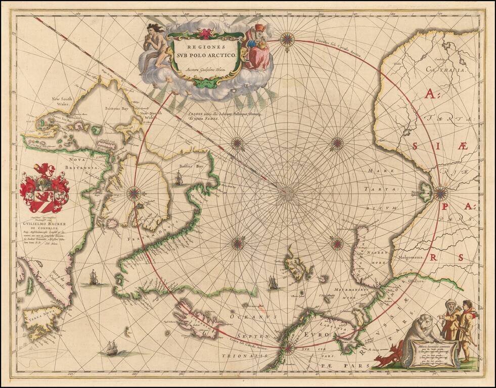
Nice example of the second edition of Blaeu's signature map of the North Polar Regions, with several wonderful cartouches and decorative coat of arms. Blaeu's decorative map of the North Pole, including Arctic North America, Scandinavia, and northern...
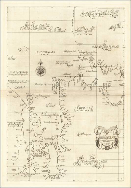
The First Sea Chart of Hudson Bay and Hudson Strait Fine example of the first edition of Robert Dudley's chart of Hudson Bay and Hudson Strait, the earliest sea chart of the region and the first printed map to focus on Hudson Bay. Dudley's chart is...
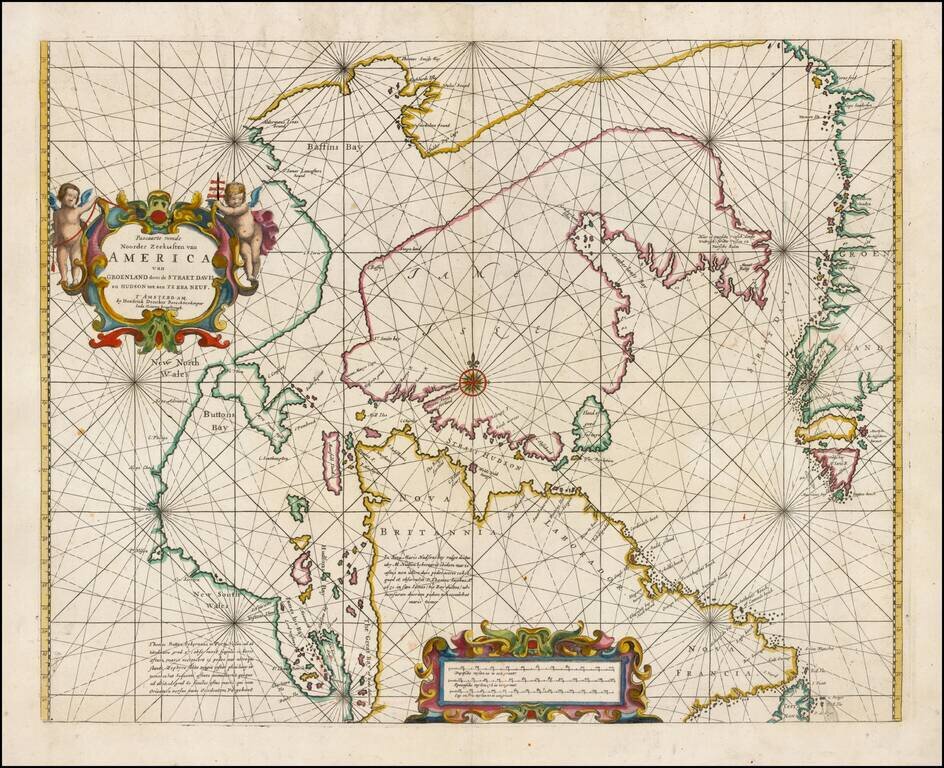
Fine example of Doncker's rare early map of the Northern part of America, including Hudson Bay, Davis Straits, Button Bay and the west coast of Greenland. Doncker's chart is one of the earliest obtainable charts to show this configuration and much of...
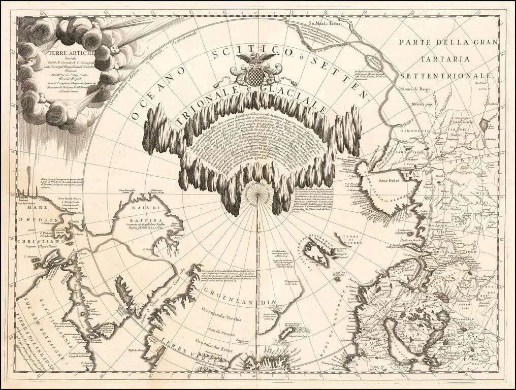
Fine example of Vincenzo Maria Coronelli's map of the North Polar Regions, published in Venice circa 1690. Coronelli's map provides a remarkable depiction of the Arctic Circle, North Pole, Greenland, and Baffin Bay, with parts of Canada, parts of...
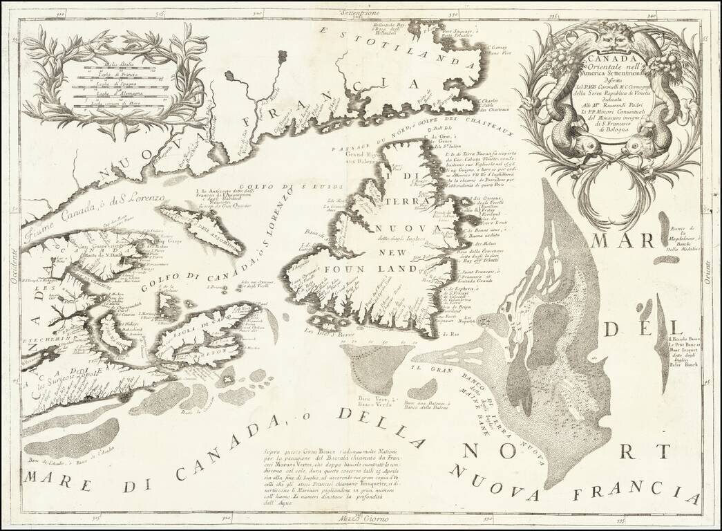
Detailed map of the Newfoundland, Labrador, Nova Scotia and the Gulf of St. Lawrence, by Vincenzo Maria Coronelli. The map comes from Coronelli's rare Atlante Veneto, one of the most decorative and ornate of all 17th Century Atlases. It exhibits the...
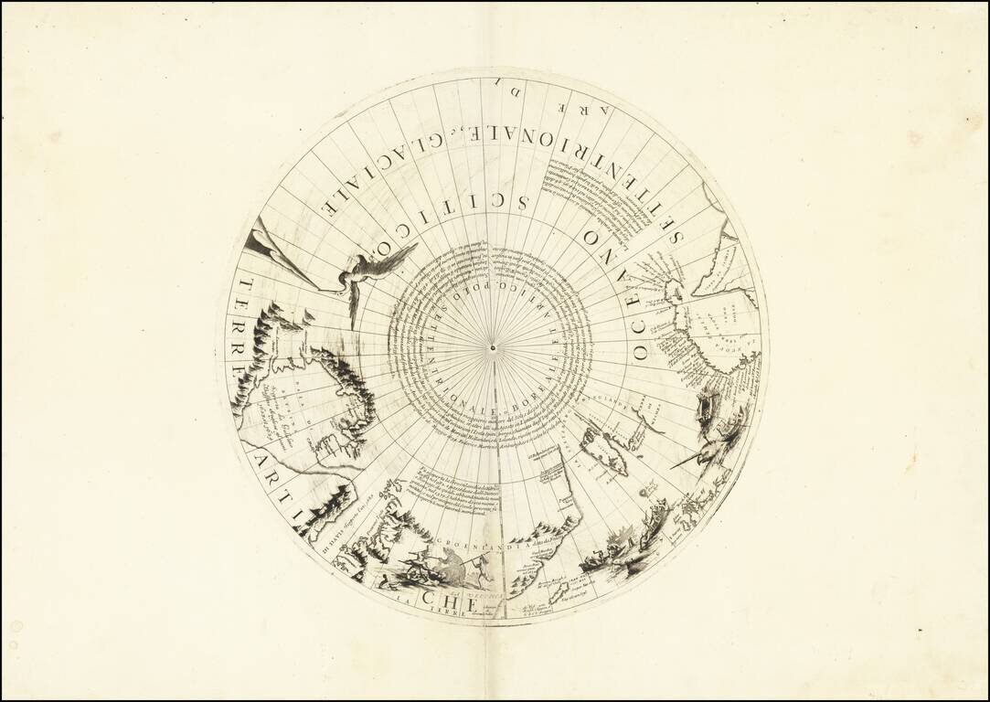
Rare north polar section of Coronelli's remarkable globe gores, first published in 1690. The present gore section is the upper calotte for Coronelli's large (110cm) globe showing the north pole and surrounding areas. The section includes extensive...