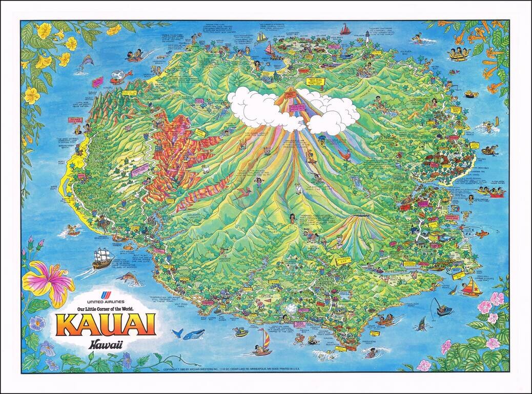
Lively pictorial map of Kauai, issued as a promotional item for United Airlines. The map is packed full of whimsical images of tourist destinations, points of interest and native scenes. A marvelous decorative image.
![[Hawaiian Islands] Aloha Airlines The Spirit Moves Us . . .](/map/small/59216.jpg)
Fine early promotional map for Aloha Airlines.

This is a pictorial tourist map of Waikiki, showing the many attractions of Honolulu. In addition to being a tourist map and advertising many of the businesses that operate in the area, the map delves into Hawaii's long history and culture, providing...
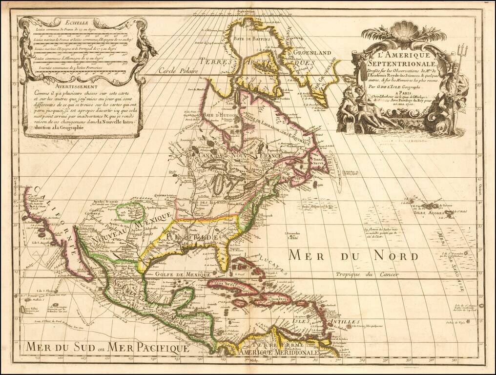
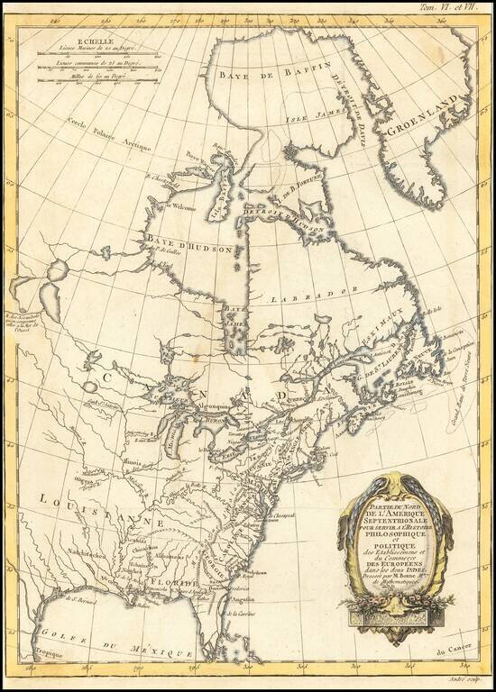
De L’Isle’s Foundational Map of North America, with Milestone Depictions of the Mapping of the Mississippi and California This is a striking example of De L'Isle's highly important map of North America. It is the first to correctly place the mouth...
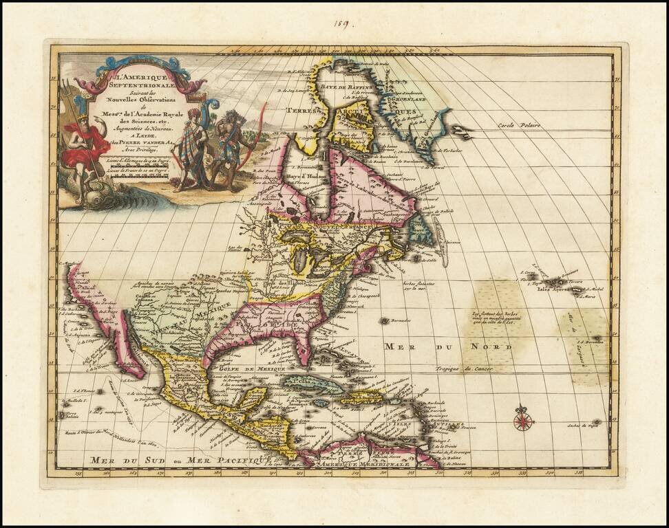
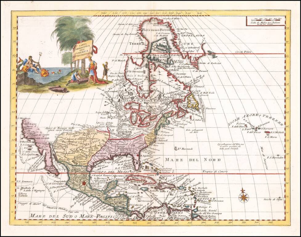
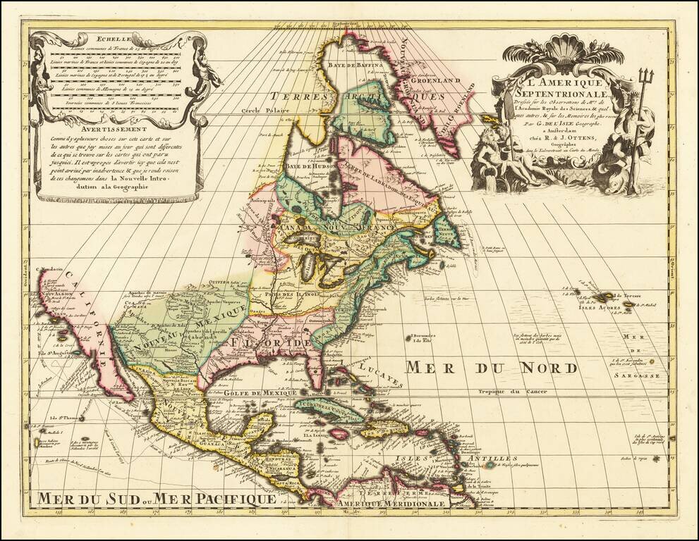
Nice example of Vander Aa's map of North America, based upon Guillaume De L'Isle's map of 1700. Uncommon map of North America and the West Indies. Interesting depiction of California which is ambiguous about whether it is an island or not. The Gulf of...
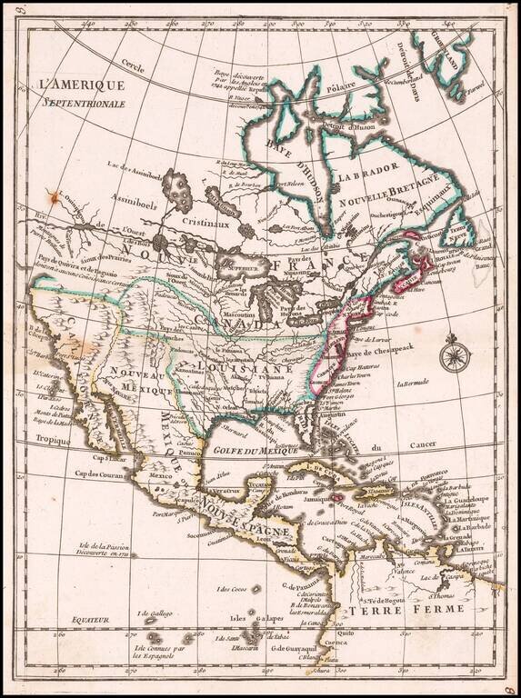
Attractive map of North America, based upon De L'Isle's highly influential map of North America published in 1700, from Chatelain's monumental 7 volume Atlas Historique, published in Amsterdam. California is a peninsula with a number of villages,...
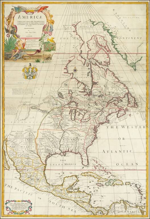
One of the earliest large-scale English maps of North America, incorporating the best available French and English sources. The map represents a British attempt to consolidate new information about the region and borrows data from such recently...
Striking map of North America, based upon De L'Ise's map. Includes a well delineated Great Lakes and corrected rendering of Baja California. The cartography of the Mississippi River Valley and the Rio Grande are still quite inaccurate. Lots of...
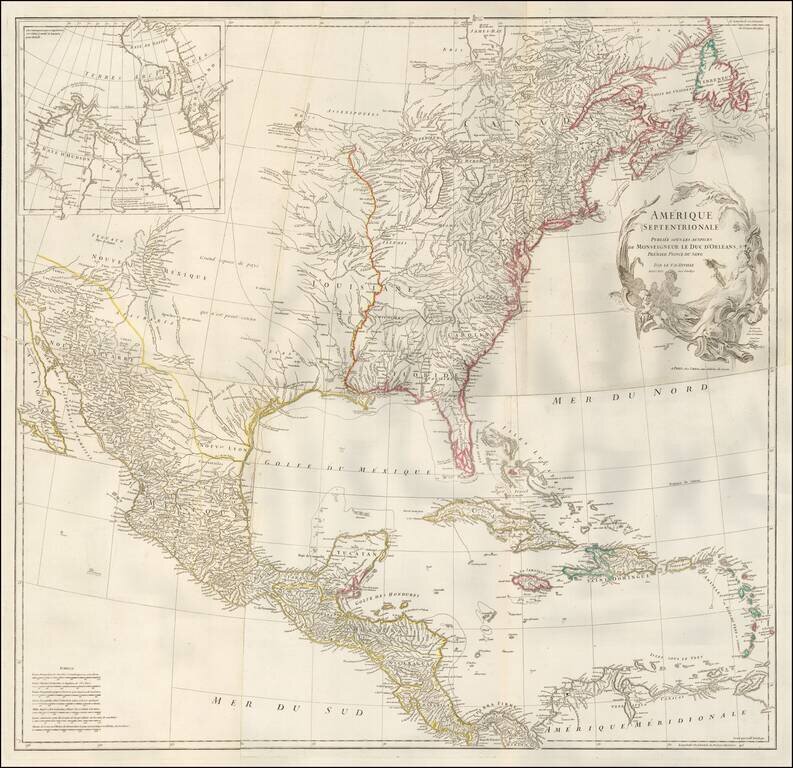
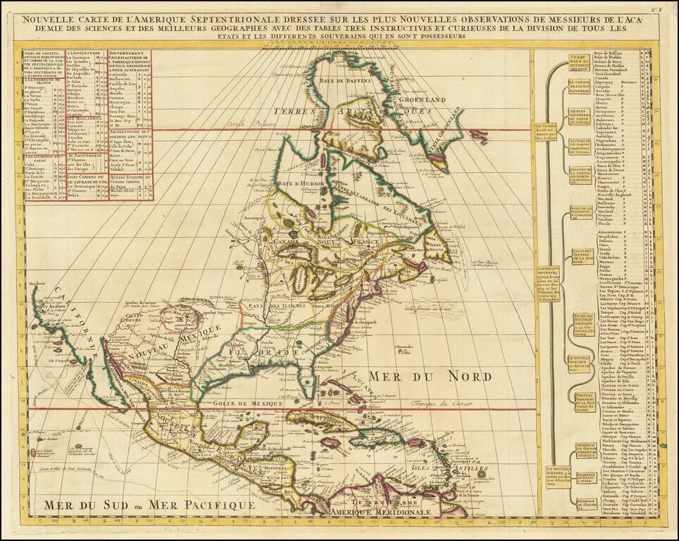
Nice unjoined example of D'Anville's 4 sheet map of North America, one of the best French Maps of North America prior to the French & Indian War. The map shortly after Bellin's seminal map of the Great Lakes, although the projection of Lake...
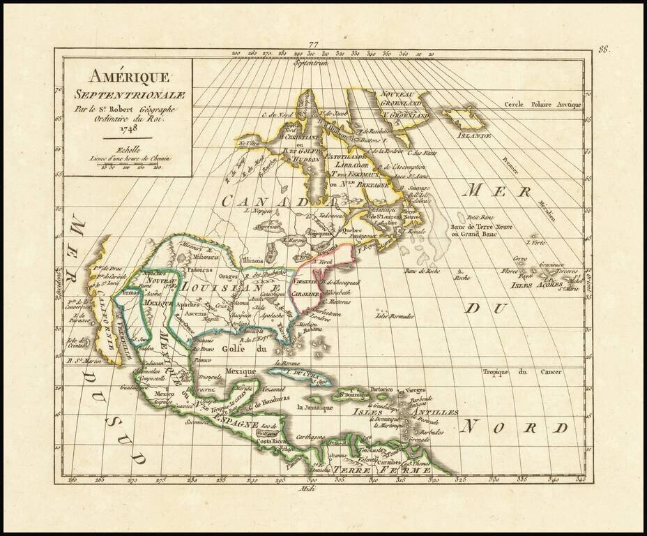
Scarce map of North America, with an early example of the Bay of the West from Le Rouge's Atlas nouveau portatif à l'usage des militaires et du voyageur, published in Paris in 1748. The map shows both the Bay of the West and River connecting Hudson's...
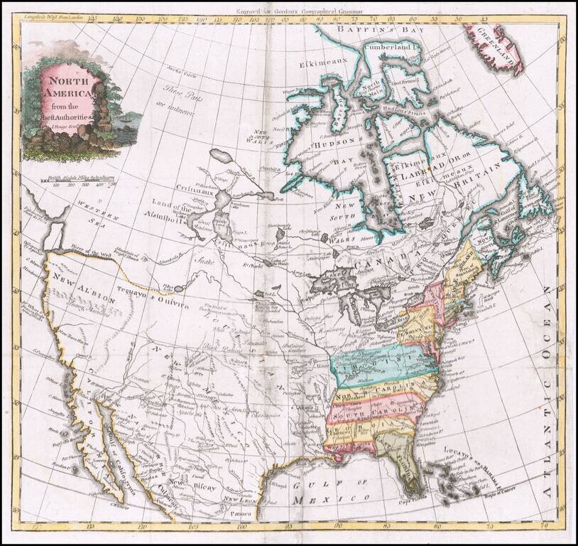
Interesting mid 18th Century map of North America, published by Robert De Vaugondy. The map shows Quivira, Nouvelle Albion, P. de Drake, etc., on the West Coast of North America, which extends North to C. Blanc and shows the inland river. A number of...
Striking Map of North America Based on De L’Isle’s Foundational Map of North America--With Manuscript Annotations! Lotter’s rendition of De L'Isle's highly important map of North America (1700), which was the first map to correctly place the...
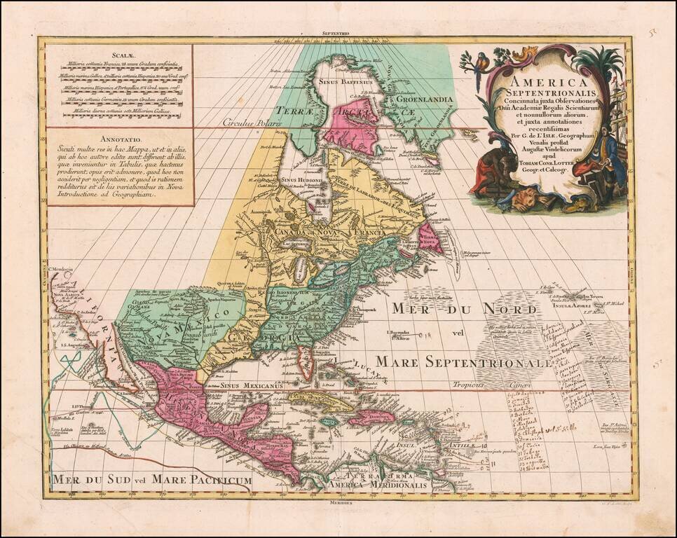
Dutch edition of Guillaume De L'Isle's Highly Important Map of North America Finely colored example of the Ottens edition this seminal map of North America. In its initial 1700 publication, it was the first to correctly place the mouth of the...
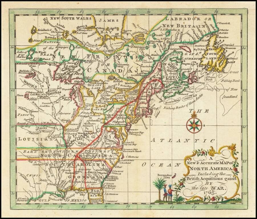
Rare map of the British Colonies in North America, which appeared in Entick's General History of the Late War. North Carolina, South Carolina, Virginia and Georgia all extend to the Mississippi River, with North Carolina noting Earl Granville's...
Decorative map of North America, published in 1774. The map extends west to include Texas and much of the supposed course of the Missouri, north to a mythical set of lakes referenced as the supposed location of the Sea of the West. Includes Indian...
North America Signed by a Rarely Seen Map Engraver Rare mid-18th Century map of North America, engraved by I Buego in Edinburgh. The map shows the British Colonies extending from the Atlantic to the Rocky Mountains. East and West Florida are shown,...