Map size in jpg-format: 43.8527MiB
Click to open in high resolution (open in new tab).
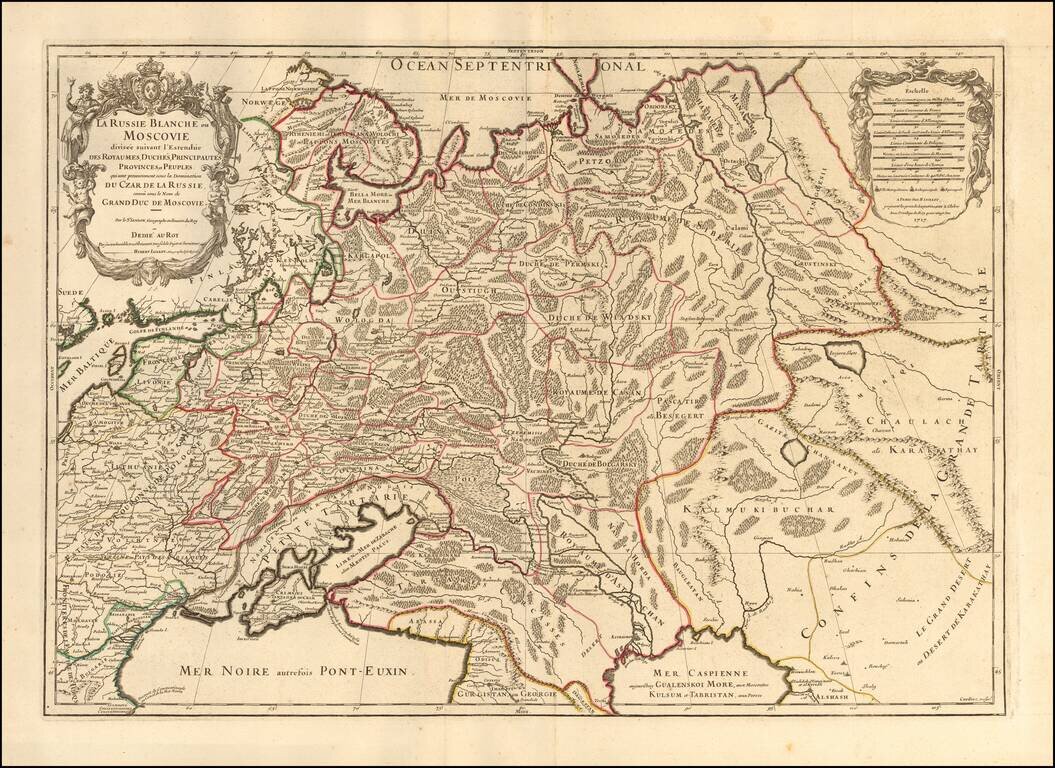
Striking large format map of Russia, extending from the Baltic and Black Seas to Grande Tartarie and the Grande Desert or Desert De Karkkathay, published by Hubert Jaillot.
This map of Russia provides a highly detailed picture of European Russia and part of Central Asia, based upon the geographical compilations and work of Nicolas Sanson which remained unpublished at the time of his death. Jaillot conceived in 1674 of the re-issue of Sanson's major work (published and unpublished) in an enlarged format. The maps were issued as early as 1674 and were later jointly issued by Sanson and Mortier in Amsterdam.
Alexis-Hubert Jaillot (ca. 1632-1712) was one of the most important French cartographers of the seventeenth century. Jaillot traveled to Paris with his brother, Simon, in 1657, hoping to take advantage of Louis XIV's call to the artists and scientists of France to settle and work in Paris. Originally a sculptor, he married the daughter of Nicholas Berey, Jeanne Berey, in 1664, and went into partnership with Nicholas Sanson's sons. Beginning in 1669, he re-engraved and often enlarged many of Sanson's maps, filling in the gap left by the destruction of the Blaeu's printing establishment in 1672.
If you are a student, write to us in telegram: @antiquemaps and indicate what material you need and for what work you need a map in high detail. We are ready to provide material on special terms. For students only!
![[Signed Political Satire Artwork] Vietnam ... Vietnam ... Vietnam ...](/map/small/68726.jpg)

