
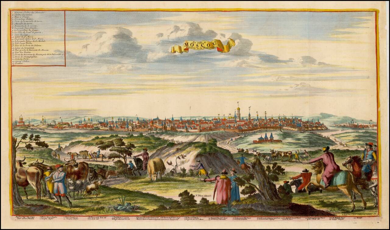
Fine view of Moscow, after Nicolas Witsen's view. The view includes a key identifying 24 locations.
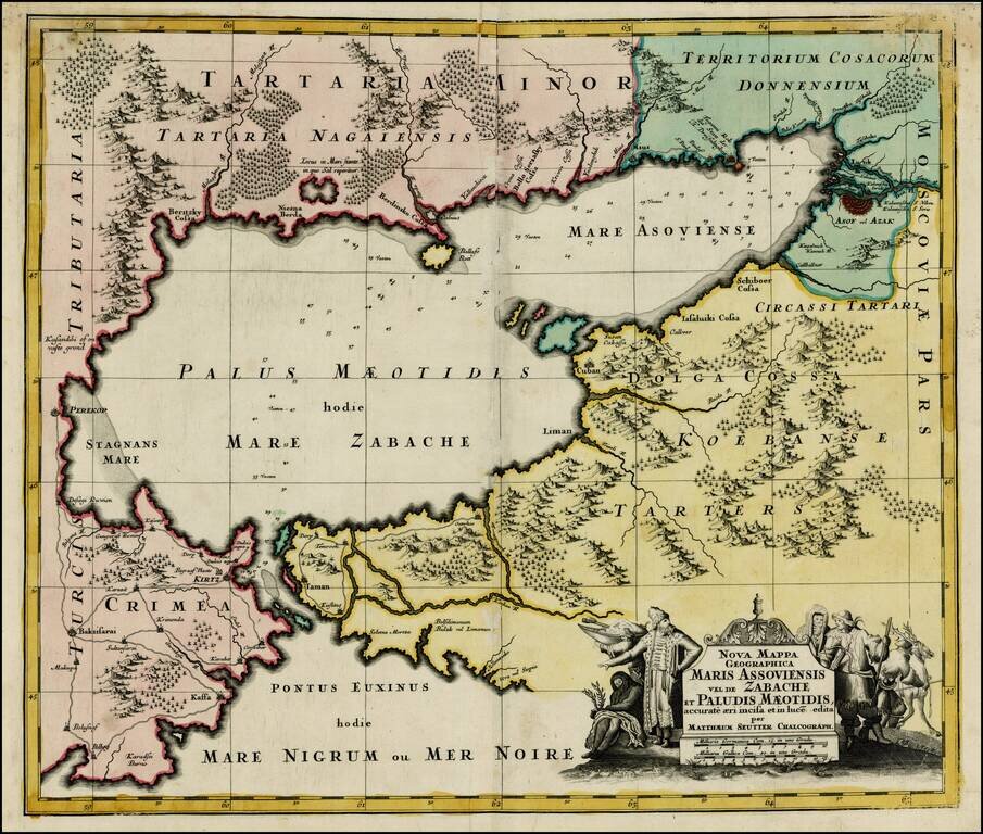
Striking map of the Sea of Azov and the surrounding regions, with a decorative allegorical cartouche, showing the costumes of the indigenous people of the region.
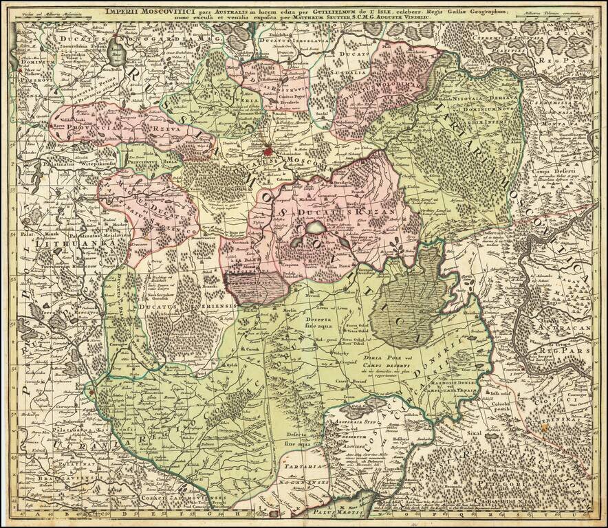
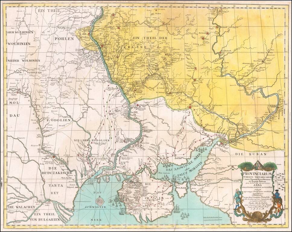
Centered on Moscow Detailed map of Southern Russia, including the Ukraine, Cosack Regions and the Southern part of Moscovie. Includes towns, roads, rivers, lakes, mountains, castles, forests and other details.
![[Book with map] Nova Descriptio Geographica Tattariae Magnae tam orientalis (with Das Nord =und Ostliche Theil von Europa und Asia . . . )](/map/small/68134.jpg)
First Edition of Strahlenberg's Seminal Work on Russia, bound with an English Edition of the Map Nice example of the London edition of Strahlenberg's map of Russia, one of the most important maps of Russia published in the 18th century, bound with the...
![Ingermanlandiae seu Ingriae novissima Tabula luci tradita MDCCXXXIV [Includes inset view of St. Petersberg]](/map/small/25206.jpg)
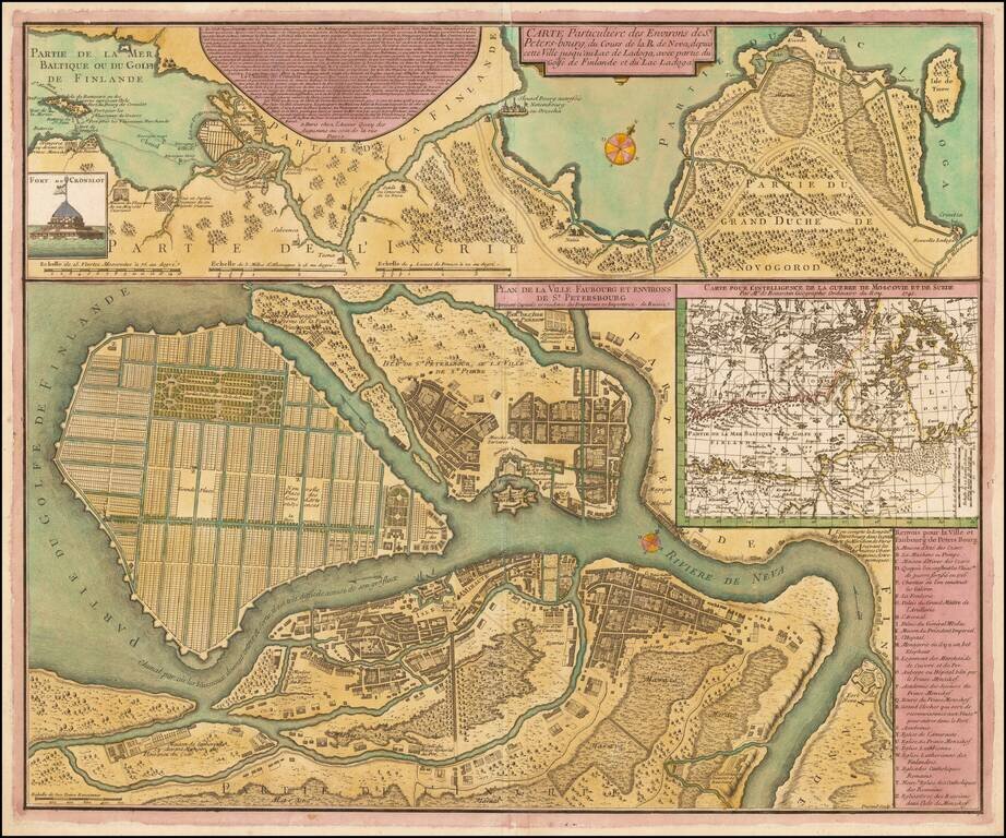
Highly detailed regional map of Russia, showing the area around St. Petersburg. Includes a large birdseye view of the harbor and two decorative cartouches.
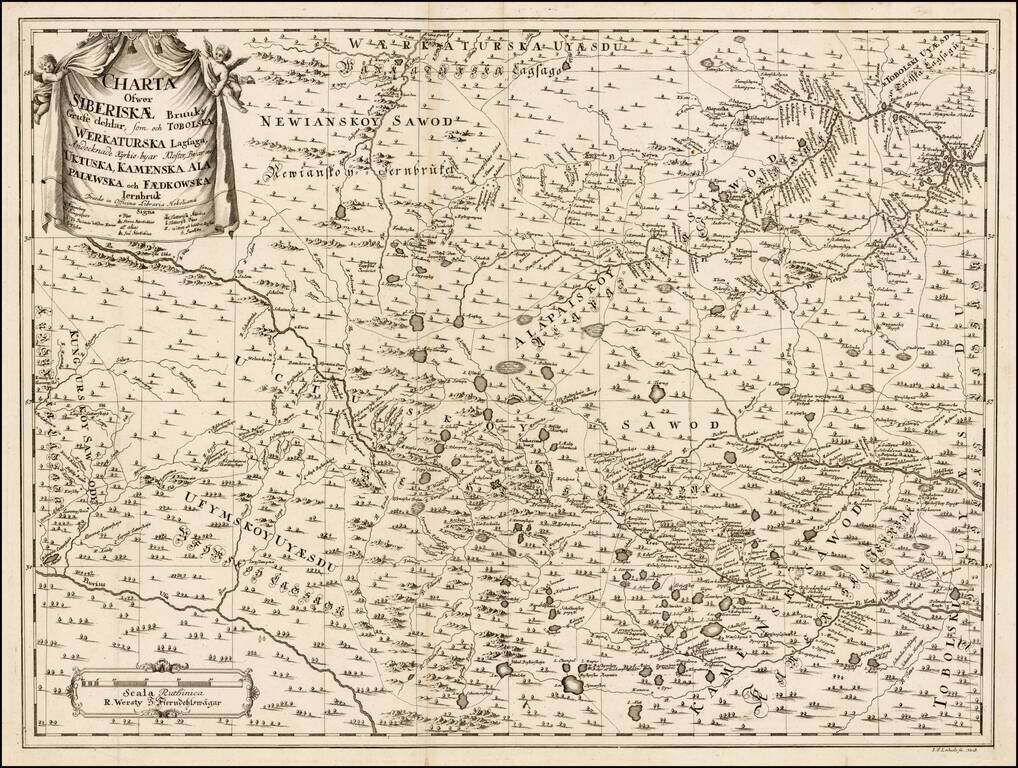
Rare Swedish map of part of Russia, showing Siberia, Ufymskoy Uyaesdu, Uctuskoy, Alapaiskoy Sawod, Kamensk Sawod, Toboloski, Newianskoy Sawod, etc. The map is apparently very rare. The notation at the bottom of the cartouche is Dresdae in Officina...
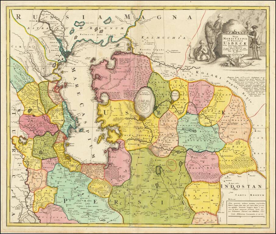
Antique Map of Usbekistan, Kazakhstan, Azerbaijan, Northern Iran, Turkmenistan and the Caspian Sea Region - The First Map to Name Usbekistan in the Title Decorative and detailed map of Usbekistan, Kazakhstan, Azerbaijan, Northern Iran, Turkmenistan...
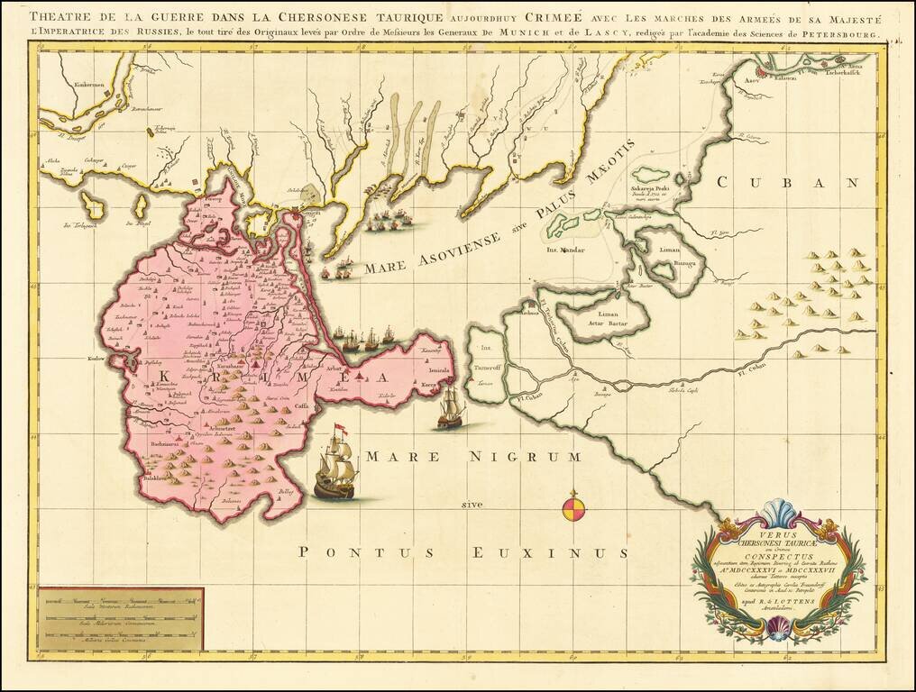
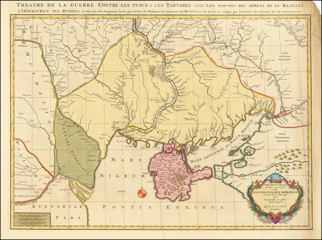
Rare Russian-Austrian Turkish War Map Fine map of the Theater of war in the south part of Ukraine and the contiguous coatlines of the Black Sea. According to an article in Neue Zeitungen von gelehrten Sachen auf das Jahr ...., Volume 33 (1738) at...
![[Plan of the Emperor's Capital of Moscow] Plan Imperatorskago Stolichnago Goroda Moskvy. Sochinennoi pod smotreniem arkhitektora Ivana Michurina v 1739 godu.](/map/small/38306.jpg)
Fine example of the first plan of Moscow made to scientific specifications, by the architect Ivan Fyodorovich Michurin, published in St. Petersburg in 1739. Michurin's plan of Moscow is a scientific milestone in the modern history of Moscow,...
Fine Old Color Example Rare map of part of the Ukraine and the Black Sea region, showing the route of the Russian Army in its expedition against the Tartars in 1736 and 1737. Includes sailing ships, cartouche, compass rose and detailed movements of...
Rare early plan of St. Petersburg, engraved by Durand and published in Paris by Jean de Beaurain. This fine plan shows St. Petersburg as it was planned to be built while it was still in the process of construction. In 1703, the site, at the head of...
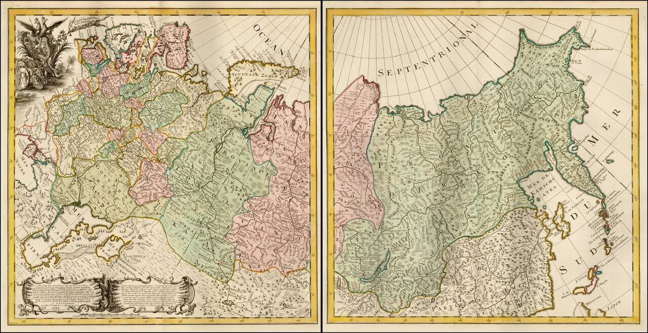
Impressive two-sheet engraved map of Russia, published by the famous Amsterdam mapmaking pair of Covens & Mortier, circa 1741. Probably based on the efforts of Joseph Nicholas de L'Isle, who revolutionized the mapping of Russia in the 1730s and...
![[St. Petersburg, Russia]. Grond-Tekening van de Russische Hoosdstadt St. Petersburg, door Czaer Pieter de Eerstre In't Jaer 1703 aengelegt. . . . .](/map/small/40904.jpg)
A rare and detailed separately-issued early plan of St. Petersburg by Johann Matthias Hase, printed in Utrecht by Johannes Broedelet. This fine plan shows St. Petersburg shortly after the initial phases of its construction had been completed. In...
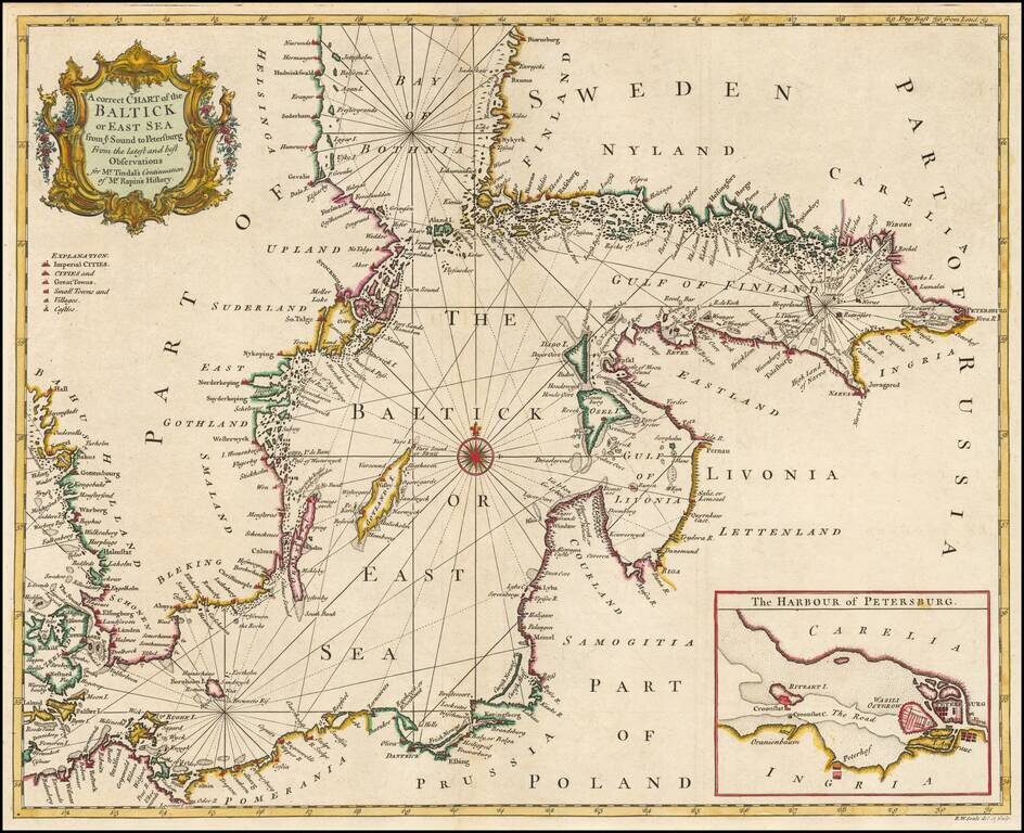
Detailed coastal chart of the Baltic Sea, Bay of Bothnia, Gulf of Finland and contiguous coastlines, with a large inst map o the Harbour at St. Petersburg. Includes a compass rose and rhumblines, with a decorative title cartouche.
Fine old color example of this rare map depicting the theater of the Russo-Turkish War in the Ukraine in 1737. The map provides excellent detail of the fortifications including the Ukrainian line - a system of defenses from the Dnipro to the Donetz...
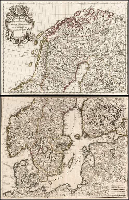
Large format 2-sheet map of the region from Scandinavia to the Baltic and part of Poland, originally issued by De L'Isle in 1708.