Map size in jpg-format: 907087B
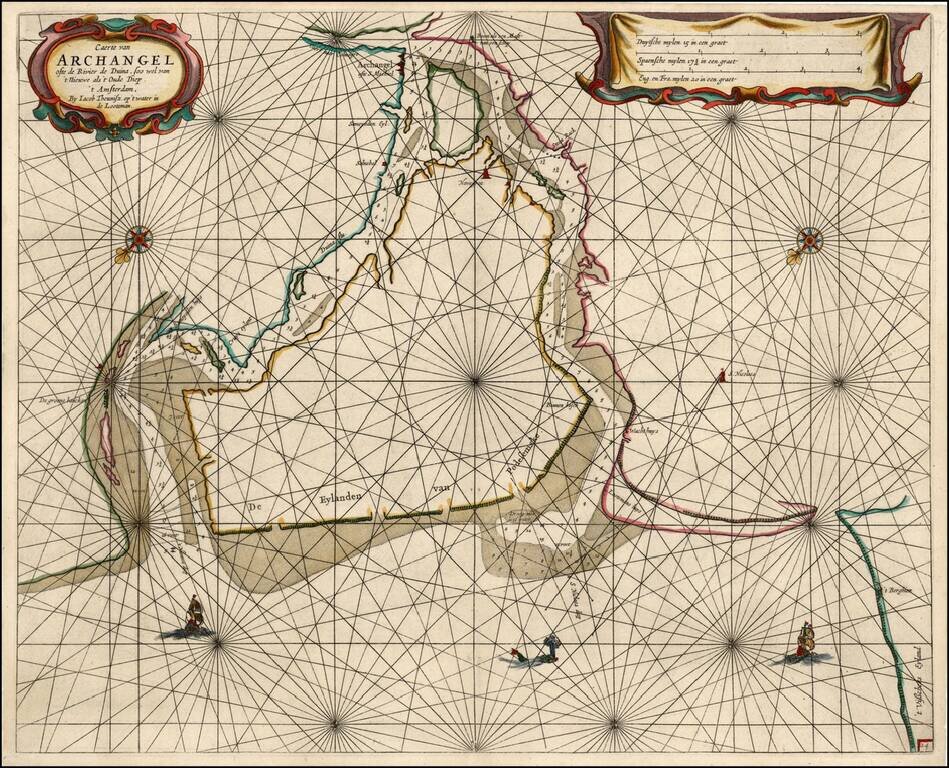
Rare sea chart of the mouth of the Duina River and the port town of Archangel, published by Jacob Theunisz (Lootsman).
At first Jacob adopted his father Anthonie's name, being known as Jacob Theunisz. Later with his brother Caspar, in association, they added the name Lootsman to their name to avoid confusion with the father. In 1666 Jacob Lootsman published the first known edition of the Nieuwe Water-Werelt, Ofte Zee-Atlas.
The present example predates the granting of a privileged to Theunisz.
If you are a student, write to us in telegram: @antiquemaps and indicate what material you need and for what work you need a map in high detail. We are ready to provide material on special terms. For students only!
![[Signed Political Satire Artwork] Vietnam ... Vietnam ... Vietnam ...](/map/small/68726.jpg)

