logo

1584. Poloniae Finitimarumque locorum descriptio Auctore Wencelslao Godreccio

  • Poloniae Finitimarumque locorum descriptio Auctore Wencelslao Godreccio

Poloniae Finitimarumque locorum descriptio Auctore Wencelslao Godreccio information:

Year of creation: 
Resolution size (pixels): 
 12806x9847 px
Disk Size: 
 39.3842MiB
Number of pages: 
 1
Place: 
 Antwerp
Author: 

Print information. Print size (Width x height in inches):
Printing at 72 dpi 
  177.86 х 136.76
Printing at 150 dpi 
 85.37 х 65.65
Printing at 300 dpi 
 42.69 х 32.82

An example of detailing the file of this map of in a printable high-resolution:

Click to open in high resolution (open in new tab).
Attention! this is just the central piece (central area 960x960 px) of the map file!
This is an example, so that you can see and study the level of detail of a given map. The entire Map will be fully available after payment!

Poloniae Finitimarumque locorum descriptio Auctore Wencelslao Godreccio

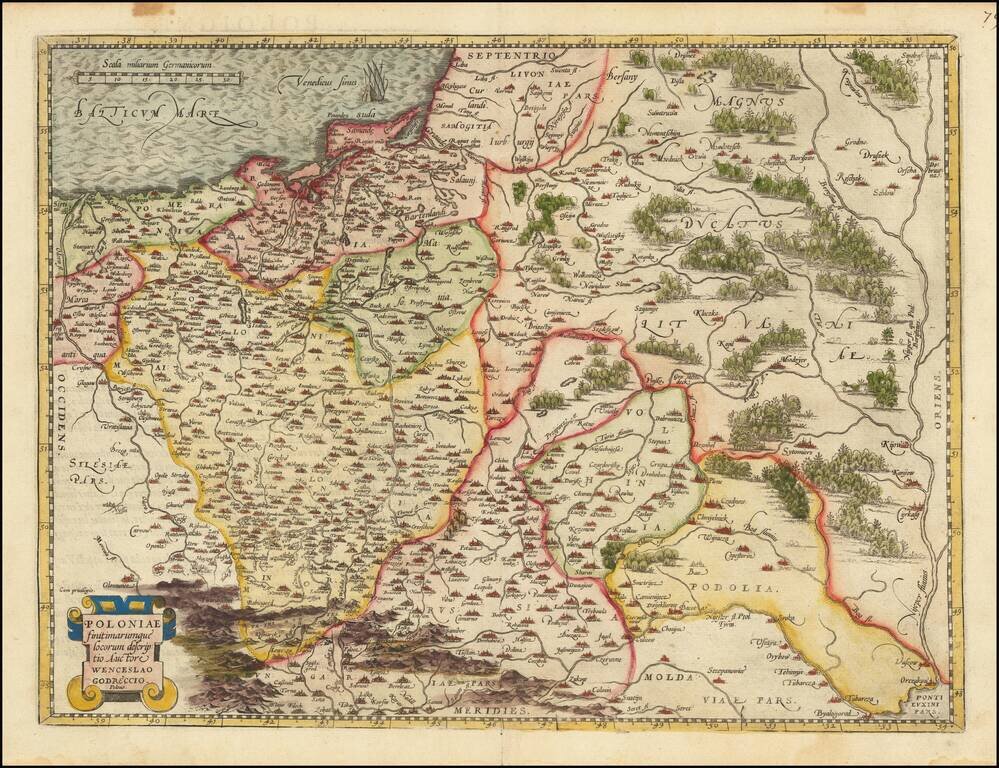
Decorative example of Ortelius' first map of Poland, from Ortelius' Theatrum Orbis Terrarum, the first modern atlas of the World.

This map is based upon the map of Godrecki which was first published in 1558.

One of the earliest modern maps of Poland.

Van den Broeke 154.

Special conditions for students!

If you are a student, write to us in telegram: @antiquemaps and indicate what material you need and for what work you need a map in high detail. We are ready to provide material on special terms. For students only!

Item information:

Year of creation:
Size:
12806x9847 px
Disk:
39.3842MiB
Number of pages:
1
Place:
Antwerp
Author:
Abraham Ortelius.
$14.99

Related item