Map size in jpg-format: 8.95494MiB
Click to open in high resolution (open in new tab).
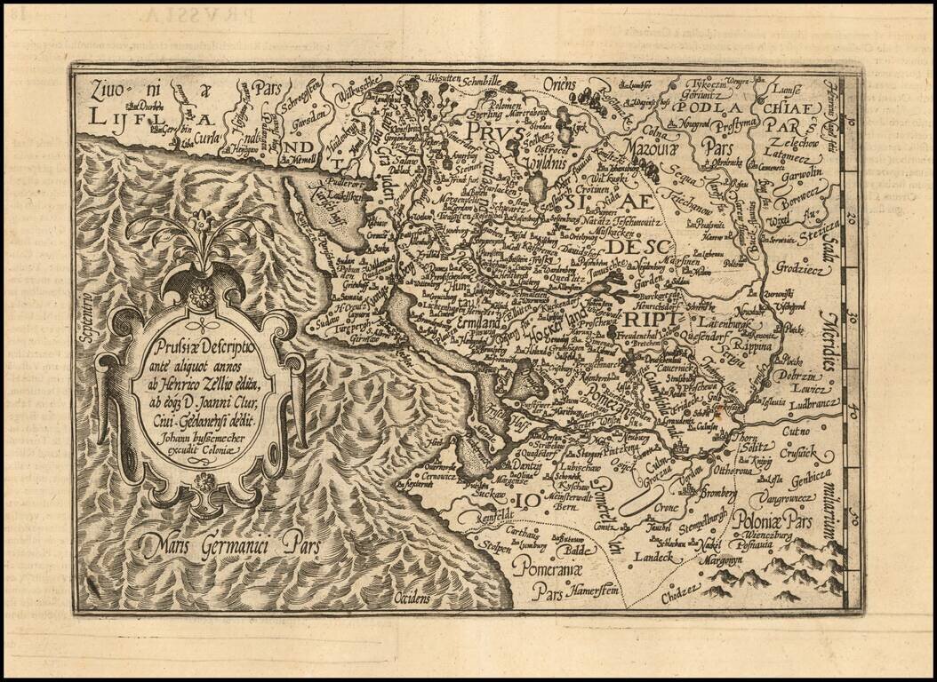
An Early Map of Prussia
Detailed map of the region centered on the southern Baltic Coast, reaching inland to the Bug River.
Includes a detailed early coverage of the areas around Dantzig, Konnigsberg and the Lithuanian coastline.
East is oriented at the top.
Matthias Quad (1557-1613), a map publisher based in Cologne, was trained in the Netherlands by Johannes van Doetecum, who also worked with the De Jodes. Quad used many De Jode maps as a base to which he added additional information and decorations. Quad was best known for his atlases, which were part of the first boom in atlases best characterized by Abraham Ortelius’ Theatrum Orbis Terrarum. In 1592, Quad released an atlas of Europe that had 38 maps. He expanded it in 1594 to 50 maps. In 1600, he expanded the collection of maps further still, this time to 82 maps, and called the atlas, Geographisch Handtbuch. All three were small in size, allowing them to compete as cheaper alternatives to the larger atlases of Ortelius, Mercator, and the De Jodes. Quad released one other atlas, in 1608, with 86 maps, the Fascilus Geographicus.
If you are a student, write to us in telegram: @antiquemaps and indicate what material you need and for what work you need a map in high detail. We are ready to provide material on special terms. For students only!


![[Hand Drawn Prussian Military Encampment at Opole, Poland] Special Grund-Riss Des Kaeyserl Feldl Lagers bey Oppeln in Ober Schlesien](/map/small/59726.jpg)