Map size in jpg-format: 23.7566MiB
Click to open in high resolution (open in new tab).
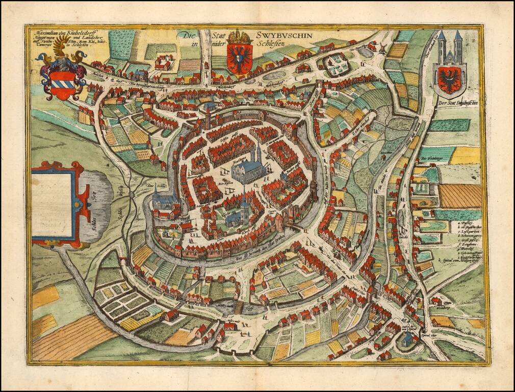
Fine example of Braun & Hogenberg's map of Swiebodzin.
The earliest historical records mentioning Swiebodzin dates to the beginning of the fourteenth century.
The town grew around the confluence of old trade routes linking Silesia with Pomerania and a branch of the route running from Lusatia to Wielkopolska. In the beginning, the town was probably a defensive fortification, built on the western banks of Lake Zamecko at a slight elevation.
The town wall was ringed by settlements, which were much later incorporated into the city itself.
Georg Braun (1541-1622) was born and died in Cologne. His primary vocation was as Catholic cleric; he spent thirty-seven years as canon and dean at the church St. Maria ad Gradus, in Cologne. Braun was the chief editor of the Civitates orbis terrarum, the greatest book of town views ever published. His job entailed hiring artists, acquiring source material for the maps and views, and writing the text. In this role, he was assisted by Abraham Ortelius. Braun lived into his 80s, and he was the only member of the original team to witness the publication of the sixth volume in 1617.
If you are a student, write to us in telegram: @antiquemaps and indicate what material you need and for what work you need a map in high detail. We are ready to provide material on special terms. For students only!


![[Hand Drawn Prussian Military Encampment at Opole, Poland] Special Grund-Riss Des Kaeyserl Feldl Lagers bey Oppeln in Ober Schlesien](/map/small/59726.jpg)