Map size in jpg-format: 37.8089MiB
Click to open in high resolution (open in new tab).

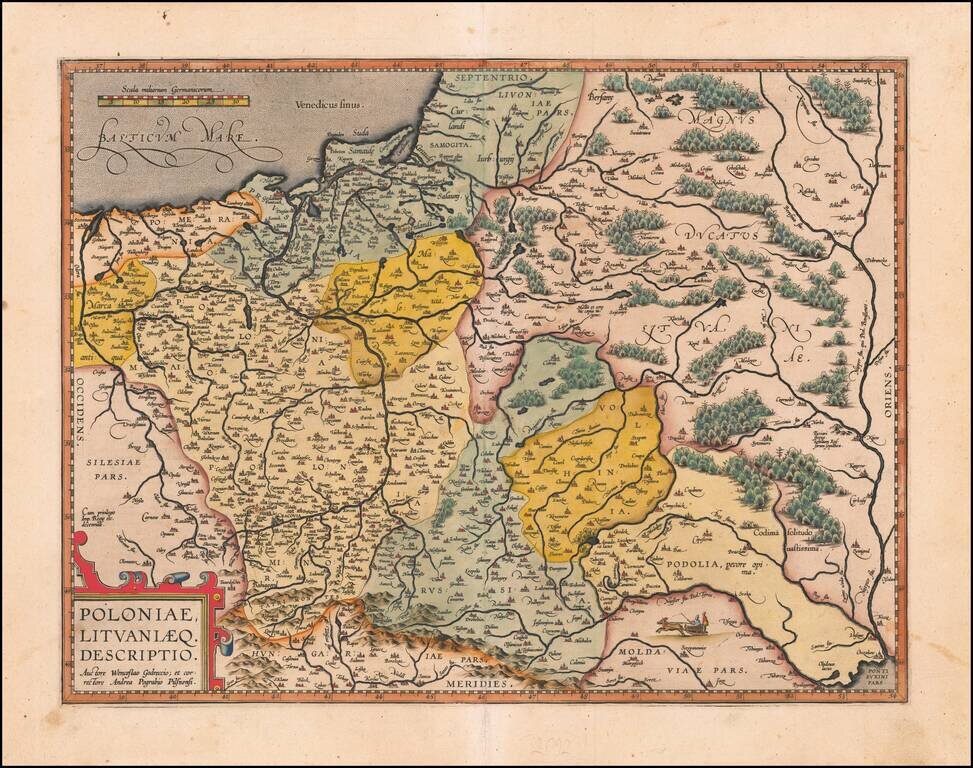
Nice example of Ortelius' second map of Poland and Lithuania which first appeared in the 1595 Latin edition of Ortelius' Theatrum.
The map extends from the Dniepr River in the east to the Oder in the west and includes all of Poland, as well as Pomerania, Prussia Lithuania, etc.. Interesting small vignette.
The present example includes the corrections noted by Van Den Broecke on the Dniester River, which were first made in 1598.
The map is based upon the maps of Grodecki, published in 1558, 1562, as corrected by Pograbka. Grodecki's map itself is based on a map by Wapovsky of 1526.
If you are a student, write to us in telegram: @antiquemaps and indicate what material you need and for what work you need a map in high detail. We are ready to provide material on special terms. For students only!


![[Hand Drawn Prussian Military Encampment at Opole, Poland] Special Grund-Riss Des Kaeyserl Feldl Lagers bey Oppeln in Ober Schlesien](/map/small/59726.jpg)