Map size in jpg-format: 24.8446MiB
Click to open in high resolution (open in new tab).
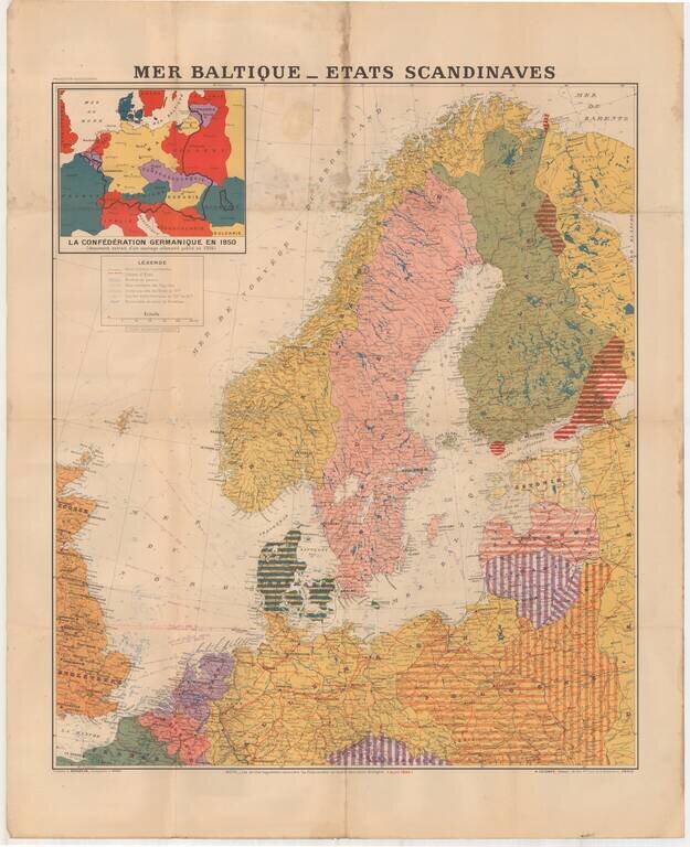
Large format map of the Theater of War in 1940, published in Paris.
The inset map shows the German Confederation as it will appear in 1950, based upon a public German document from 1904.
The areas identified in Striped regions have already been taken by Germany.
If you are a student, write to us in telegram: @antiquemaps and indicate what material you need and for what work you need a map in high detail. We are ready to provide material on special terms. For students only!

![[Eastern Hemisphere Globe Gores] (Nova et integra universi Orbis descriptio)](/map/small/54480.jpg)
![[Signed Political Satire Artwork] Vietnam ... Vietnam ... Vietnam ...](/map/small/68726.jpg)