
Map size in jpg-format: 2.74624MiB
Click to open in high resolution (open in new tab).
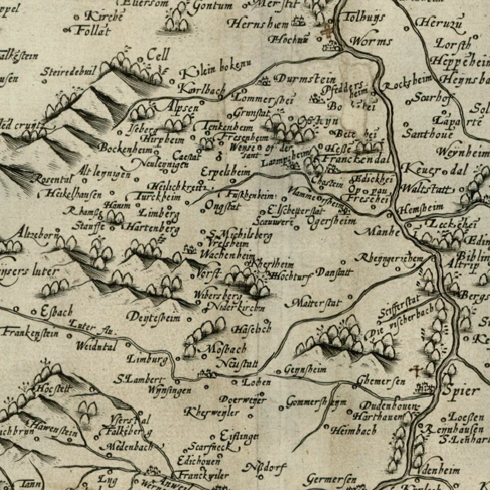
Rare separately issued example of De Jode's map of Palatinus Rheni (no text on the verso, which more commonly appeared in De Jode's Speculum Orbis Terrarum, which along with Ortelius' Theatrum Orbis Terrarum are the earliest modern atlases of the World.
The map extends from Frankfurt and Binge in the North, following the course of the Upper Rhein River. A bit of minor soiling, but generally a nice example of the map, which was bound into a composite atlas of the period.
Gerard De Jode (1509-1591) was a pre-eminent mapmaker in the late seventeenth century, a time when the Dutch dominated the map trade. He was known for his many maps, some of which featured in Speculum Orbis Terrae (first edition Antwerp: 1578). Although never as successful as Ortelius’ Theatrum, the Speculum did get republished in a second edition in 1593, two years after De Jode’s death, by Arnold Coninx, and included this map. After his death, Gerard’s son, Cornelis (1568-1600), and his wife, Paschina, ran the shop. Unfortunately, Cornelis died young in 1600, aged only 32, and the stock and plates were sold to the publisher Joan Baptista Vrients.
If you are a student, write to us in telegram: @antiquemaps and indicate what material you need and for what work you need a map in high detail. We are ready to provide material on special terms. For students only!


