
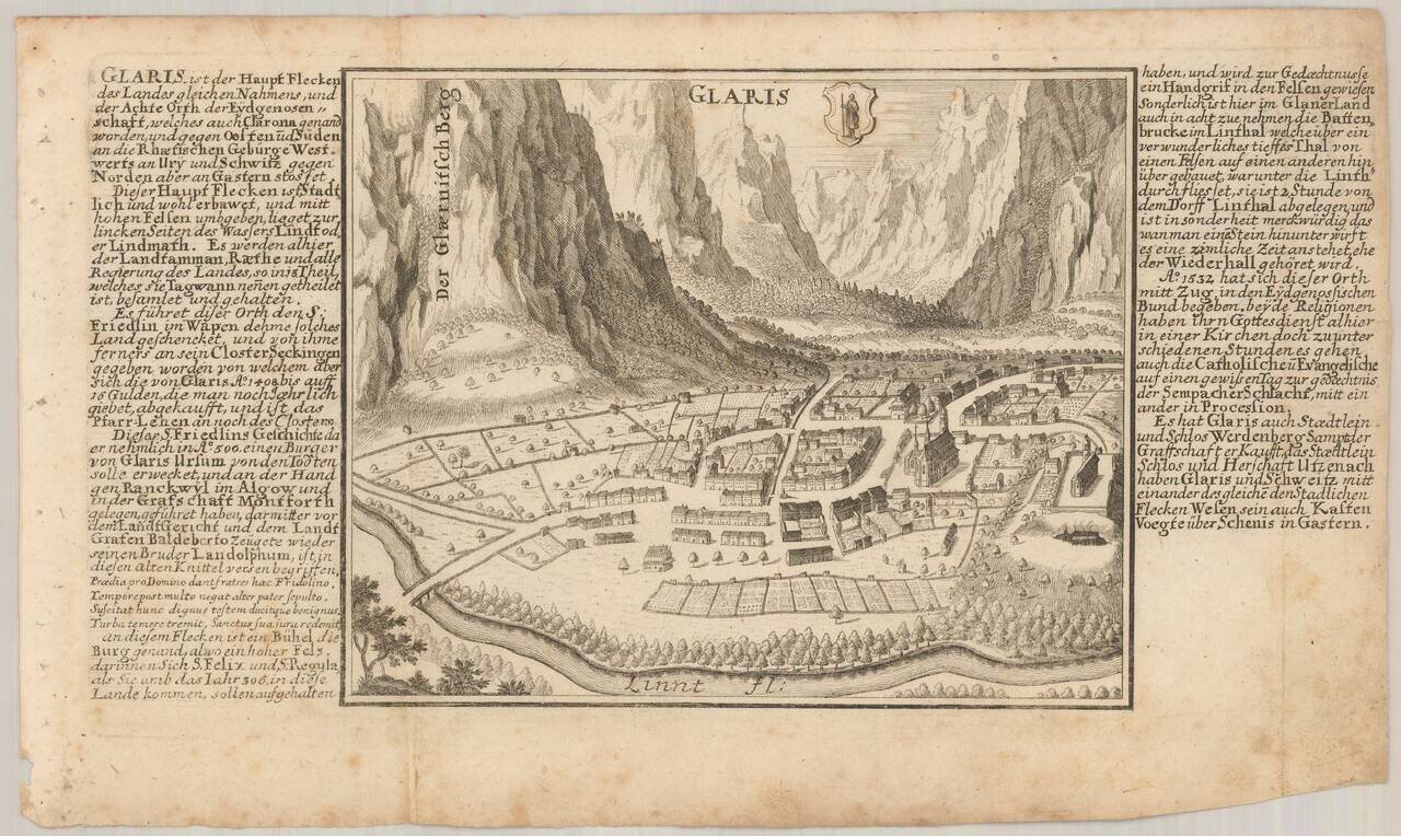
Antique engraved view of Glarus (Glaris), Switzerland, published by Gabriel Bodenehr in his Europeans Macht und Pracht between 1704 and 1720.
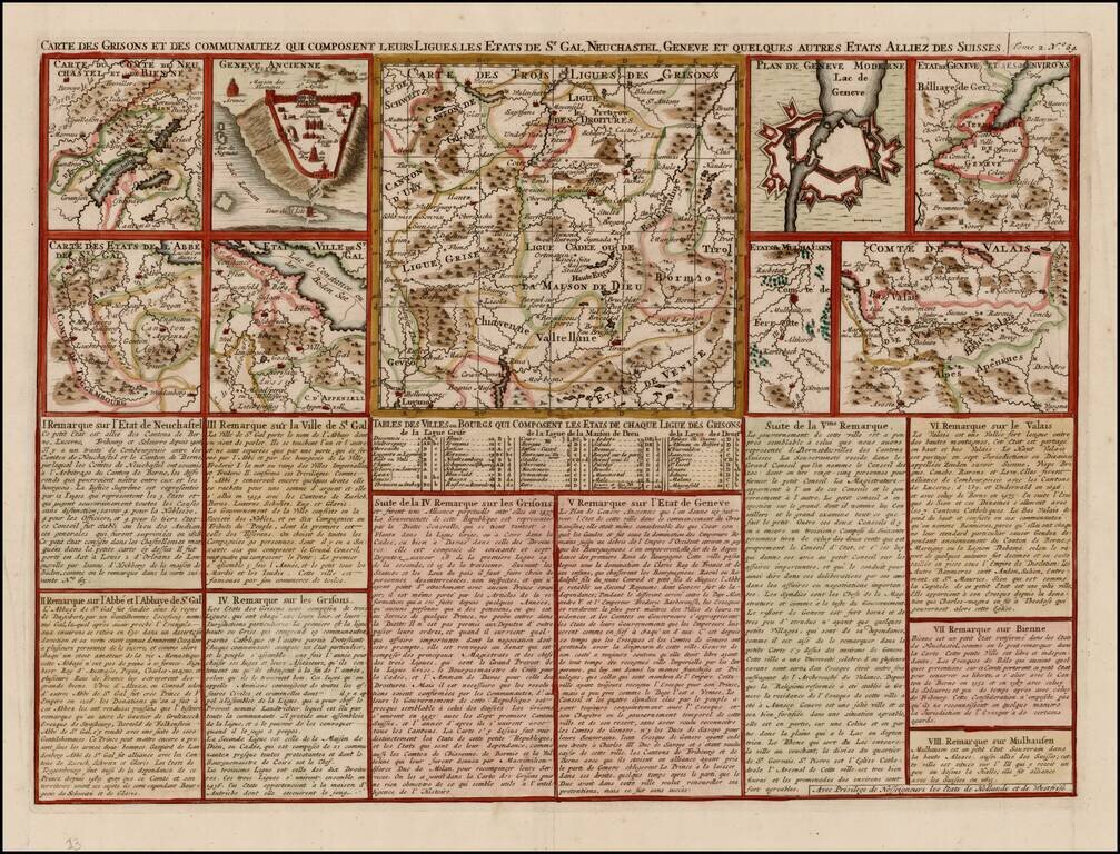
Detailed group of regional maps and town plans of Geneva (ancient and modern), showing battle fortifications. From Chatelain's monumental Atlas Historique, published in 7 volumes.
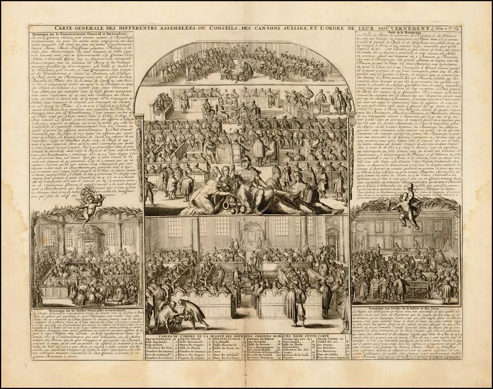
Fascinating series of scenes, illustrating the activities and principal members of the ruling houses of the Swiss Cantons. Remarkable detail. Very decorative. From Chatelain's monumental Atlas Historique.
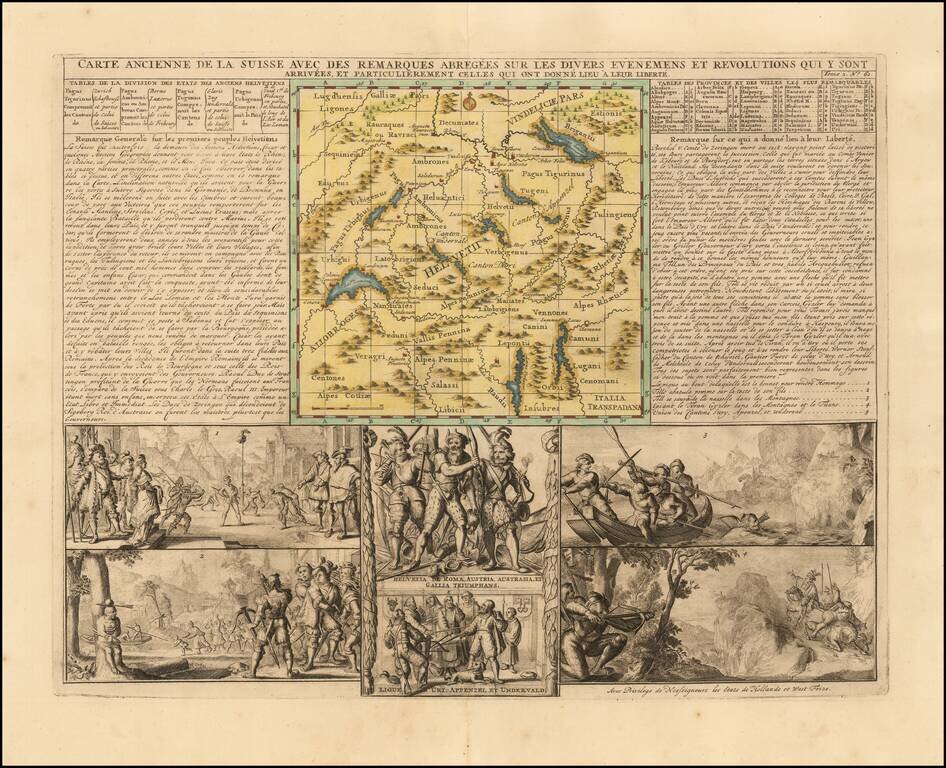
Attractive double-page engraved map of Switzerland by Henri Chatelain, in his typical style, with the map image in the center and descriptive historical text and imagery surrounding it. Shows the Old Swiss Confederacy, which lasted roughly from the...
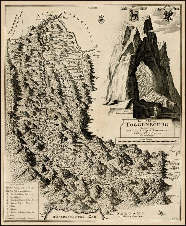
Detailed regional map of Toggenbourg in the Kanton of St. Gallen, with two coat of arms and a striking mountain image. Fantastic topographical image.
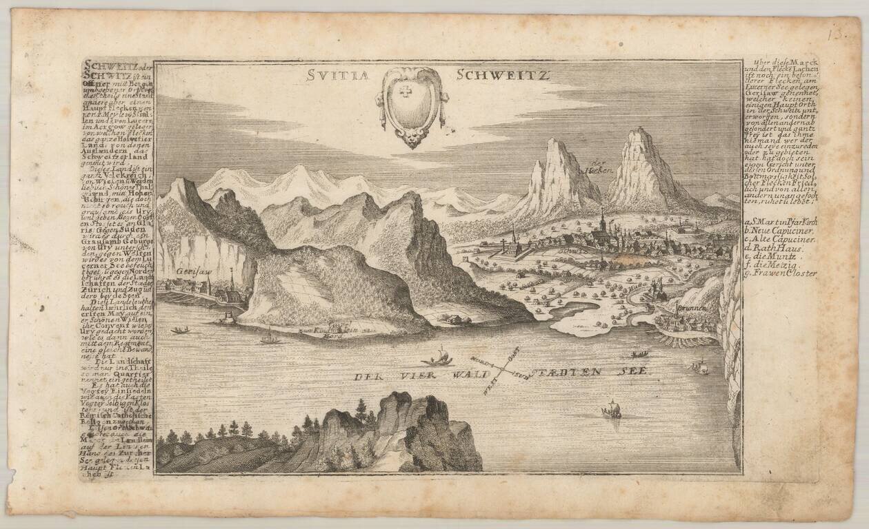
Detailed antique engraved view of Schwyz, Switzerland, probably published in Bodenehr's Curioses Staats und Kriegs Theatrum. The view faces north over Vierwaldstattersee, with Gersau on the left and Schwyz on the right. The coat of arms of Schwyz is...
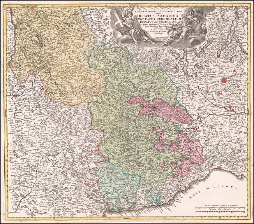
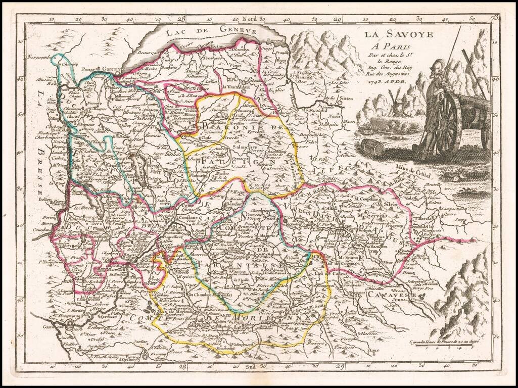
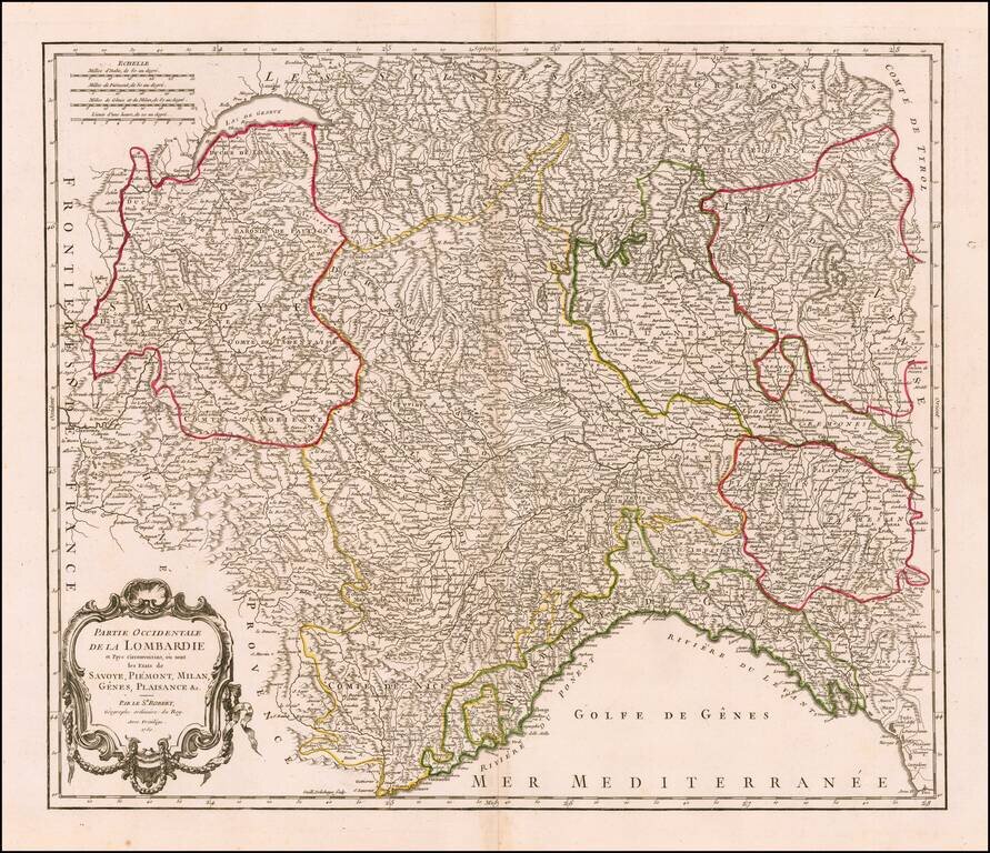
Striking example of Homann's decorative map of the Savoy and Piedmont regions, centered on Torino. The map coverage extends from Grenoble, Geneva, Die and Romans, to Genoa and Milan. Highly detailed, with excellent graphical representation of the...
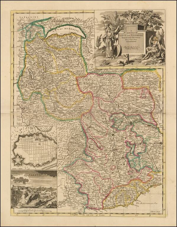
Nice example of John Senex's map of Piedmont & Savoy, from his New General Atlas. The map includes an inset plan of Turin and a view of Verrua. Fine dark impression of this scarce map, with an ornate title cartouche. John Senex John Senex...
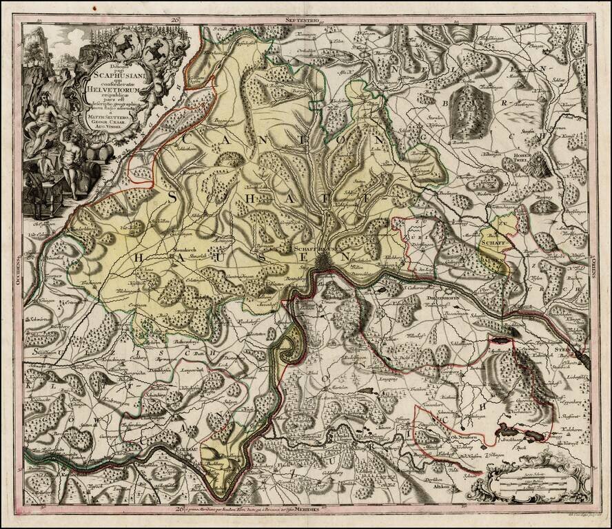
Nice example of Seutter's map of the area around Schffhausen on the Rhein River. One of a series of finely engraved regional maps of Switzerland produced by Seutter. Includes fine details, including towns, roads, rivers, mountains, castles, forests,...
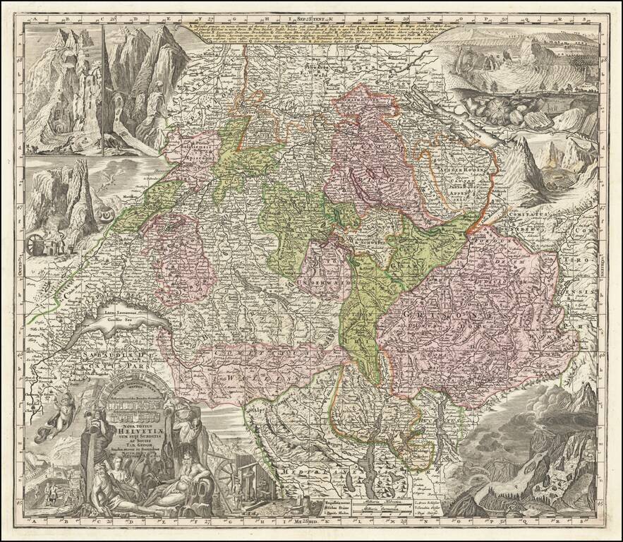
Striking and highly detailed map of Switzerland, with 8 elaborate vignettes and title cartouche. The vignettes show scenes of various mountains and rivers and other scenes, most notably a flying dragon. Includes the coats of arms of each of the...
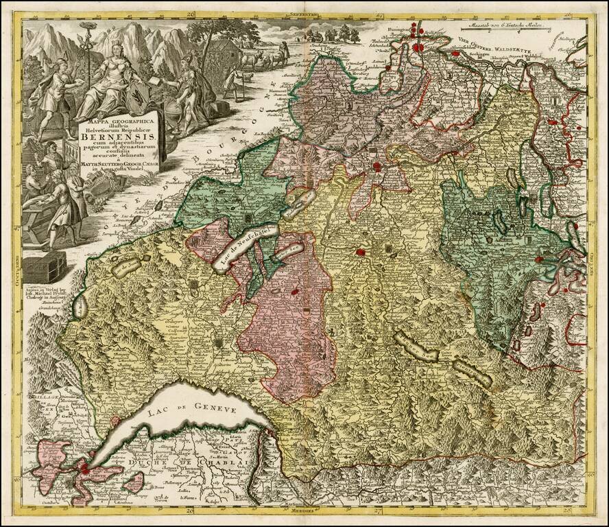
Decorative map of the Kanton of Bern and environs, extending to Geneva, Lucerne and Basel. Includes a decorative cartouche and a number of coat of arms within the map.
![[Untitled Map of Part of Switzerland in the area of Canton Berne and Terre de Saint Claude]](/map/small/29668.jpg)
One sheet of a larger map of part of Switzerland, probably covering the region south of the Canton of Berne. The map is centered on Terre De Saint Claude and shows the Bailliages' of Pontarlier, Salins, Quingey, Poligny, Arbois, Gex, Bugy, Saunier and...
Highly detailed map of Northern Italy, Nice region and part of Switzerland, from DeVaugondy's Atlas Universel. Includes towns, mountains, rivers, lakes and a host of other details. Decorative cartouche. De Vaugondy's atlas was one of the most...
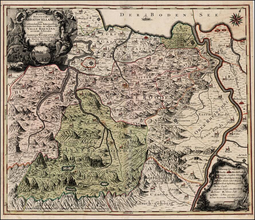
Scarce regional map of Switzerland showing the Cantons south of the Boden See. Includes St. Gallen, Appenzell, Altstatten, Hohen and Hochst on the Rhine River.
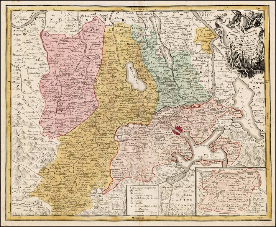
Detailed map of the Kanton of Luzerne in Switzerland with decorative cartouche.