
![Gallia Narbonensis Ora Marittima Recenter descripta [and] Sabaudiae Et Burgundiae Comitatus descriptio . . .](/map/small/57206.jpg)
The regions include a detailed area map of the Avignon region on the upper Rhodanus River (and coastline from Narbone to Marseille) and the area around Lake Geneva, extending west to Lyon, and showing Grenoble, Geneva, San Moritz, and Torino (Italy)....
![Basiliensis Territorii Descriptio Nova [with] Circulus Sive Liga Suevia Vulgo Schwabische Kraiss](/map/small/65392.jpg)
Two detailed regional maps by Ortelius, from his Theatrum Orbis Terrarum, the first modern atlas. The first map shows the region around Basel, in Switzerland, based upon the work of Sebastian Munster. The second map shows the region bounded by the...
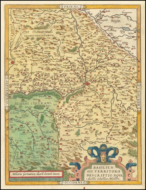
Old color map of the Basel region by Abraham Ortelius, from his Theatrum Orbis Terrarum, the first modern atlas. The first map shows the region around Basel, in Switzerland, based upon the work of Sebastian Munster.
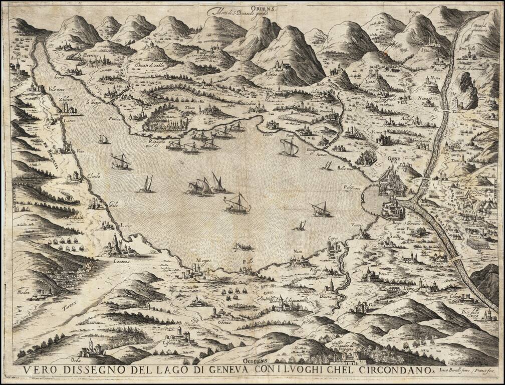
Previously Unknown First State Important early of Lake Geneva, published by Giacomo Franco and Lucca Bertelli. The present map is perhaps the second earliest known map of Geneva, and is based upon the map of Giacomo Fornasieri (1589 circa), the...
![Gallia Narbonens [on sheet with] Savaudiae Ducat. [on sheet with] Venuxini Comitatus Descr.](/map/small/61542.jpg)
Fine old color example. The regions include a detailed area map of the Avignon region on the upper Rhodanus River (and coastline from Narbone to Marseille) and the area around Lake Geneva, extending west to Lyon, and showing Grenoble, Geneva, San...
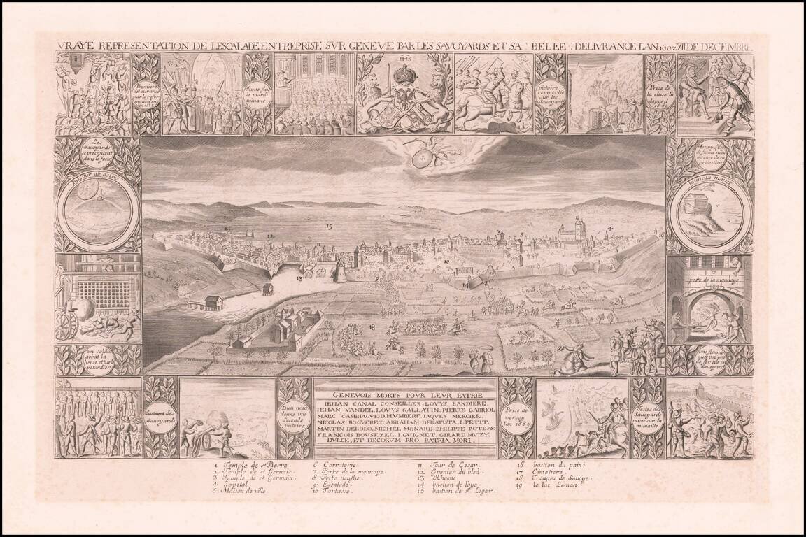
Early 17th Century image of L'Escalade, commemorating the defeat of the siege of Geneva by Charles Emmanuel I, Duke of Savoy in December 12, 1602. Around the central engraving, which shows a bird's eye view of the armies around Geneva, are smaller...
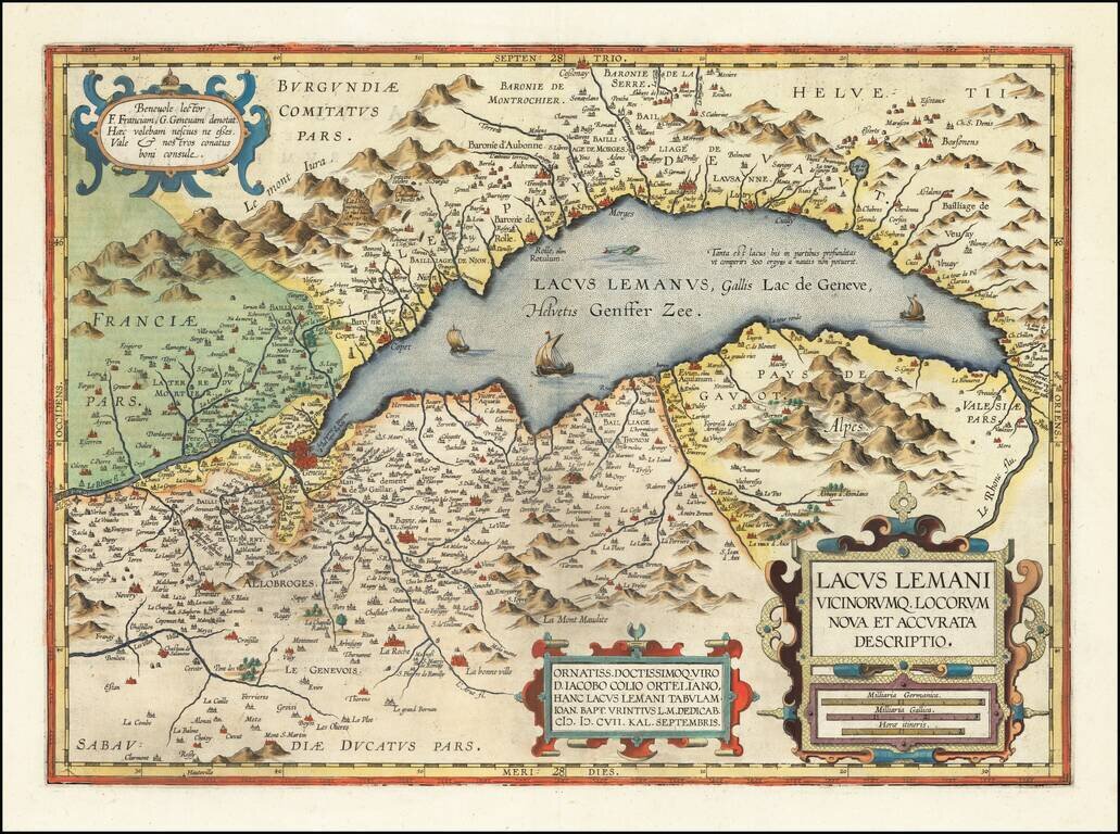
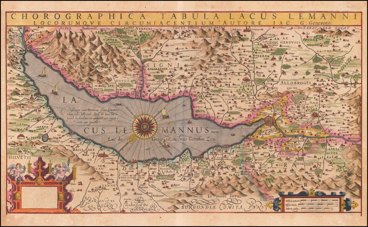
Fine example of Jan Baptiste Vrients' map of the Lake Geneva region, which first appeared in the 1608 edition of Ortelius' Theatrum Orbis Terrarum. A number of islands shown off the coast. Includes 3 sailing ships, a sea monster and 3 large...
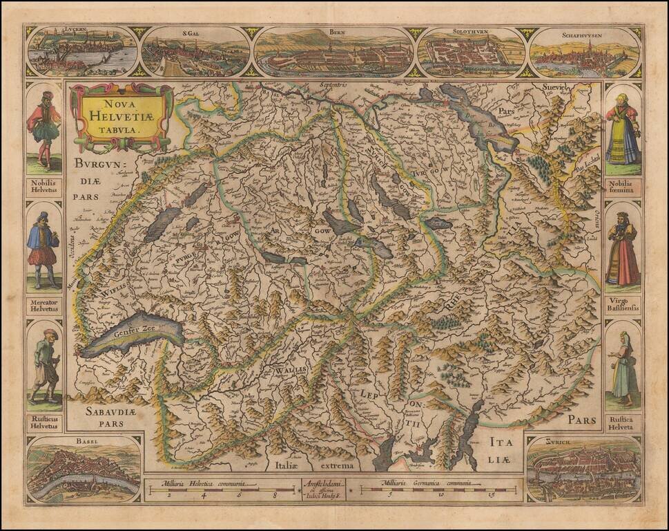
One of the Most Decorative 17th Century Maps of Switzerland. Decorative early map of Switzerland, including 7 city views and 6 costumed figures. Hondius' map of Switzerland is one of the most decorative single sheet maps of Switzerland published in...
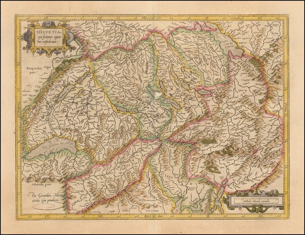
Nice old color example of Gerhard Mercator's detailed map of Switzerland, from his Atlas Sive Comographie . . . , the first book of maps to include the title of "Atlas." One of the earliest maps of Switzerland to appear in a modern atlas.
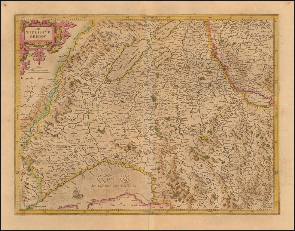
Old color example of Mercator's detailed map of southwestern Switzerland showing Geneva, Lake Geneva, Lake Neuchatel, Lake Biel, Bern, Freiburg, Lake Thuner, etc. Decorative cartouche.
Finely colored example of Jodocus Hondius' map of the Lake Geneva area, oriented to the southeast. Includes fine detail and decorative embellishment. The extremely rare early editions of this map include 5 portraits at the bottom, which are now...

Decorative example of this fine map of Northern Italy and contiguous regions, extending from Venice on the Adriatic, to Pisa and Nice on the Mediterranean, to Lake Geneva in the west, and the Alps in the North, from Ortelius' Theatrum Orbis Terrarum,...
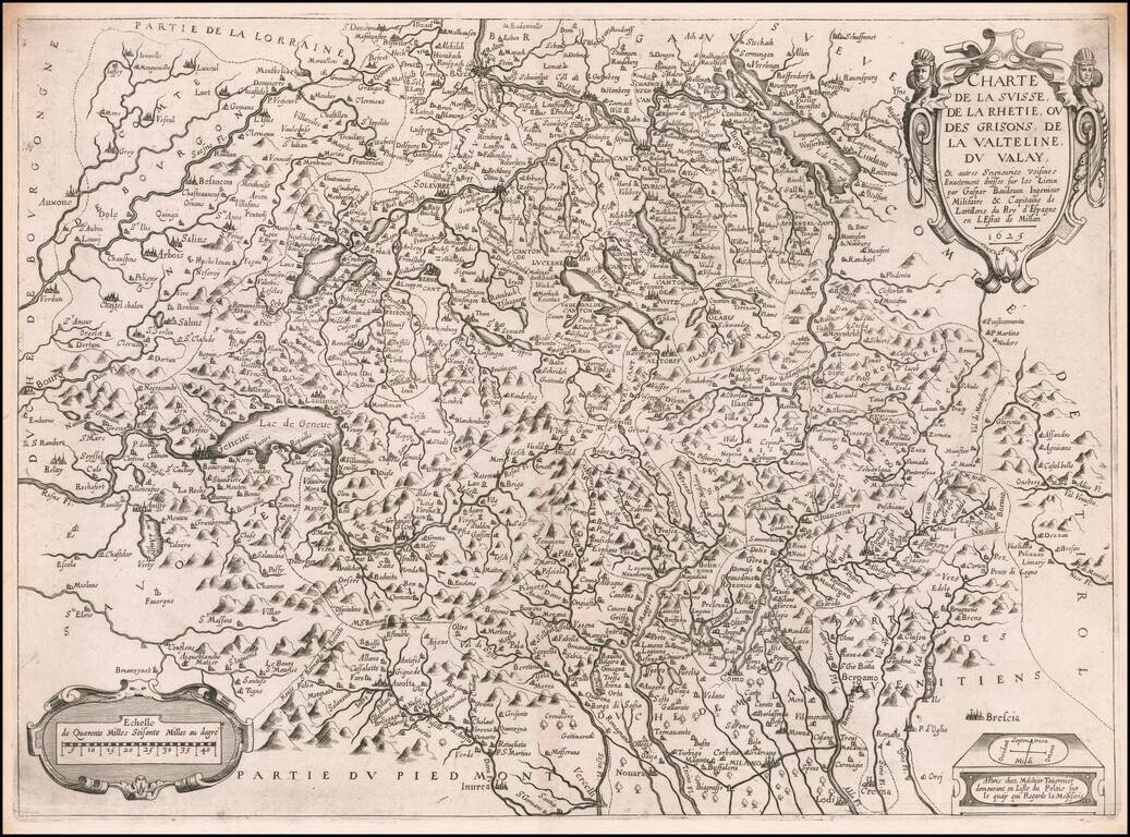
Rare early Tavernier map of Switzerland and part of Italy, based upon the surveys of Gaspard Baudouin, illustrating the region of Switzerland and Northern Italy which was the scene of military action during the reign of Louis XIII. The map extends...
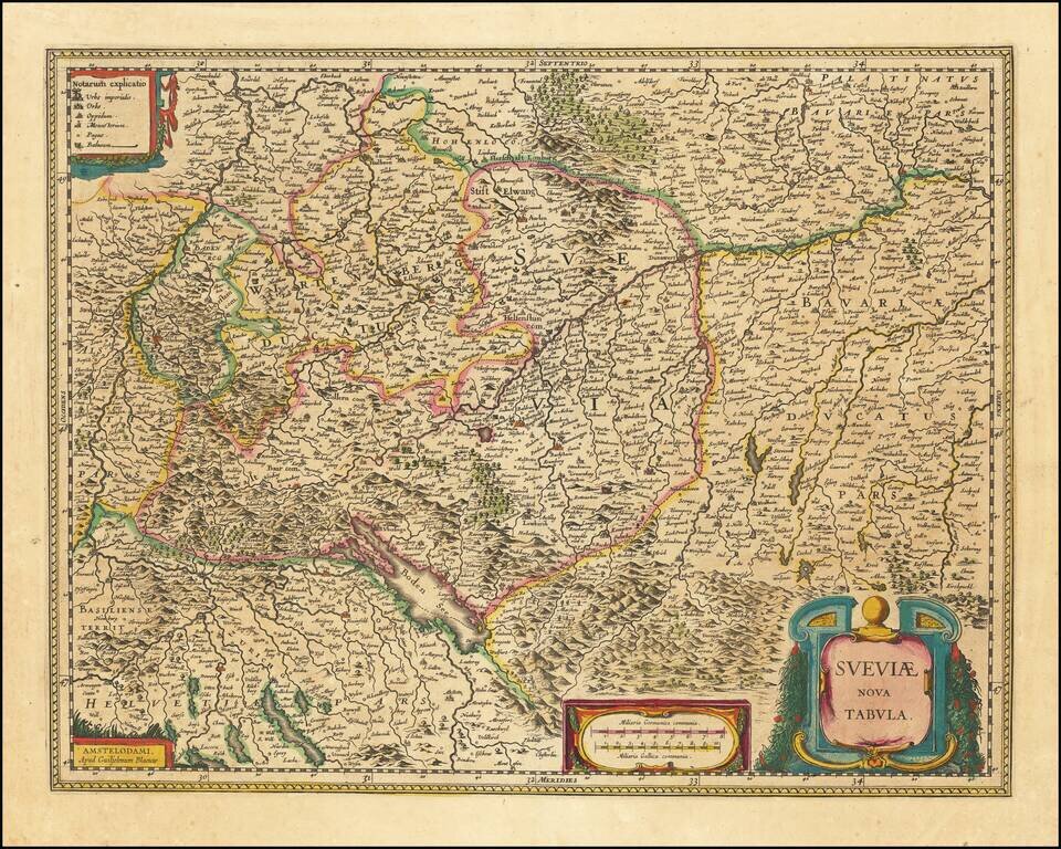
Antique engraved map of the area south of Heidelberg, showing Stuttgart, Ulm, Augsburg, and the River Danube. It also covers some of northern Switzerland including Basel and Zurich. The map was made by Willem Janszoon Blaeu in Amsterdam. The map...
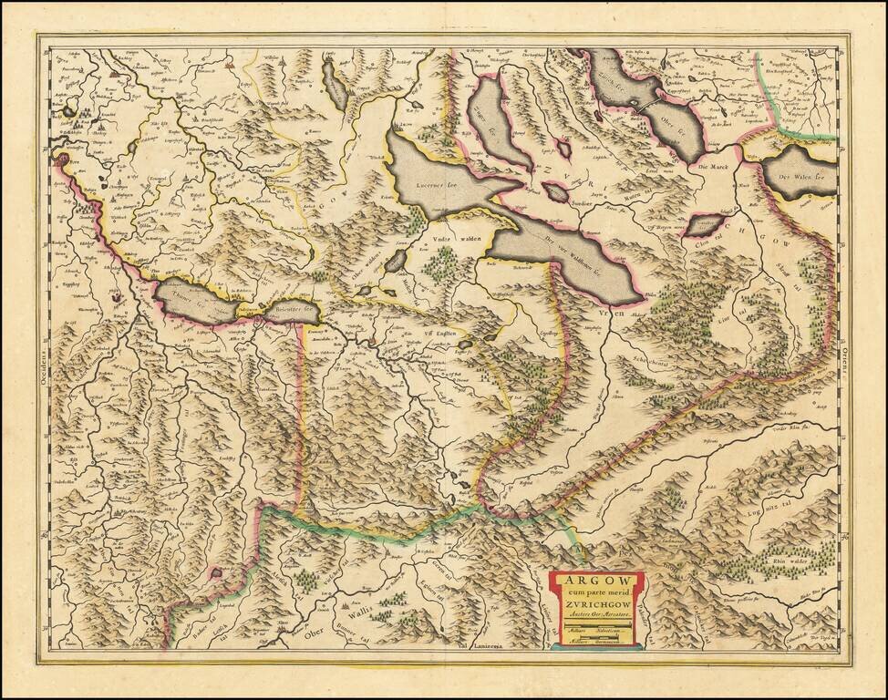
Antique engraved map of the Swiss Canton of Argow, south of Zurich, published by Willem Janszoon Blaeu in Amsterdam. The map shows Lucern and Lake Lucern.
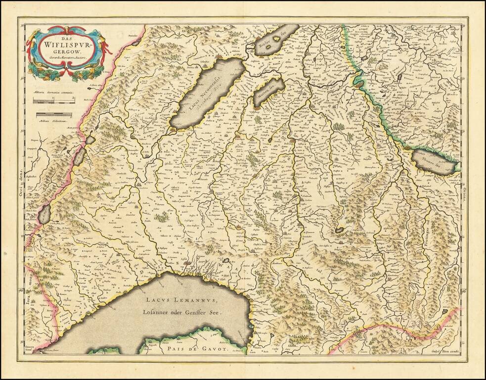
Detailed map of Southwestern Switzerland, showing Geneva, Lake Geneva, Lake Neuchatel, Lake Biel, Bern, Freiburg, Lake Thuner, etc. Decorative cartouche.