Map size in jpg-format: 2.36371MiB
Click to open in high resolution (open in new tab).
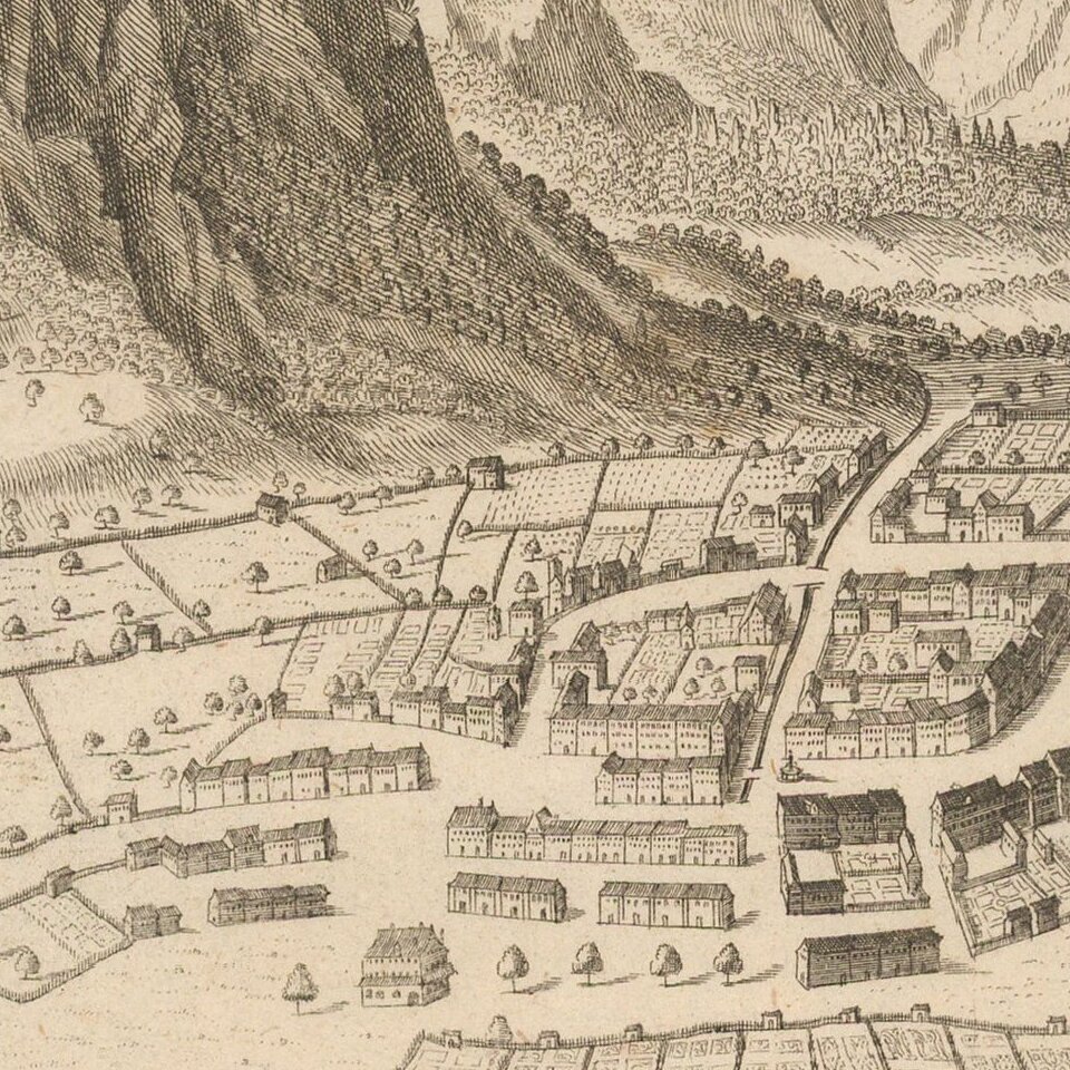
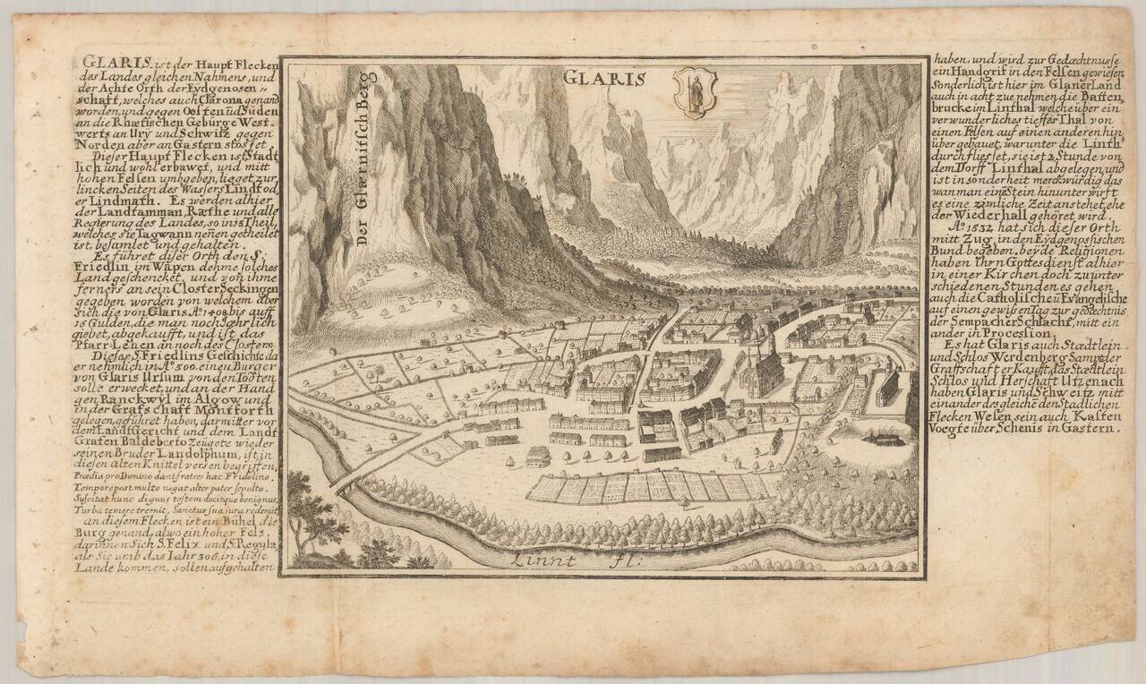
Antique engraved view of Glarus (Glaris), Switzerland, published by Gabriel Bodenehr in his Europeans Macht und Pracht between 1704 and 1720.
Gabriel Bodenehr the Elder (ca. 1673-ca. 1766) was a German engraver and publisher. He originated views of many German cities, for example the first plan of Passau (1710), and is best known for his Atlas Curieux (1704). His son, Gabriel the Younger (1705-1779), followed his father in his profession and was also a well-known engraver.
If you are a student, write to us in telegram: @antiquemaps and indicate what material you need and for what work you need a map in high detail. We are ready to provide material on special terms. For students only!
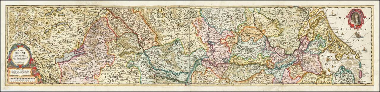
![[Course of the Rhine River] Nova Tractus Totius Rheni Oder Neue beschreibung des Rhein-Strom](/map/small/58670.jpg)