
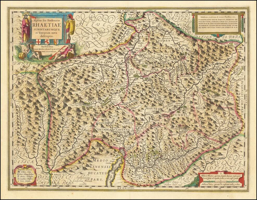
Antique Willem Janszoon Blaeu map of the Canton of Grisons, the largest and easternmost Canton of Switzerland. The map shows the towns and cities of the mountainous region, including Davos and St. Moritz. Beautiful cartouche at the upper right with...
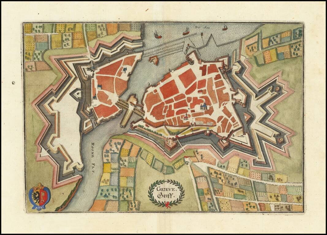
Decorative plan of Geneva, Switzerland and the Rosne River, including the entrance to Lake Geneva, published by Merian. Includes a decorative coat of arms.
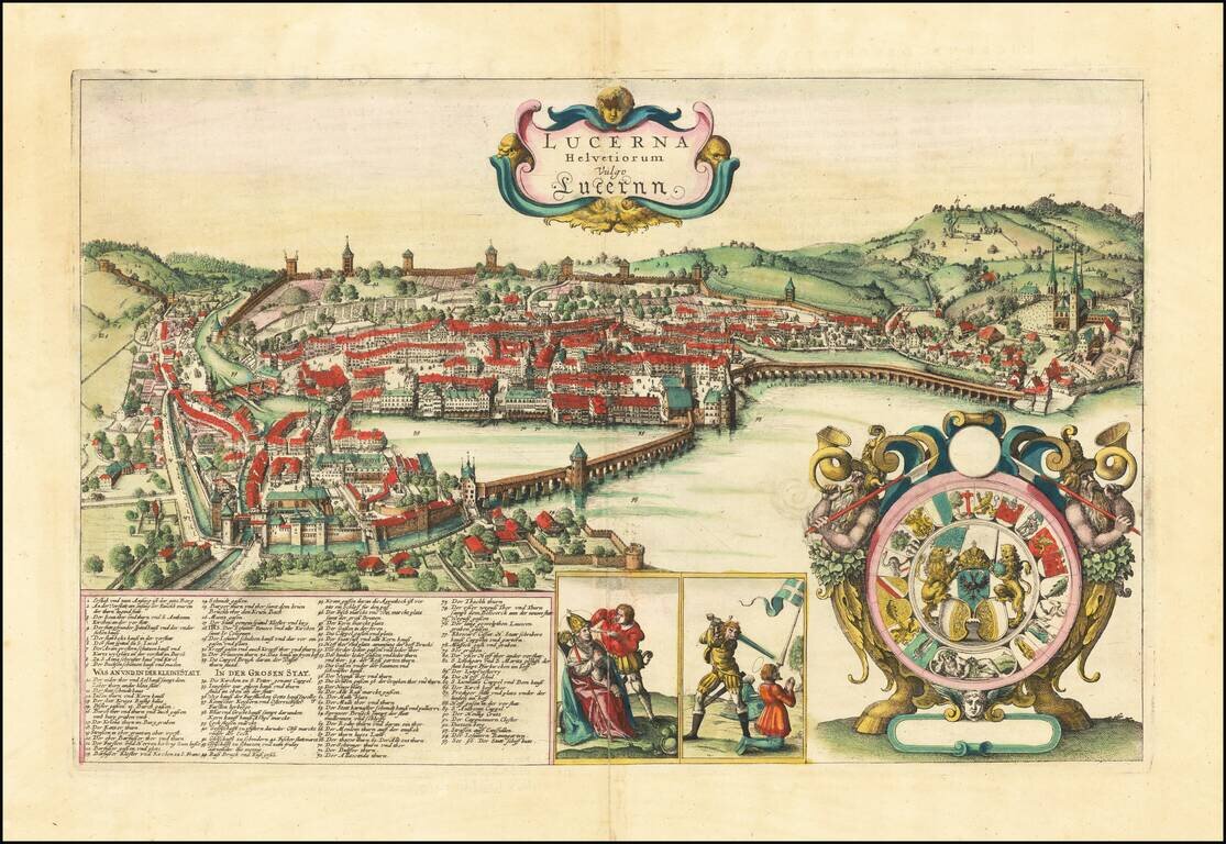
First State in Original Hand-Color. Fantastic etched view of Lucerne, Switzerland, by Wenceslaus Hollar, one of the best practitioners of the art in the 17th century. As is typical of his work, here Hollar elevates the depiction of Lucerne above what...
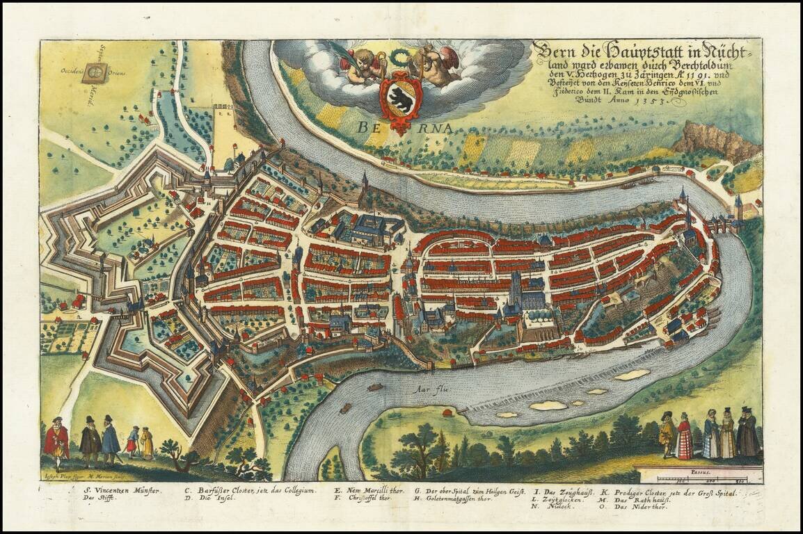
Fine early view of Bern, Switerlands, on the Aare River, engraved by Joseph Plep for Matthaus Merian the elder. The map shows a detailed treatment of the city, its main bridge and fortified walls at the west end of the town. Decorative cartouche shows...
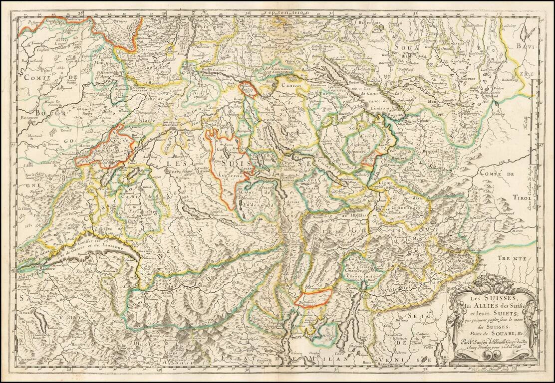
Nicolas Sanson's 1648 double-page engraved map of Switzerland. The map extends from Anneci, Aosta, Lago Magiore, Lago Como and Bergamo in the south to Brisgow, Friburg, Lake Constance and Landsburg in the north. Centered on Lucerne.
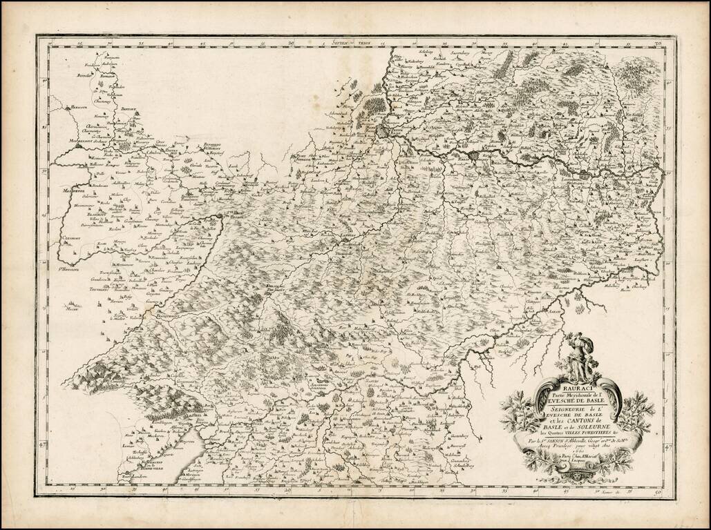
Scarce regional map of the region around Basle, including a striking cartouche.

Striking regional map, centered on Lake Geneva, based upon a map from Abraham Ortelius's Epitome. The map is oriented with East at the top and extends to Basel and Strasbourg in the North, Turin and Grenoble in the south, and Dijon and Lyon in the...
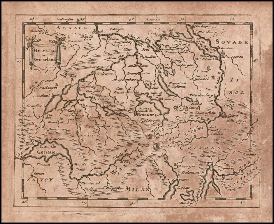
Rare map of Switzerland published by Sir Jonas Moore in London. The map appeared in Moore's A New Geography. Many of the plates in the work were engraved by Herman Moll, who had moved to London in 1678 and had not yet begun publishing under his own...
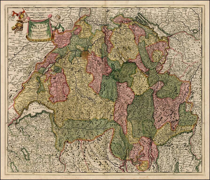
![[Switzerland] Helvetiae Rhaetiae et Valesiae Nova Tabula Geographica M. DC. LXXXV](/map/small/54596.jpg)
Rare map of the Swiss Cantons, published by Johann Caspar Steiner, published in Zug. Steiner was also the author of Germano-Helveto-Sparta, oder, Kurz-deutliche Grund Zeichnung dess alt-teutschen Spartier-Landes, dass ist Schweitzer-Land, published in...

Fine old color example of Theodore Danckerts rare map of the Upper Rhine Region, published in Amsterdam. Cartouche surrounded by cherubs.

An exceptional old color example of this scarce map of the Savoye region, topped by Lake Geneva. The color in this example is truly extraordinary. The map is adorned with a title cartouche decorated with a globe crowned with fleurs de lys and two...
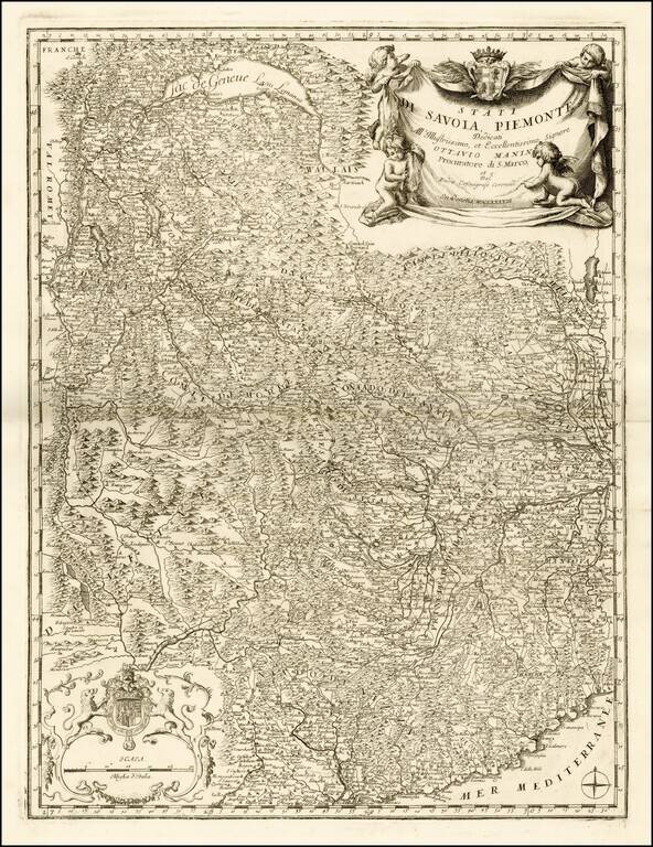
Fine example this striking map of Piemonte and Savoye, from Vincenzo Maria Coronelli's Corso Geographico, published in Venice. The map provides a fantastic image of the topography of the region, naming mountains, rivers, lakes, towns, castles, etc....
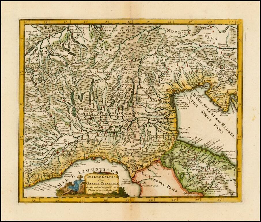
Striking and decorative map of Northern Italy and the Alps, embellished by a decorative cartouche.
Decorative map of Switzerland, the Lake Geneva area and the areas around Lago Magiore, Lugano and Lago di Como and Bergamo. Includes a decorative title cartouche.
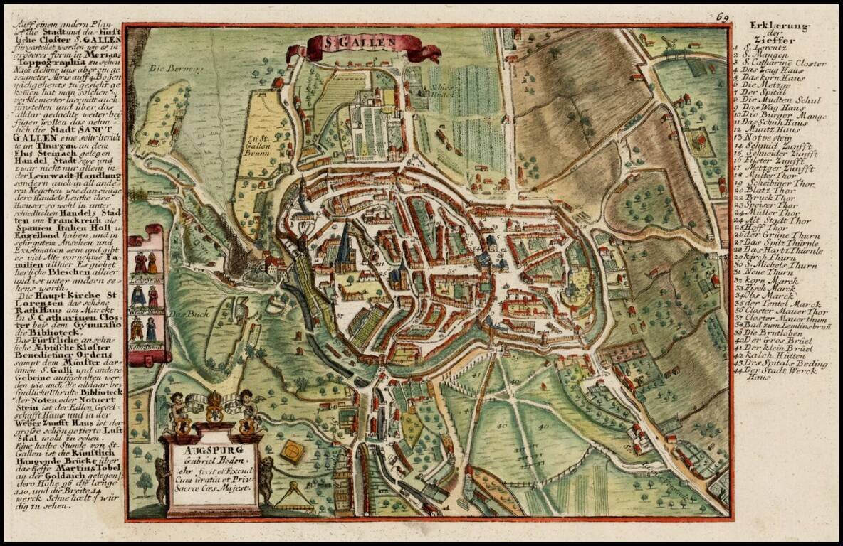
Scarce detailed town plan of St. Gallen and vicinity, published by Bodenehr. Bodenehr did a second view of the City, which is more focused on the town within its fortified walls: /gallery/enlarge/30360