
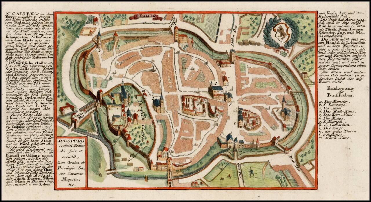
Scarce detailed town plan of St. Gallen, published by Bodenehr. Bodenehr did a second view of the City, which shows a broader area: /gallery/detail/30360
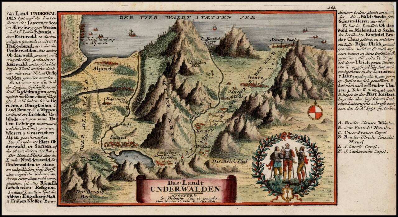
Decorative map showing the region along the southern part of Lake Lucerne, from Stansstad to Kerns and Sarnen, published by Bodenehr.
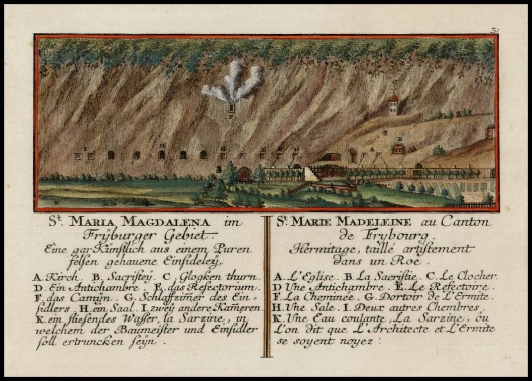
Scarce detailed map of St. Mary Madaline's Convent near Freybourg, published by Bodenehr.
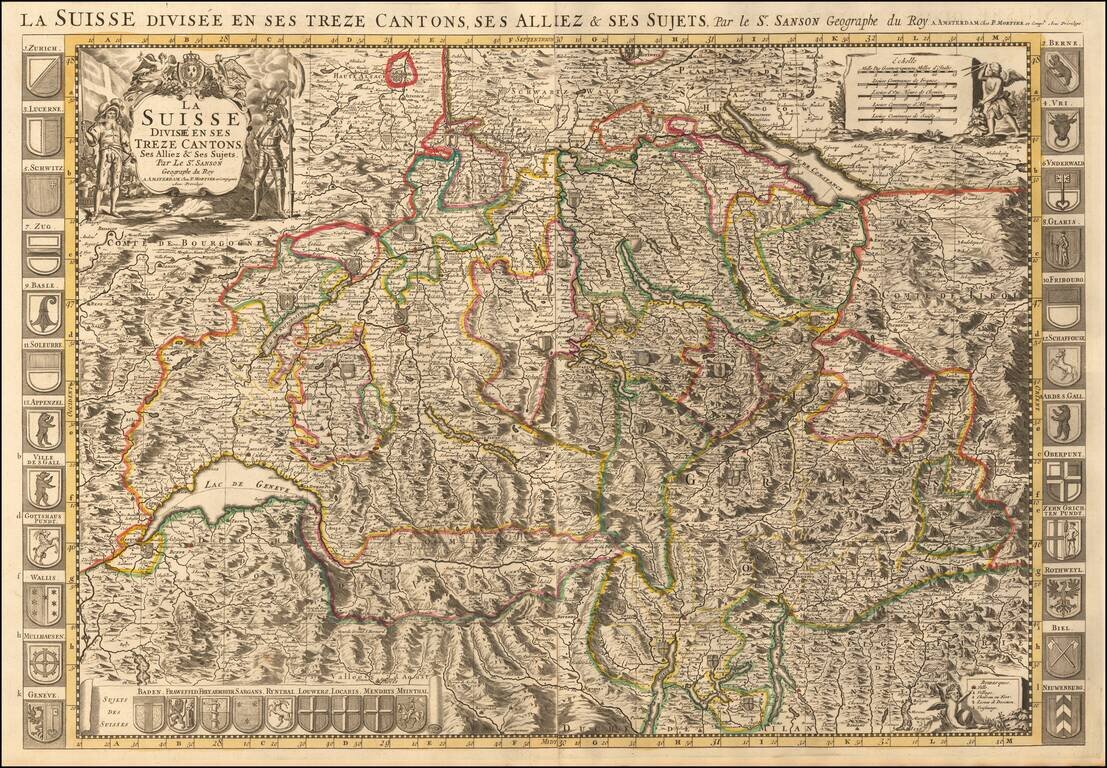
Map of Switzerland with decorative title cartouche at top left. The map is flanked at each side by a total of 24 coats of arms of the Swiss cantons, principal cities, and allies. A panel at the bottom left includes a further nine arms of "Sujets Des...
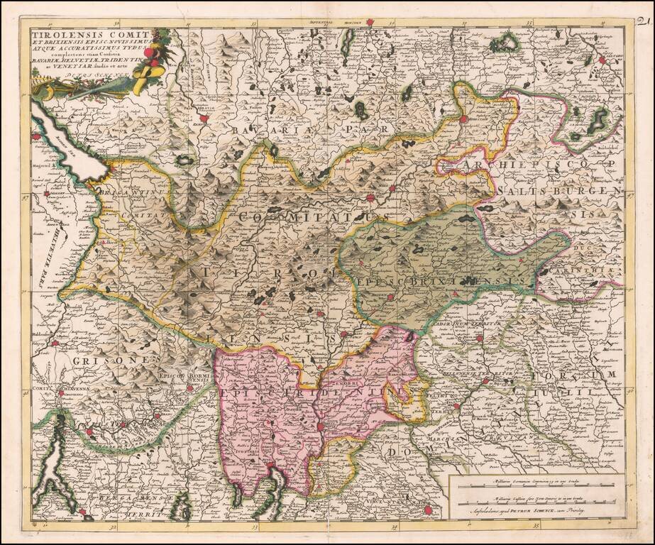
Fine old color example of the Tirolia region, published by Peter Schenk in Amsterdam.
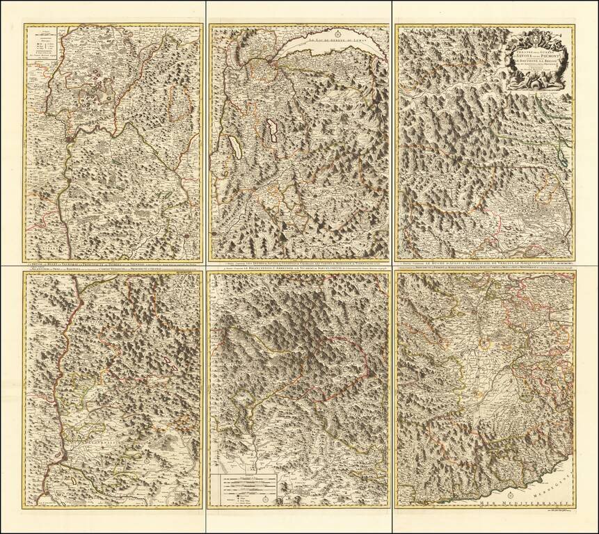
Rare 6-sheet map of the Savoy and Piemonte region, published by Pierre Mortier in Amsterdam. The map provide a highly detailed treatment of the topography of the region. Lake Geneva at the top center, with Monaco and the Italian Riviera at the bottom...
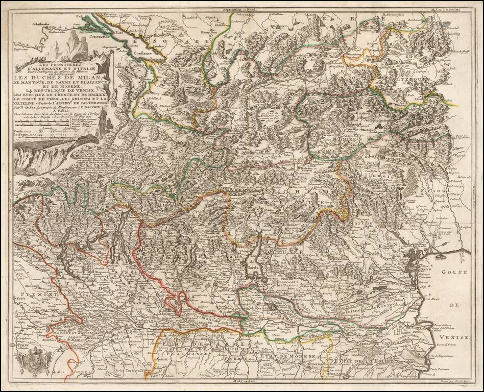
Detailed map of the Theater of War in Northern Italy, published in 1702 by Nicolas De Fer. The map extends from Locarno and Lake Constance to the Gulf of Venice and Saltzurg.

De L'Isle's map of the Rhine River and neighboring regions, from Strassbourg in the north to the Swiss Alps.
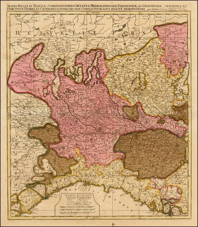
Detailed map of Northern Italy and contiguous parts of Switzerland.