logo

1714. The Plan of Edenburgh Exactly done From the Original of ye famous D: Wit

  • The Plan of Edenburgh Exactly done From the Original of ye famous D: Wit

The Plan of Edenburgh Exactly done From the Original of ye famous D: Wit information:

Year of creation: 
Resolution size (pixels): 
 4747x1964 px
Disk Size: 
 3.14412MiB
Number of pages: 
 1
Place: 
 London
Author: 

Print information. Print size (Width x height in inches):
Printing at 72 dpi 
  65.93 х 27.28
Printing at 150 dpi 
 31.65 х 13.09
Printing at 300 dpi 
 15.82 х 6.55

An example of detailing the file of this map of in a printable high-resolution:

Click to open in high resolution (open in new tab).
Attention! this is just the central piece (central area 960x960 px) of the map file!
This is an example, so that you can see and study the level of detail of a given map. The entire Map will be fully available after payment!

The Plan of Edenburgh Exactly done From the Original of ye famous D: Wit

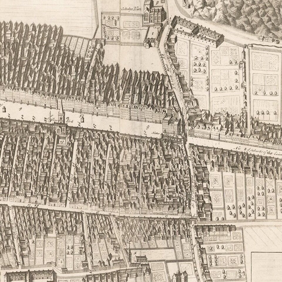
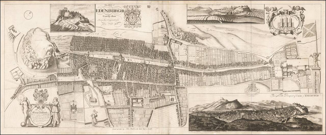
Rare Decorative Plan and View of Edinburgh Dedicated to George Lockhart esq.

Rare town plan, bird's-eye view and prospect of Edinburgh, engraved by the Scots mapmaker Andrew Johnston, and first published in 1714.

The map first appeared in the Nouveau Theatre de la Grande Bretagne, published by Joseph Smith from 1719 onwards. The plan is based upon a rare two-sheet plan of Edinburgh drawn by James Gordon in 1647, and published by Johannes Blaeu in 1647, and later re-printed by Fredrick de Wit.

The present example was re-issued by John Bowles, circa 1814.


Special conditions for students!

If you are a student, write to us in telegram: @antiquemaps and indicate what material you need and for what work you need a map in high detail. We are ready to provide material on special terms. For students only!

Item information:

Year of creation:
Size:
4747x1964 px
Disk:
3.14412MiB
Number of pages:
1
Place:
London
Author:
John Bowles.
$9.99

Related item