Map size in jpg-format: 516389B
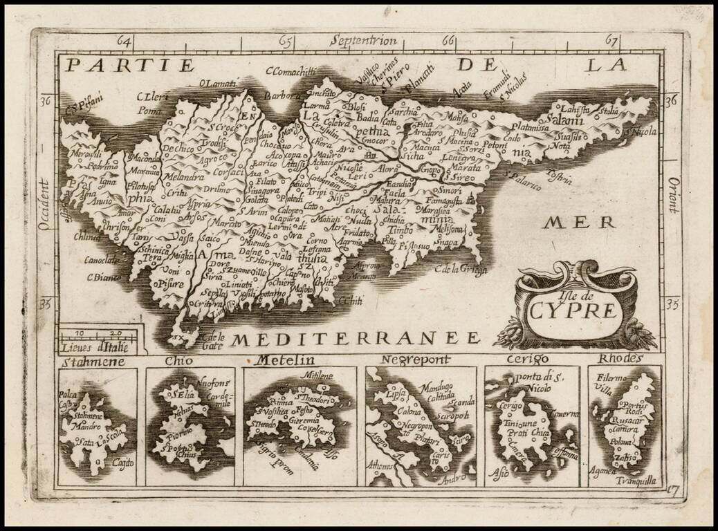
Detailed map of Cyprus, with 6 smaller inset maps below, most likely published by Antoine de Fer in his Cartes de Geographiques, although it may be by a different publisher, as the map is apparently unrecorded.
Burden suggests that the 1657 De Fer work was originally published in 1651 by Jean Picart, with the plates later passed to De Fer and Pierre Du Val for the issuance of a second edition in 1657, which we believe to be the source of this atlas. Burden's Mapping of North America, Entries 306 and 307. We surmise that some of those plates in this map may have been added by De Fer and Du Val and did not appear in the original 1651 edition.
The map includes 6 inset maps, showing Stahmene, Chio, Metelin, Negrepont, Cerigo and Rhodes, and is based upon Jansson's map of 1628, from the Atlas Minor.
While the map is similar to Stylianou 101 and 101a, the title of the map is different and it would appear that this map is an entirely different plate, rather than a variant of the editions illustrated by Stylianou.
If you are a student, write to us in telegram: @antiquemaps and indicate what material you need and for what work you need a map in high detail. We are ready to provide material on special terms. For students only!
![Patriarchatus Antiocheni Geographica Descriptio . . . [shows Cyprus]](/map/small/54177.jpg)
![[Eastern Mediterranean]](/map/small/61501sb.jpg)
![Cyprus Insula [with] Candia, Olim Creta](/map/small/65746.jpg)