Map size in jpg-format: 1.28065MiB
Click to open in high resolution (open in new tab).
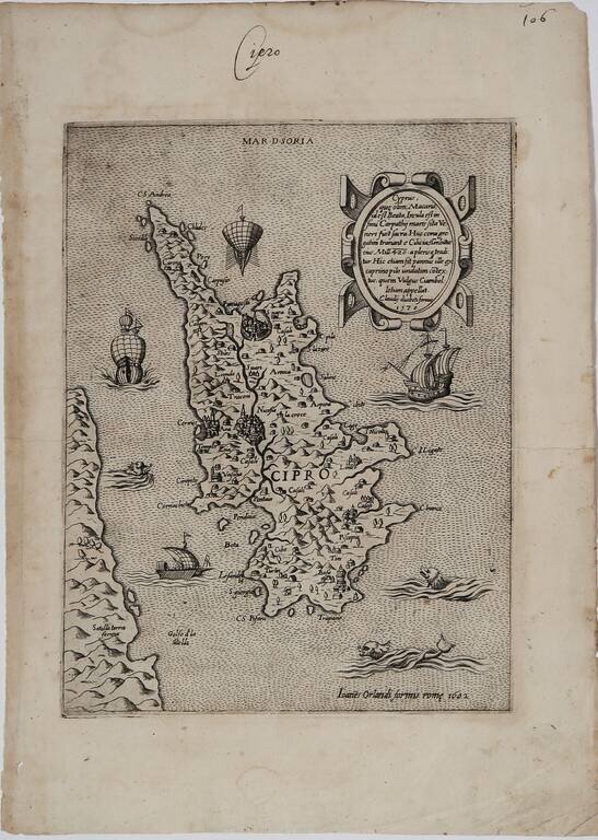
Rare Early Map of Cyprus By Paolo Forlani
Second state of this rare early map of Cyprus, published in Venice by Paolo Forlani.
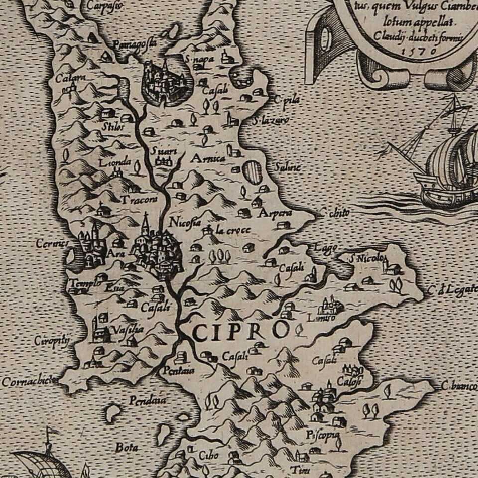
The map is oriented with the east at the top and includes a nice descriptive cartouche at the top right. From the cartographic point of view, except for the orientation, the map follows the model published in Rome in 1560 by Bartolomeo Faleti (Bifolco-Ronca, table 837). Other elements, such as the course of the river Pediaeus, derive from the manuscript map of 1562, by Giorgio Sideri. Nicosia is still surrounded by the walls built by the Franks, which were destroyed in 1567.
The engraving is ascribed to Paolo Forlani by Ashley Baynton-Williams, for obvious stylistic reasons, however it does not appear among the Forlaini's monograph by David Woodard (1990). For this reason the place of printing is brought back to Venice, where Duchetti made use of the collaboration of Forlani.
A second issue of the map was printed in Rome by Giovanni Orlandi in 1602. The plate is present in the catalog of the widow of Giacomo Gherardi, heir to the Duchetti calcographic collection - October 1598 (No. 275) described as "l’Isola di Cipri" - then it was bought by Orlandi in 1602.
Rarity
The second state of the map is known in only one other recorded example, in the Silvia Ioannou Foundation, Vaduz (cfr. Bifolco-Ronca p. 1670, Baynton-Williams, pp. 51-53).
If you are a student, write to us in telegram: @antiquemaps and indicate what material you need and for what work you need a map in high detail. We are ready to provide material on special terms. For students only!
![Patriarchatus Antiocheni Geographica Descriptio . . . [shows Cyprus]](/map/small/54177.jpg)
![[Eastern Mediterranean]](/map/small/61501sb.jpg)
![Cyprus Insula [with] Candia, Olim Creta](/map/small/65746.jpg)