Map size in jpg-format: 27.0349MiB
Click to open in high resolution (open in new tab).

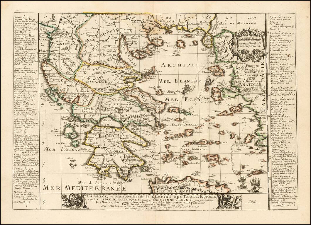
Rare map of the Greek Islands by Pierre Du Val, published in Paris.
Du Val's map focuses on the Aegean and the various trade routes through the region and beyond, tracking the routes of ancient and modern Mariners from the Dardenelles, Gallipoli and Smyrne through the southern islands and on the Mediterranean both to the east and west of the Isle of Candie (Crete). A curious trio of birds flying southward from the Morean coast is apparently symbolic of Greece's role as the gateway for Orientale trade with the Western Mediterranean and the rest of Europe.
Du Val, then serving as Geographe Ordinaire to the King of France, also includes an unusually early table (index) of place names on each side of the map, one of the earliest such uses on the frontice of a map, which he uses as key for correlating ancient and modern names. At the time, Greece was still an important part of the Turkish Empire, although within the next several decades, Turkish control of the region would be contested by a series of wars led by the Northern European powers and through which Turkish control of the region would be weakened.
Pierre Duval (1618-1683) was a French geographer, cartographer, and publisher who worked in Abbeville and Paris during the seventeenth century. He was born in the former city, in northeast France, before moving to Paris. Duval was the nephew of the famous cartographer Nicolas Sanson, from whom he learned the mapmaker's art and skills. Both men worked at the royal court, having followed the royal request for artists to relocate to Paris. In addition to numerous maps and atlases, Du Val's opus also includes geography texts. He held the title of geographe ordinaire du roi from 1650 and died in 1683, when his wife and daughters took over his business.
If you are a student, write to us in telegram: @antiquemaps and indicate what material you need and for what work you need a map in high detail. We are ready to provide material on special terms. For students only!

![Patriarchatus Antiocheni Geographica Descriptio . . . [shows Cyprus]](/map/small/54177.jpg)
