Map size in jpg-format: 4.71006MiB
Click to open in high resolution (open in new tab).
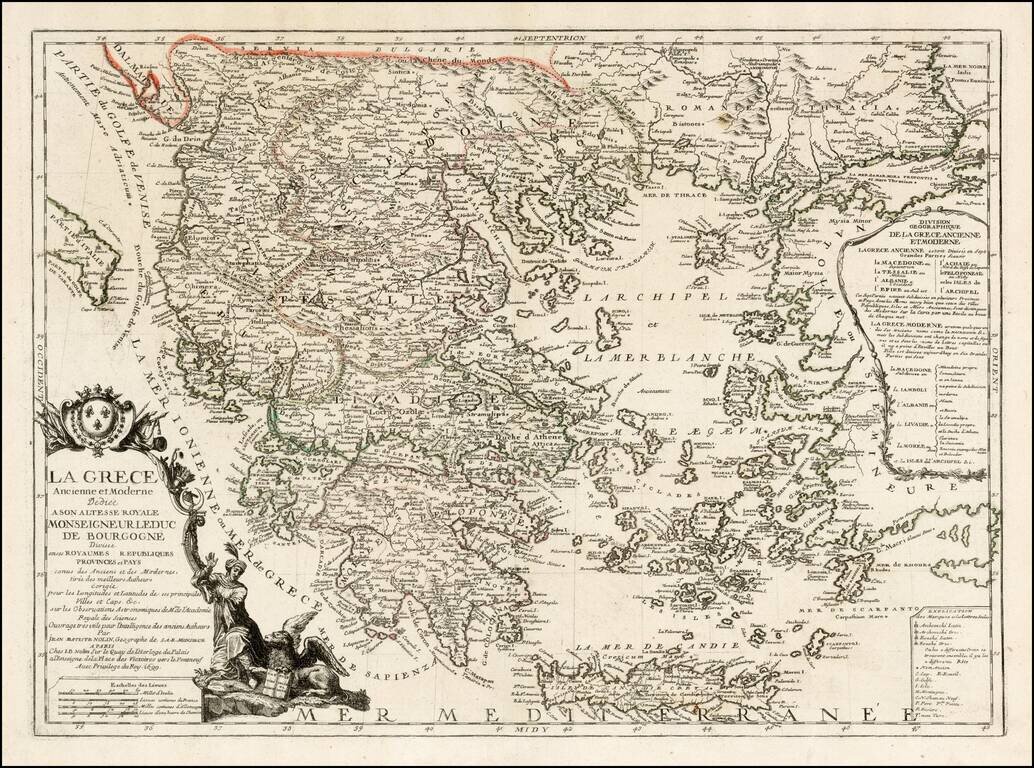
Fine example of Nolin's map of Greece, first published in 1699.
The map is divided into kingdoms, republics and provinces and includes a coat of arms and elaborate title cartouche.
If you are a student, write to us in telegram: @antiquemaps and indicate what material you need and for what work you need a map in high detail. We are ready to provide material on special terms. For students only!

![Patriarchatus Antiocheni Geographica Descriptio . . . [shows Cyprus]](/map/small/54177.jpg)
