
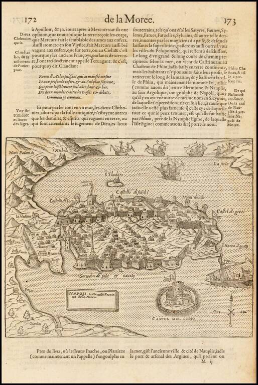
Scarce map of the fortified city and harbor at Nafplio, during the Ottoman Reign, which appeared in Francois de Belleforest's Cosmographie Universelle De Tout le Monde. The area surrounding Nafplio has been inhabited since ancient times, but few...
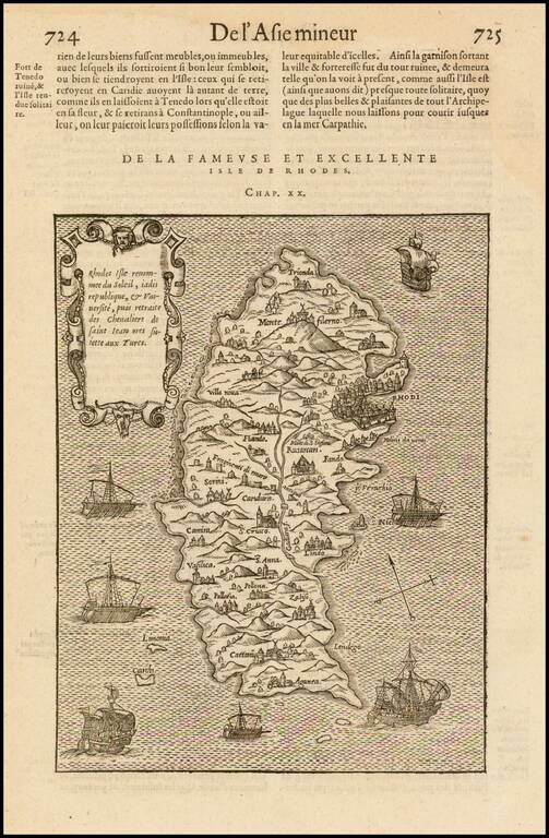
Detailed map of the island of Rhodes, published in Francois De Belleforest's Cosmographie Universelle De Tout le Monde. The map is intended to illustrate the island of Rhodes, which had become a stronghold of the Knights of St. John, following the...
![[Corfu]](/map/small/40413.jpg)
Detailed map of the island of Corfu, published in Francois De Belleforest's Cosmographie Universelle De Tout le Monde.
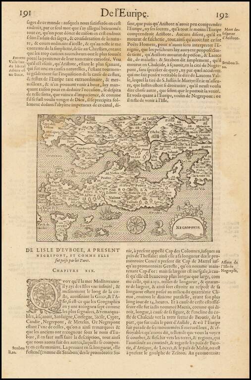
Scarce map of the region centered on Negroponte, Greece, which appeared in Francois de Belleforest's Cosmographie Universelle De Tout le Monde.
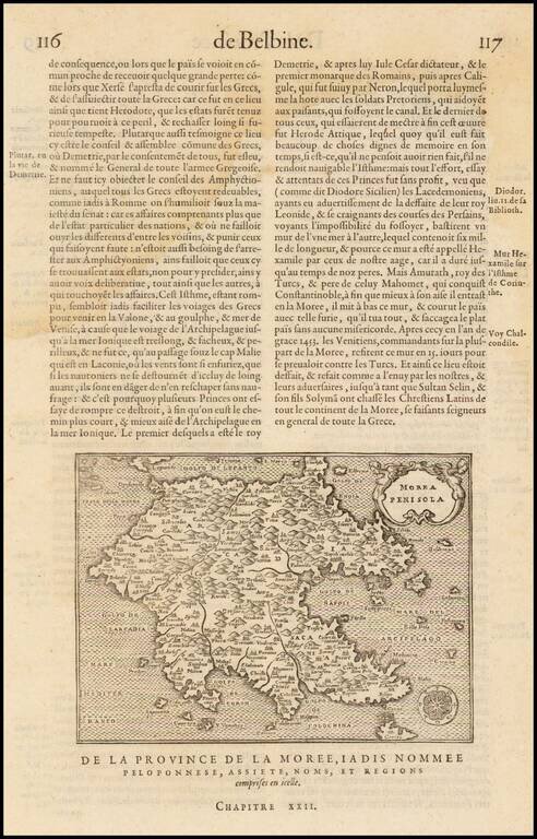
Scarce map of Morea, which appeared in Francois de Belleforest's Cosmographie Universelle De Tout le Monde.
![[Methoni] Modon Cite, situee en la Moree](/map/small/41018.jpg)
Scarce view of the harbor and city of Modon, Greece, which appeared in Francois de Belleforest's Cosmographie Universelle De Tout le Monde. The map illustrates the city from and after the time of the Siege of Modon. The Battle of Modon took place in...
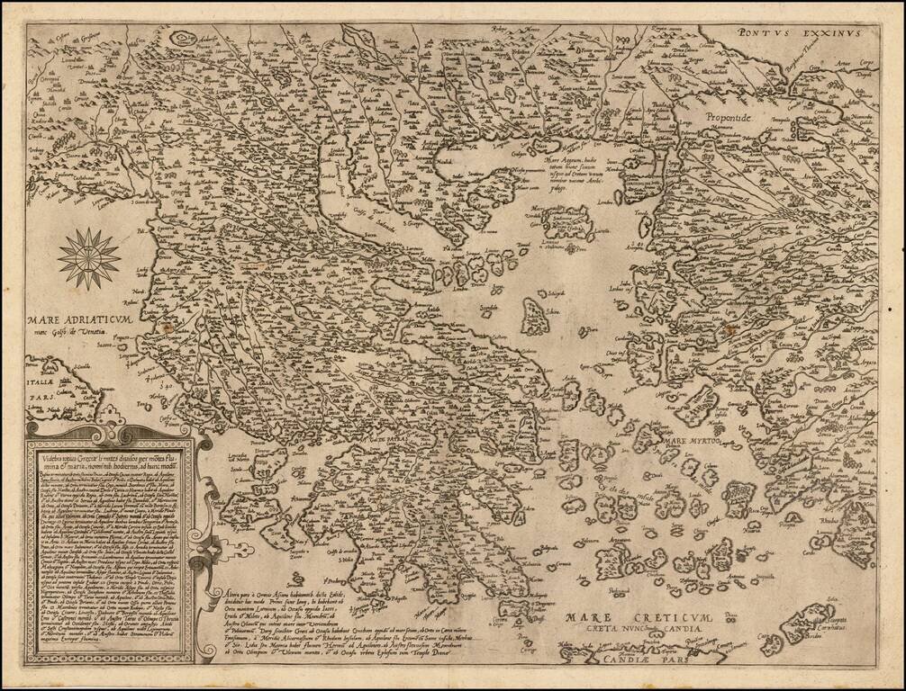
Nice example of De Jode's modern map of Greece, which was both separately issued and included in his Speculum Orbis Terrae, drawn from the work of the Italian Renaissance Architect, Pirro Ligorio. The present example has no text on the verso and...
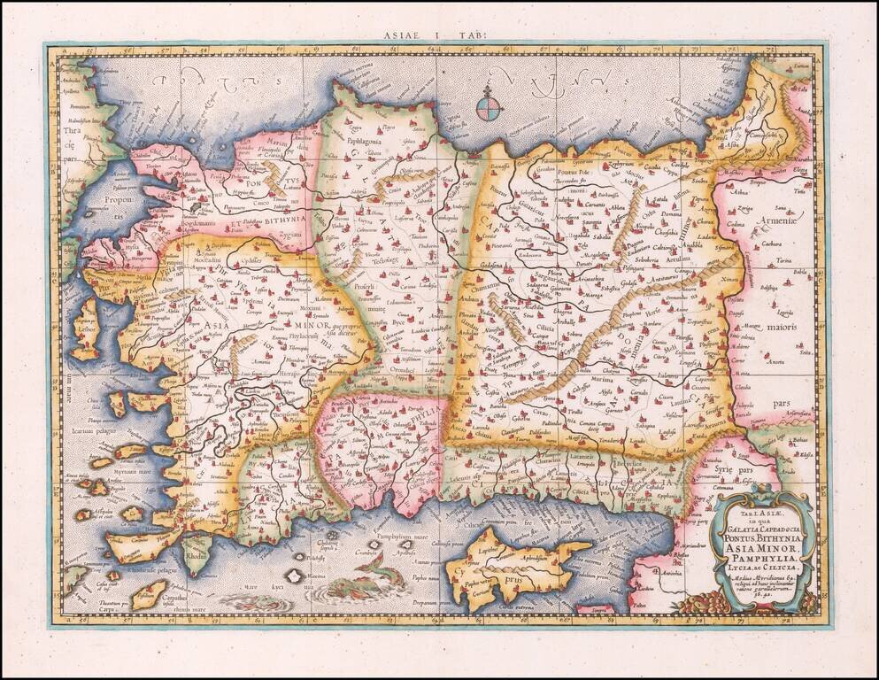
Nice example of Mercator's map of Asia, Minor and Cyprus, from Mercator's edition of Ptolemy's Geographia, first published in 1578 and republished in Amsterdam beginning in 1695. Includes a Sea Monster, cartouche and a detailed treatment of the...
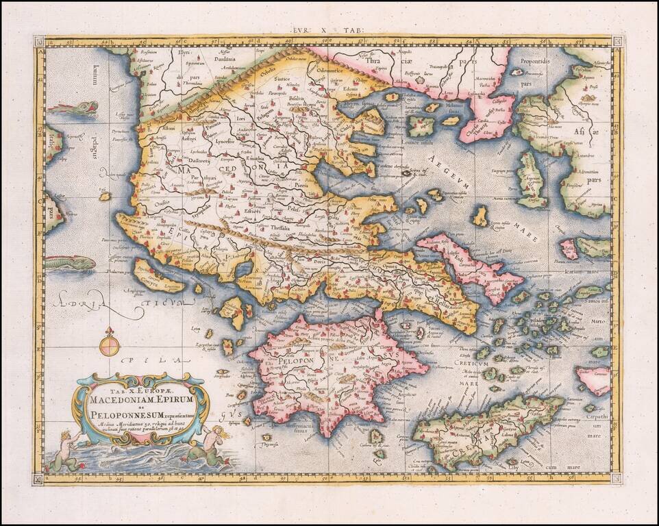
Nice example of Mercator's map of Greece from Mercator's edition of Ptolemy's Geographia, first published in 1578 and republished in Amsterdam beginning in 1695. Includes a Sea Monster, cartouche and a detailed treatment of the region. Gerard...
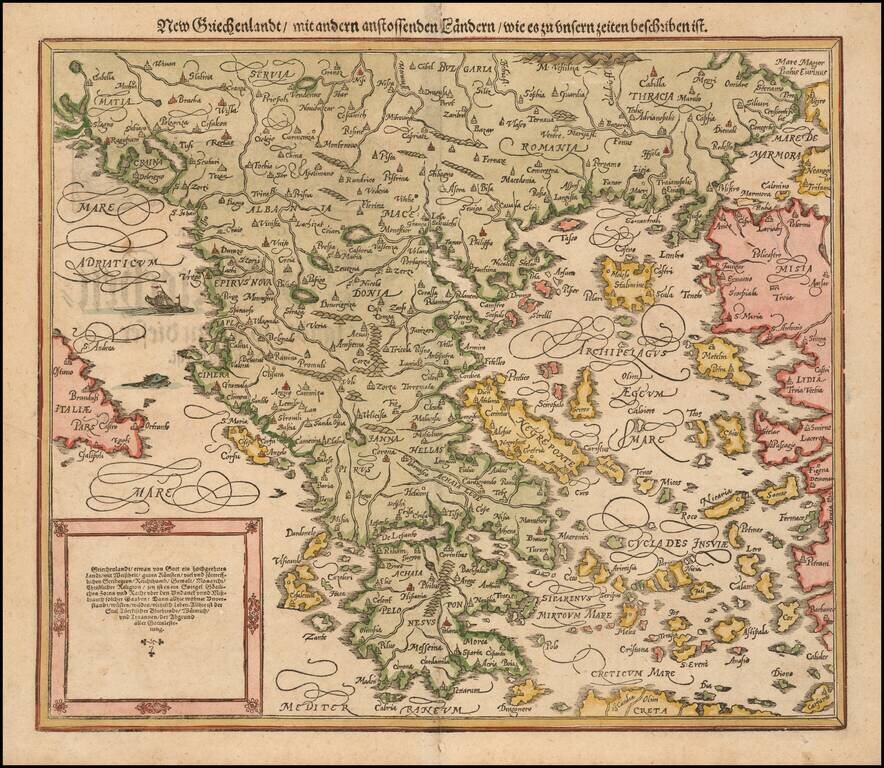
Nice full color example of Munster's second map of modern Greece, from Munster's Cosmographia, one of the most influential georgaphical works of the 16th Century. Munster's Geographia (first published in 1540), and his later Cosmographia, were...
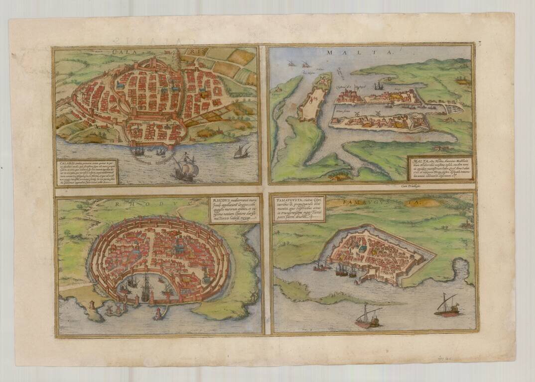
Nice old color example of Braun & Hogenberg's views of Famagusta, Rhodes, Malta and Cagliari. From Braun & Hogenberg's Civitatus Orbis Terrarum, the most important book of town plans and views published in the 16th Century.
![Candia [and] La Cita De Corphu](/map/small/55652mp2.jpg)
Nice old color example of Braun & Hogenberg's views of Candia and Corfu.
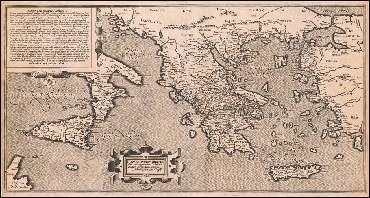
Extremely rare 16th Century map of the "New Greek Universe," by George Achatz von Eneneckel. The map extends from Sicliy and Puglia to the western coast of Asia minor, the regions controlled by the Ancient Greeks. This is the first time we have ever...
![[Crete / Corsica / Sardinia] Corsica [and] Sardinia [and] Creta . . . [and] Insulae Mari Ionii](/map/small/33196bp.jpg)
Decorative example of Ortelius' maps of Corsica, Sardinia, Crete and the Ionian Sea, from his Theatrum Orbis Terrarum, the first modern atlas of the world.
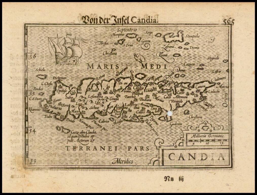
Nice example of this early state of Barent Langenes's map of the Island of Crete, which first appeared in the 1598 edition of Langenes's Caert-Thresoor, published in Middelburg. Langenes's map was first issued in his Caert-Thresoor and later...