Map size in jpg-format: 4.3663MiB
Click to open in high resolution (open in new tab).
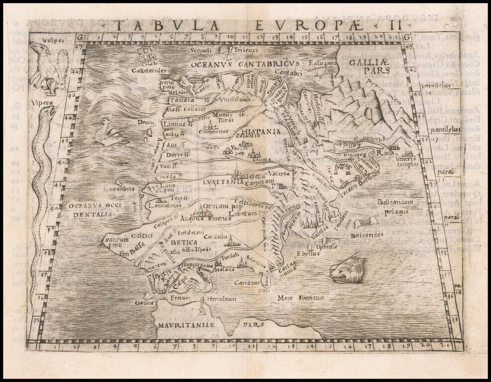
Nice example of Gastaldi's map of Spain & Portugal Peninsula, from Gastaldi's Geografia di Claudio Ptolemeo Alexandrino . . . , published in Venice in 1548.
Giacomo Gastaldi is considered as the foremost Italian cartographer of the 16th century along with Paolo Forlani. From Piedmont, Gastaldi established his reputation in Venice and was cosmographer to the Republic of Venice. Gastaldi enjoyed a productive relationship with Giovanni Ramusio, Secretary of the Venice Senate, who used Gastaldi's maps for his Navigationi et Viaggi. This map is from Gastaldi's edition of Ptolemy, Ptolemeo. La Geografia..., begun as early as 1542 and published in Venice in 1548.
If you are a student, write to us in telegram: @antiquemaps and indicate what material you need and for what work you need a map in high detail. We are ready to provide material on special terms. For students only!
![(Pro-Spanish Republic Political Broadside) [Lift The Embargo Against The Spanish Republic] President Roosevelt says . . .](/map/small/50218.jpg)

